It was the May long weekend, and we wanted to go out for a nice hike! We meant to go to do the Tunnel Bluffs hike, but when we got there we couldn’t for the life of us find a parking spot… So we decided to drive on, further up toward Squamish, and look for an alternative. I browsed my AllTrails app and found a promising one… The Slhanay Peak Trail didn’t disappoint!
Way less well-known than the famous Stawamus Chief, Slhanay Peak can be found just north from it in the Coast Mountains, close to the town of Squamish. At about 650 meters, the peak offers gorgeous views of the town and an opportunity to see the much-hiked Chief from a different vantage point. It overlaps a little bit with the Chief hike, so if you’ve done that one before, you’ll see some familiar rocks that you need to navigate over.
I find the names of areas here very intriguing, and have been wondering for a while not only how to pronounce Slhanay (‘slah-nay’) but also what its meaning is. I learned that originally, the peak was disrespectfully called the Stawamus Squaw. “Squaw” is a rather controversial word, used by early European settlers and traders in North America to describe Native American women.
Though the word had a neutral meaning originally, over time it was used in very negative ways to imply inferiority and dehumanization of (indigenous North American) women. Transformed into such a derogatory and racist term, the name of this peak needed to change. This place is situation on traditional territory with significant cultural importance to the Sḵwx̱wú7mesh nation; renaming it was long overdue. In 2009, the new name Slhanay (woman), was introduced in consultation with the local First Nations.
You’ll find the start of the Slhanay Peak Trail on a gravel road, just past the Stawamus Chief trail but before you reach the town of Squamish. The gravel road is the same one you would take if you wanted to drive up to the Mamquam Falls.
Keep in mind that this hike is classified as Hard – I’d say moderately hard – so make sure you are well prepared. Wear proper walking shoes, consider bringing poles (we were fine without them but I can see how they may be useful), bring plenty of water if you go on a warm day, and I recommend using the AllTrails navigation. It saved us a couple of times when we were about to get lost; my phone started buzzing when we missed a turn onto a trail that was hard to see. Thank you AllTrails.
The trail is about 6 KM and it took us just over 4 hours. This included two breaks to fly my new drone for the first time 💛
The trail has some really fun variety that made it an interesting and worth the four hour work-out. The trail is a bit of an 8-shape, so it’s out-and-back but with a few loops that prevent you from having to take the exact same route back. There’s steep inclines, beautiful forest, also sections of more relaxed walking, flowers, impressive granite rock, a bit of technical climbing/scrambling… A little bit of everything.
Doing those steep sections made me a bit weary for the way back, especially considering there was some scrambling involved… As expected, the way back was quite challenging and straining on the knees and ankles. We were glad that we built up some experience and some hiking muscle; I don’t think I would have been able to do it in the first months we were here 😅
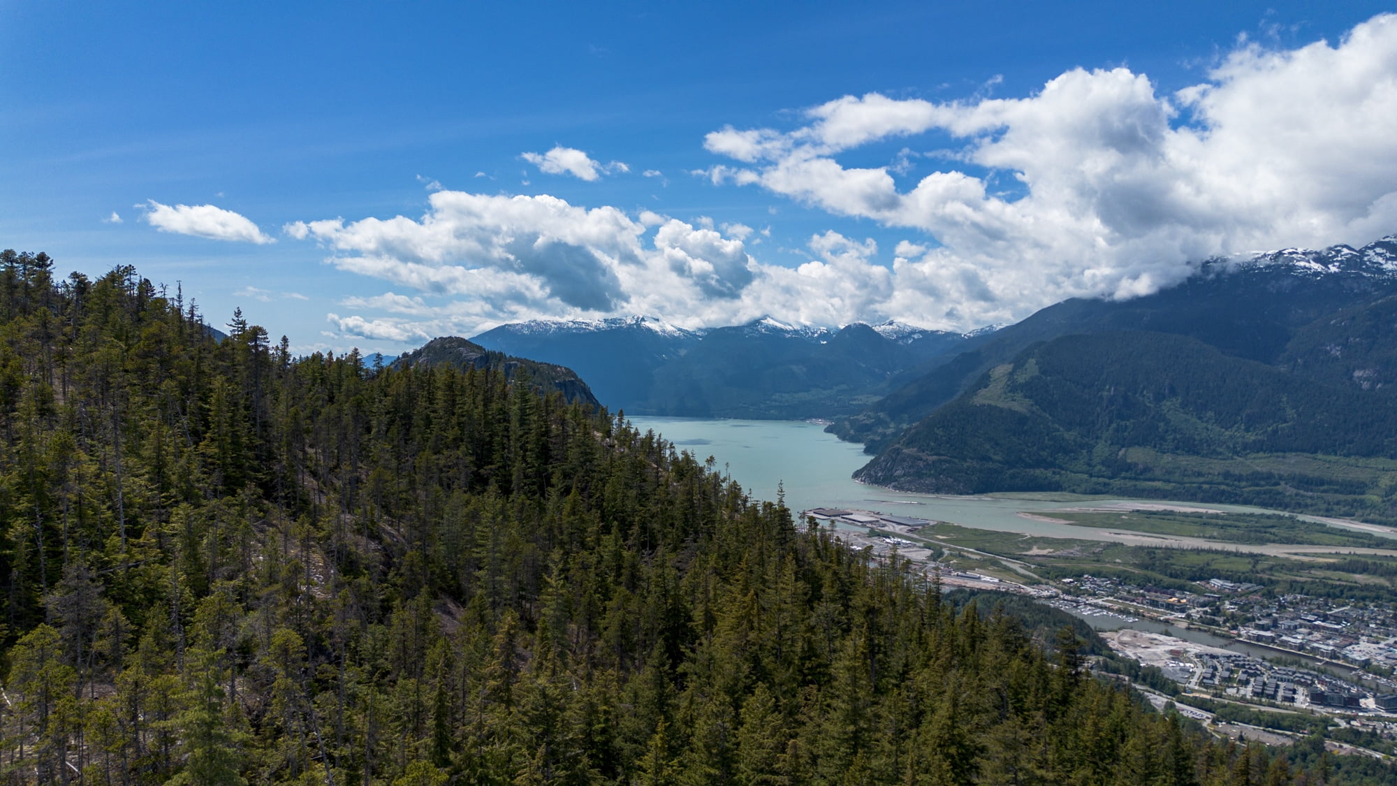
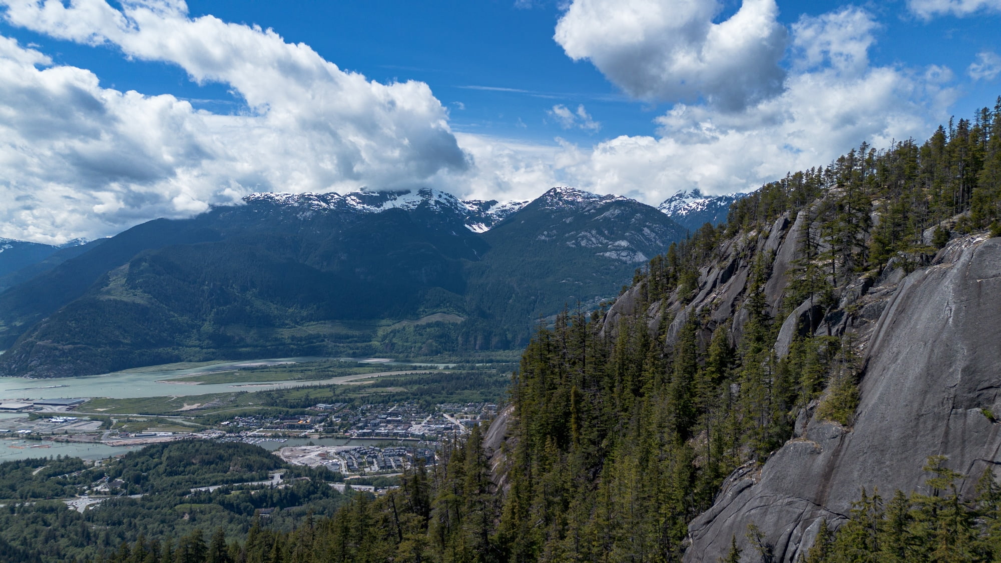
The route had 4 main lookout points, such amazing views. Looking out over Squamish and being able to see so far into the valley was incredible! Still a little bit of snow on the peaks around us… And The Chief. Gosh. It’s just such a unique peak to look at!
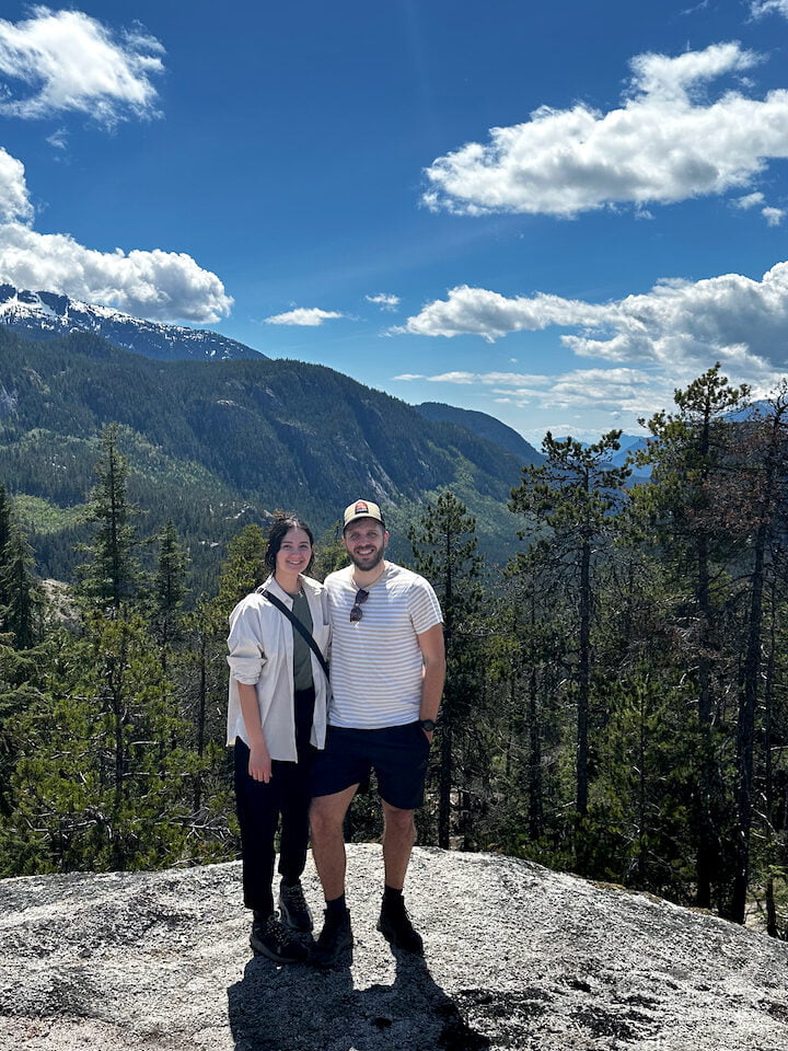
At the top of the trail, a couple was enjoying the view, and they offered to snap a photo of us. The guy was born here in Vancouver, the girl was from Toronto. We talked about how amazing it is to us to be able to just drive out on a Monday morning and be in this incredible mountainous place. I keep saying this, but I hope I’ll never get used to it – love this incredulous feeling!