Archive

February 2025

Browsing

A couple weeks into my marathon training, my schedule showed it was time to run a half marathon in the last weekend of February. It happened to coincide with a Vancouver Island weekend trip we were planning, so I searched for some running trails in the Ucluelet and Tofino area. To my delight, I learned that a multi-use path of 25 kilometers between the two beach towns had been opened in 2022. Challenge accepted: run a half marathon on the ʔapsčiik t̓ašii in the Pacific Rim National Park Reserve!

After the Christmas holidays of 2024, I sat myself down for 2025 goal setting and decided it was time to kick off my marathon training. I crafted a 16-week schedule that put me on a regime of four runs per week, with Sunday marked as my long-run day. Having a solid plan really helped me bring back some discipline, and my progress has been steady and motivating so far. Week 6 was going to be a milestone: the half marathon. 

The thing with marathon training is that at some point, you can’t just ‘go for a quick run’. The weekly long run entails setting an alarm, have a power breakfast, give the stomach about 45 minutes to process, then push out that long run, shower, and have a recovery lunch. Long story short: it takes up a whole morning. But you know what, that doesn’t mean we have to be stuck at the apartment every weekend, does it? We had been chatting about planning a weekend trip in February, and just as I completed booking our Ucluelet accommodation on Vancouver Island, we realized that weekend was half-marathon-weekend.

Tom running the ʔapsčiik t̓ašii

ʔapsčiik t̓ašii, upscheek tashee

I searched running trails near Ucluelet as well as running trails near Tofino and was just about to give up when I read something about a new ‘MUP’ between Tofino and Ucluelet. Crossing my fingers, I went on to figure out whether it was suitable for a run.

The ʔapsčiik t̓ašii (pronounced ups-cheek ta-shee) pathway was developed as part of a long-term vision to enhance sustainable transportation, safety, and cultural connection in Pacific Rim National Park Reserve. The idea of a multi-use trail had been discussed for decades, but planning and construction took several years (as it usually tends to).

The need for a safe cycling and walking route was recognized as early as the early 2000s, as Highway 4 connecting Tofino and Ucluelet was too dangerous for non-motorized travelers. Parks Canada, in collaboration with the Tla-o-qui-aht First Nation and Yuułuʔiłʔatḥ Government, began planning a trail that would respect the ecological and cultural importance of the land. Community engagement and environmental assessments helped shape the project, ensuring minimal impact on sensitive ecosystems.

Building began in 2018, and in the early summer of 2022, the 25 km pathway opened to provide a safe, eco-friendly, and super scenic connection through the national park. The name means “going the right way together” in the Nuu-chah-nulth language and honours the partnership between Indigenous communities and Parks Canada.

ʔapsčiik t̓ašii (Upscheek Tashee) | Source: ACEC BC Awards

In addition to 25-kms of new 2-way multi-use path, the fully constructed project includes: 3 bridges over fish bearing streams, 370 lineal meters of elevated boardwalks over sensitive wetlands, 4 new highway culverts, 8 highway culvert extensions, 60 amphibian culverts, 180 pathway culverts, 7 major retaining walls (up to 5m in height), 700 lineal meters of highway widening & slope stabilization, 11 Fisheries Enhancement sites, & mitigation of former slides & general slope stabilization of a 20m high foreshore slope to facilitate trail switchbacks. (ACEC BC Awards)

Running the ʔapsčiik t̓ašii, upscheek tashee

My reference point was this route from AllTrails: from the Radar Hill trailhead parking, it’s a straightforward route that has you run parallel to the coast, passing Radar Beaches, Schooner Cove Beach, Long Beach, Combers Beach, Wickaninnish Beach, and finally, Florencia Beach. 

The logistics had us torture our brain a little bit. Recovering from a injury, but still hoping to run the marathon in May, Tom wasn’t too sure if he’d join the run. If he can’t, do I still go? Is it not too creepy by myself? Are the bears awake yet? How do we get there? How do we get back to the car at the end of the 21 km? Google Maps doesn’t give any public transit options. What does a cab cost? Excuse me HOW MUCH you say? Never mind that. What if Tom rented a bike? What if we drove our car to the endpoint and found a ride to Radar Hill somehow? 

What the trail looks like most of the way

Here’s how we made it work in the end:

💛 West Coast Transit Service | There’s a local (not known on Google Maps) transit service that you can find on the Alberni-Clayoquot Regional District website. The West Coast Transit Service page included a schedule which showed that on weekends, there would be a bus going from Ucluelet to Tofino twice in the morning and twice in the afternoon. We also need the Token Transit App (App Store / Google Play) to pay for the ride.

💛 Weather check | It was forecasted to be a very rainy weekend; especially Saturday it was just pouring and pouring all day. Checking our trusted weather apps, we decided Sunday morning looked a lot better. 

💛 Double check | We went into the Pacific Rim Visitor Centre which is just at the junction right before you enter Ucluelet, to ask if this bus is really going every day and at this time of year. She confirmed, and pointed at a little pole that said ‘Transit’ just there on the parking lot.

💛 Prep & Gear up | We got ourselves some groceries the day before to ensure we could have some pre-run breakfast and post-run lunch. Our alarm went off at 6.30 AM, we prepared our peanut butter toast, and got into our running outfits. I packed one gel each, and Builder Bar for Tom. I forgot my little flexible water bottles at home, but thank goodness Tom had packed his running vest and water bladder.

💛 DO IT!

So there we went… We drove to the Pacific Rim Visitor Centre, parked the car, and waited for the 7.45 AM bus. When he arrived and we got on, the driver asked where we were planning to get off. “The Radar Hill parking lot please,” I asked. His eyebrows shot up, and he said, “Wow, you’re the first to ever ask me for a drop-off at that stop.” He went on to ask us if we would be taking a ride back to Ucluelet later in the day. “Well…” I began, “The plan is actually to run back”.

RUN back?,” he went, “Ahhh, what’s it like to be YOUNG?!”

We hopped out at the Radar Hill Parking Lot and immediately saw the entrance to the trail. “Look out for me on the road in case you get injured or something,” the friendly driver told us. We did some stretching, got the GPS tracking on our watch going, and started our 21 KM run. Thankfully, it was only drizzling rain, not pouring like it did the day before. It was actually the perfect weather for such a long forest run! 

The trail was perfect for our run. It’s paved through rain forest with a total of 128 meters elevation – good practice for our marathon in Vancouver, which will also have some hilly sections. Full disclosure: I am terrible at running upwards – I walked those steep bits of the trail asking my upper legs to please not die and asking the universe why I was doing this. At 5K, we were rewarded for finishing the first quarter with an impressive view of Long Beach. Unfortunately, it was very foggy from the drizzle, but it looked incredible nonetheless. Impossible to capture well, but here’s a photo I quickly snapped before catching up with Tom.

Long Beach on the Tofino side

Apart from that beautiful bit of beach, you don’t actually see more of the coast because of all the forest. The path switches between being surrounded on either side by forest, to having the road on your side. That allowed our bus driver to check in on us twice; he honked and waved at us as he continued his bus service back and forth between Ucluelet and Tofino. We waved back reassuringly – we’re still going, all good!

Two hours and ten minutes is how long it took us. The last 3Ks were gruelling though – why do those last kilometers always feel like it’s taking ages? Everything was hurting at that point and I was terribly thirsty. After high-fiveing and gulping down what little water was left, we walked the last bit back to the car, where two glorious water bottles were waiting for us.

And heated seats.

But the next bit was even more like heaven – our Airbnb had a hot tub, which was the perfect way to relax those angry muscles.

Looking out over the bay from our beautiful Airbnb

And that was it! I hope that the next time we come here, we’ll finally see it with sunny weather… And who knows, we might find ourselves on the trail again in the future. But maybe just for a walk or a bike ride 🥲

So you’ve made the silly decision to only plan one day in Vancouver… Ah well, everyone makes mistakes hey? I’ve got you – I’m preparing a few guides for how to spend one day in Vancouver. This post is the False Creek Ferries edition! 

If you aren’t afraid to get a big number of steps in and if you are eager to explore several neighbourhoods around the city of Vancouver, this is the one-day itinerary for you. Feel free to customize the route to what makes sense for you. If you want to do the whole thing, budget about 7-8 hours for this city adventure, plus dinner. 

Summary

Your options on a map

Depending on where you’re staying, you may want to look for the ferry dock closest to you. Ask for a day pass ($20) on the False Creek Ferry and you’ll be good to go. Below you will find the routes I recommend, followed by an interactive map. Use the filter switches to see where the ferry docks are, and play around with the categories to see what’ll be around you. This is your day, so pick and choose what you like! Read on below the map for my recommendations for each ferry dock area / neighborhood.

  • Aquatic Centre – Kitsilano – Granville Island – Stamp’s Landing – The Village
  • Kitsilano – Granville Island – Stamp’s Landing – The Village – Aquatic Centre
  • Graville Island – Stamp’s Landing – The Village – Aquatic Centre – Kitsilano

Keep in mind that this is for the False Creek Ferry, not the Aquabus Ferry! Also, keep an eye on the water as you sail between stops to see seals!

ferry dock: Aquatic Centre | the west end 

The West End is a vibrant, diverse neighborhood in downtown Vancouver. It has a mix of historic charm and modern living. The highlights of the area: Stanley Park, the scenic views of the water, and the peaceful streets despite being downtown.

Activities & Sights

  • Rent a bike at English Bay Bike Rentals and bike around Stanley Park. Make sure you ask them how to start the route; it’s a one-way direction for bicycles. The seawall is wonderful – I run it on a regular basis and the views never seize to mesmerize me. The video you see here is one of my favourite parts of the Stanley Park seawall.
  • Take a mandatory laughing photo at the Laughing Statues (A-maze-ing Laughter) at English Bay. A little touristy, but hey, you’re a tourist too!
  • Make your way to Beaver Lake, one of the little lakes within Stanley Park. Not because that lake is so great, but more so you have a chance to experience the forest trails in the park.
  • Hang out on English Bay Beach, and grab a hotdog while you’re there, or grab any other food to your liking on Denman Street before settling down on the beach.
  • If you make it all around the park, have a look at the Totem Poles and visit the cute little souvenir shop called At The Totems.
While you’re on the seawall don’t forget to look out over the water and see if you can spot any seals or sea otters!

Food recommendations

  • Have breakfast, brunch, or lunch at Red Umbrella Café ($). It can get pretty busy, so just go in to see if they have a table, and if not, you can leave your phone number on the tablet by the door and you’ll get a text as soon as your table’s ready.
  • Have breakfast, brunch, or lunch at Café Portrait ($). They also do desserts these days. This makes it a nice stop at whatever time you’re in this area. It’s a Turkish place with great coffee and delicious food. Meat-heavy though.
  • Have lunch or dinner at…
    • The Frying Pan ($). Not a fancy place at all, but they serve award-winning chicken burgers. If you’re here on a warm day, grab food here and bring it to the beach to eat. 👌🏼
    • Noah’s Café ($$).  Creative Japanese fusion, amazing food and impressive cocktails, and a cool secretive vibe. Why? Keep yours eyes open as you try to find this place, because it usually has the blinds down as if it’s not there. It’s a hidden gem!
    • Cactus Club English Bay ($$). A Vancouver classic.

Make your way back to the Aquatic Centre ferry dock to go to your next stop.

Time estimation

  • From the Aquatic Centre ferry dock to the bike rental is 1.5 km walk (20 minutes) along the seawall
  • Biking around Stanley Park over the seawall is 11 km (30 minutes)
  • Walking back to the ferry is another 1.5 km walk (20 minutes)

With exploring in mind, budget about 2-3 hours for the West End (Aquatic Centre ferry dock).

Stanley Park seawall in the fall, this is Second Beach

ferry dock: maritime museum | kitsilano 

Kitsilano, or “Kits,” is a laid-back neighborhood known for its beaches with volleyball-nets, parks, cafés and cute boutiques. It sits between Kitsilano Beach and Jericho Beach and offers an amazing view over downtown with the north shore mountain backdrop. Kits Beach is a popular spot to hang out and relax, while West 4th Avenue gets you vibrant shopping and dining options.

Activities & Sights

Here’s a convenient route you can follow, which would be a 3.5km loop. With slow walking, coffee stop, shopping, it’ll be about 2 hours.

  • From the ferry dock, walk to the Boathouse Beach Grill over Kitsilano Beach. It’s a 15 minute walk, but take your time to take in the beauty – from this side of town, you can see Stanley Park and the city peninsula with the beautiful mountain backdrop! If it’s a sunny day, you might catch people playing beach volley ball, or swimming/paddle boarding on the water. And if you’re really lucky, you might spot wildlife like a curious whale.
  • From the Boathouse Beach Grill, cross Cornwall Avenue and go down Yew Street until you reach West 4th Avenue. Make your way to 49th Parallel Café & Lucky’s Doughnuts for a cup of delicious coffee and/or a donut of your choice. 
  • After that, explore shops and boutiques on West 4th Avenue. Go east and enter any shops that sparks your interest, until you find the cute little store called Makers. Such a cute store! Check out the marker on the map above for more info.
  • From there, go north to go back to the ferry dock. Don’t go over Burrard street though, take one of the residential streets like Maple Street or Cypress Street. Zigzag your way through gorgeous streets and marvel at the beautiful homes until you reach the ferry dock again. 

Two alternatives to consider:

  • Instead of going back to the ferry dock, you can also walk to the next stop, which is Granville Island.
  • Should you have a lot of time and have a mind to learn more about Vancouver’s history, then consider going to the Museum of Vancouver in Kitsilano, which is close to the ferry dock.

Food recommendations

If you decide to skip the donut and have lunch/dinner in Kitsilano, some options: 

  • Raisu ($$) (or $$$ depending on what you order). Amazing for Japanese food. Especially if you’re planning to end your route here, make a reservation! 
  • Delara ($$). Lovely spot for Persian food.
  • LOCAL Public Eatery ($). If you prefer bar vibes and want to be close to the beach, LOCAL is nice.
There’s so much more in Kitsilano! But someone chose to only do one day in Vancouver 😉

Time estimation

The suggested loop is a 3.5 km walk (45 minutes to an hour). With the coffee stop and shopping in mind, budget about 2 hours for Kitsilano.

View of the city from Kitsilano

ferry dock: granville island

Granville Island is a lively cultural and culinary hub in Vancouver, famous for its Public Market, artisan shops, and waterfront charm. Once an industrial area, it now thrives with theaters, galleries, and local eateries. You can expect street performers, lots of fresh produce, and handcrafted goods as you stroll over the little island.

Activities & Sights

  • Go to the Public Market – it’s indoors, and I’d say a must-see if you decide to make this stop. Also a good bathroom stop. If you go, and feel like snacking, consider Lee’s Donuts. Don’t be intimidated by the long line; it goes pretty fast.
  • Explore the little shops and boutiques. Whenever I’m on Granville Island, I visit Paper-Ya, another one of those cute gifts and crafts stores. Cute cards, beautiful posters, stationery, and more. There’s also a little bean-to-bar chocolate shop called Kasama. You’ll find chocolate made in Vancouver from beans from the Philippines.
  • Find the Sea Village on the north east end of the island. It’s a little floating-home marina committed to eco-friendly living. 

Food recommendations

  • Alimentaria Mexicana ($$). If you’re hungry for tacos or other Mexican platos, this is a nice spot.
  • Tap & Barrel ($). Great spot with a nice view over the False Creek water and harbour, and close proximity to the ferry dock.

Walk back to the Granville Island ferry dock to go to your next stop.

Time estimation

Walking around Granville Island is about 2 km (30 minutes). With exploring and shopping, expect to spend about 1 – 1.5 hours here.

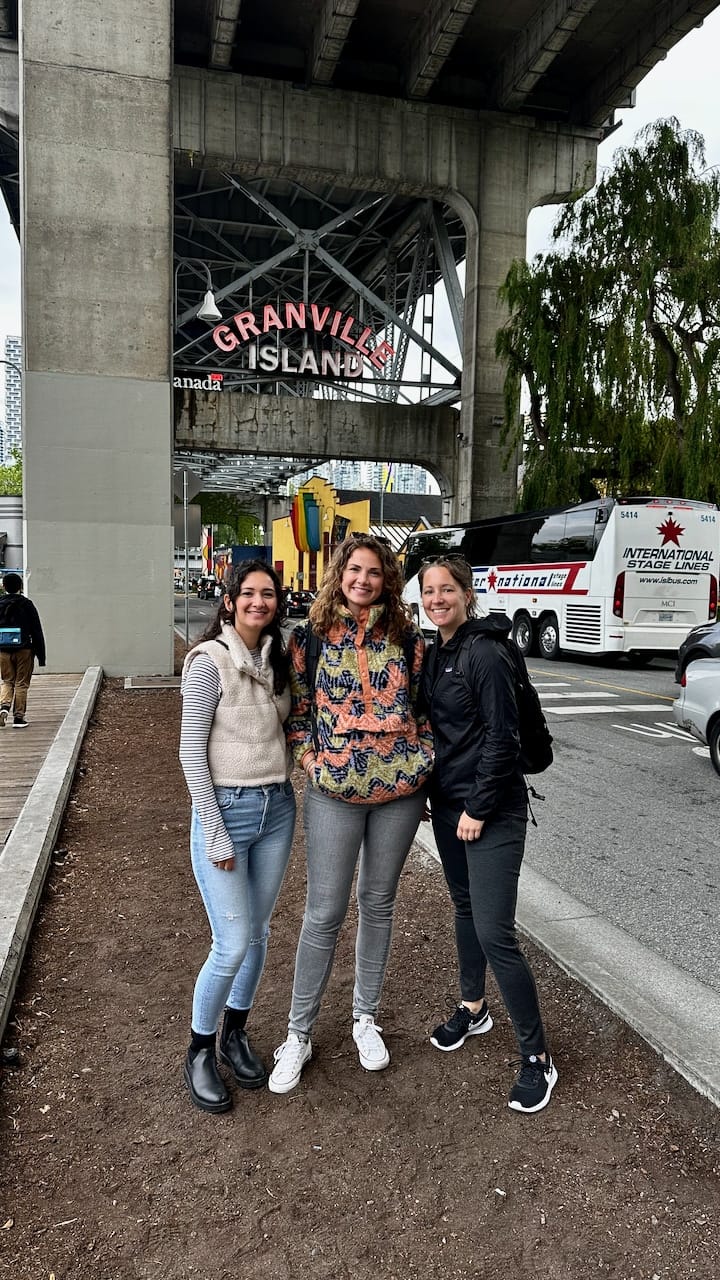
Walk toward the car entrance of Granville Island to find the sign

ferry dock: stamp’s landing | olympic village

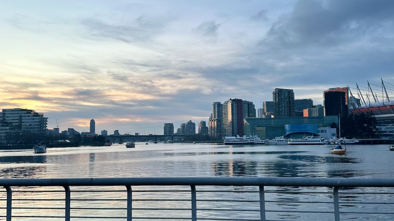
When you get off the ferry at Stamp Landing, you’ll find yourself in a more quiet spot along False Creek (the water). You’ll find mostly residential buildings here, but what’s worth coming here is the walk on the picturesque seawall. Make your way to the next ferry dock, which is The Village (Olympic Village). Just look out for the big sphere which is the Science World museum and walk that way. It’s a 15 minute walk by the water. You can also keep walking to the Science World Museum and take a beautiful photo over the water (like the photo below).

When you’re close to the ferry dock, you’ll see Olympic Village Square with oddly large bird statues and a big red barn-looking building at the end of it: that’s CRAFT Beer Market False Creek. Perfect spot for a drink or a bite to eat depending on the time of the day and your appetite. Once you’re done here, walk over to the ferry dock. From here, go wherever you want to go next! If you started at the Aquatic Centre in the West End, make your way back there on the ferry.

That’s all? Where are the food recommendations? Well, here’s the thing. There are big, busy roads beyond CRAFT that I don’t think are worth the time on your short stay. I can recommend some restaurants, but it would require you to walk around a rough area, so I’ll leave it here and recommend to go back to the ferry and decide on your next/last stop.

If this is your last stop and it’s time for dinner, I would recommend to take the ferry to David Lam (Yaletown) if you want to eat downtown, or back to whichever area was your favourite / closest to your accommodation.

Time estimation

Walking from Stamp’s Landing to The Village is 1.5km (20 minutes). If you’re going to make a stop at CRAFT, add about 45 minutes to an hour to it for enjoying food/drinks and the stroll back to the ferry. 

Photo taken on the walkway around Science World

one day in Vancouver ✅

There you go! One day in Vancouver. You’ll be dead tired but satisfied at the end of this. Please let me know if you ended up doing this itinerary – I’d love to hear how you liked it!