Tag

british columbia

Browsing

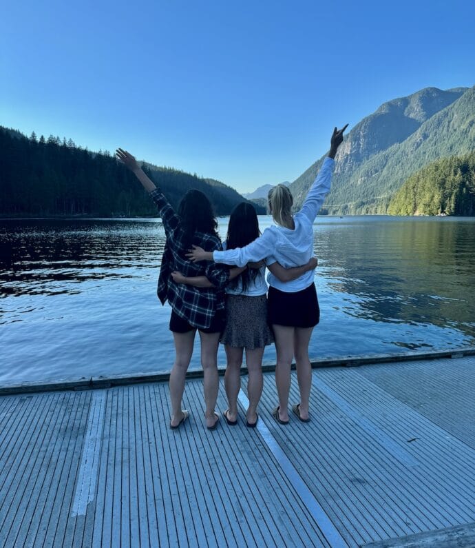
Salt Spring Island is a Southern Gulf Island between Vancouver Island and the mainland of British Columbia. It’s a gorgeous and very laid-back island with an artistic community, a local food scene, and fantastic scenery. Here’s how to spend two nights on this unique isle.

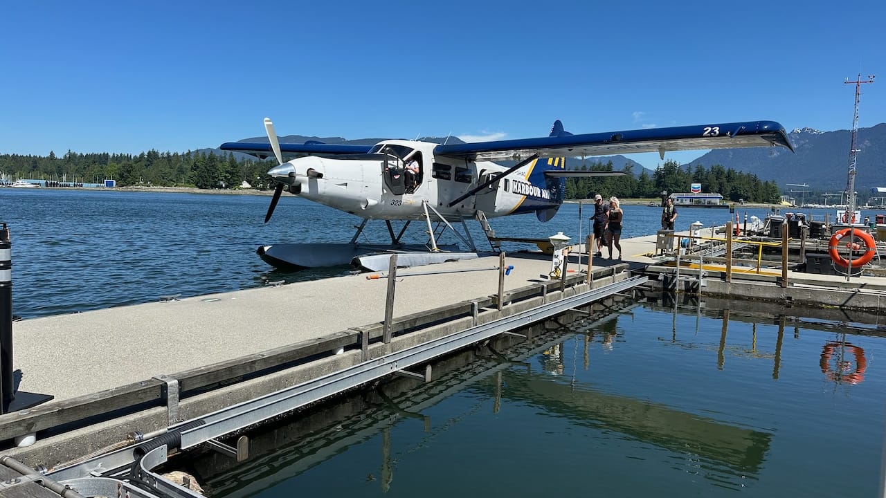
Seaplane from Vancouver to Salt Spring Island

The best way to get to Salt Spring Island is to take a Seaplane. It’s an incredible experience that will get you to the island in under 25 minutes. You can book a flight on Harbour Air from Vancouver Harbour to Ganges, Salt Spring Island. 

We booked the Light ticket type, which allows you to bring 10 lbs (4.5 kg) of luggage. This turned out to be very doable for just the two nights. For the two of us, the flight was $170 in total.

You can also choose to take take BC Ferries, however it can take you about 4 hours to arrive to the island. You’ll need to first find your way to Tsawwassen (45 minutese from Vancouver), arrive early for your ferry reservation, then finally sail for about 3 hours until it finally stops at Salt Spring Island. We decided the travel would be much too long for such a short weekend stay.

Rent a car

It’s a 10-15 minute walk from the Harbour Airport to Salt Spring Car Rental. I recommend booking ahead; they no longer had any $99 small cars, so we had to grab the mid-size at $110 per day. After a short check-in process, we were on our way.

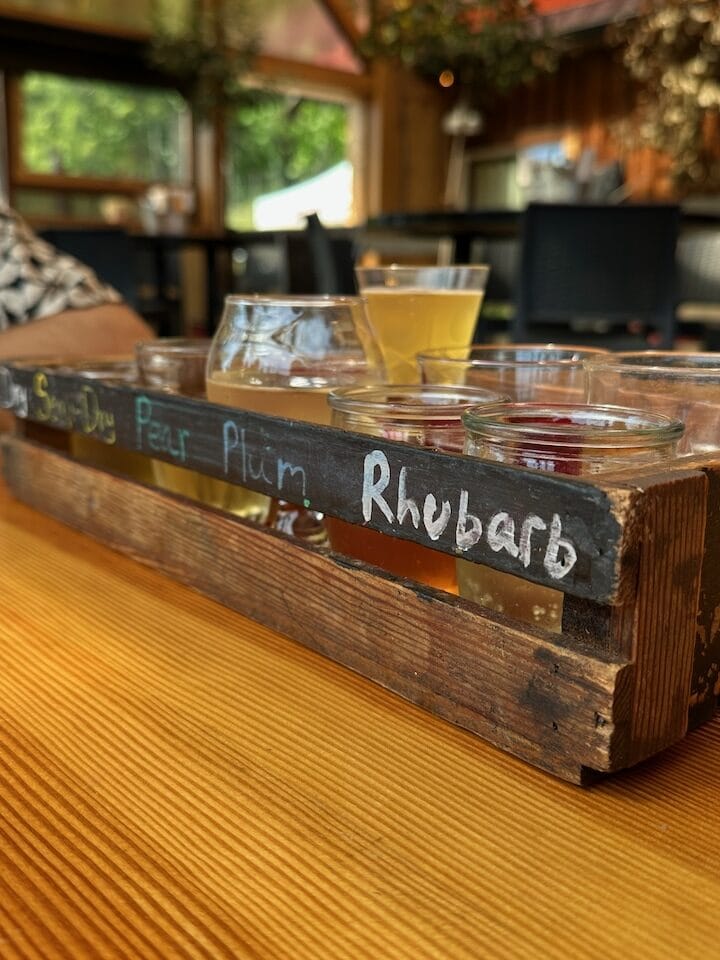
Sip ciders at Salt Spring Wild Cider House

From the car rental, it’s a 4-minute drive to the Salt Spring Wild Cider House, an artisinal cidery that only sells to private local liquor stores throughout BC. They have a gorgeous spot–it’s a barn building with a gorgeous patio and a wonderful view. We ordered a full flight of ciders and shared it, along with a charcuterie board. The ciders were really nice and it did make me regret we didn’t have a lot of luggage space. Would have gladly purchased a bottle… Guess I’ll just have to go back some time.
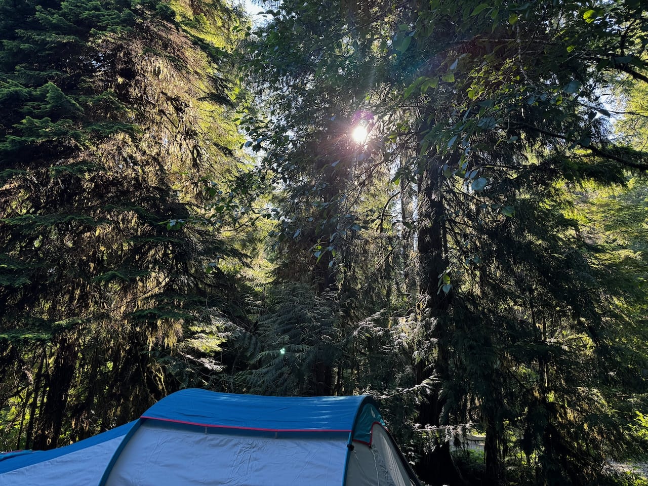
check into a yurt

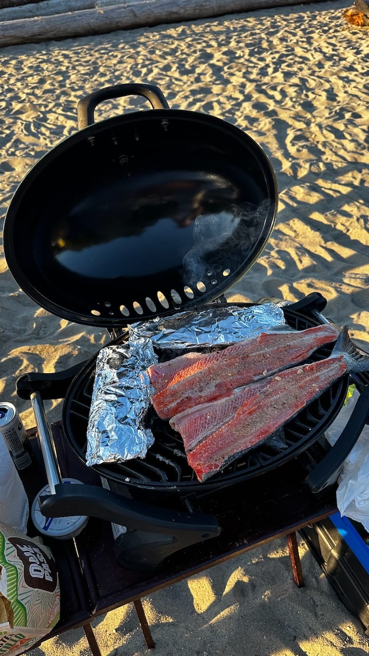
We went for a unique Airbnb experience for our stay: we found a yurt on the north west side of the island. It had everything: a king size bed, a well equipped kitchenette, a barbeque on the patio, and a bathroom and shower behind the bedroom. It even had air conditioning, which came in handy when the temperature climbed above 25 degrees.🔗 OceanView Lodge – The YurtBefore driving to our Airbnb, we paid a visit to the local grocery store and got ourselves a nice piece of trout, a bunch of Spot Prawns–in season only briefly and they were super fresh!–and some ingredients for a simple salad. Tom cooked dinner on the barbecue while two deer munched away at some leaves right behind him. Amazing.

Watch the sunset on Bader’s Beach

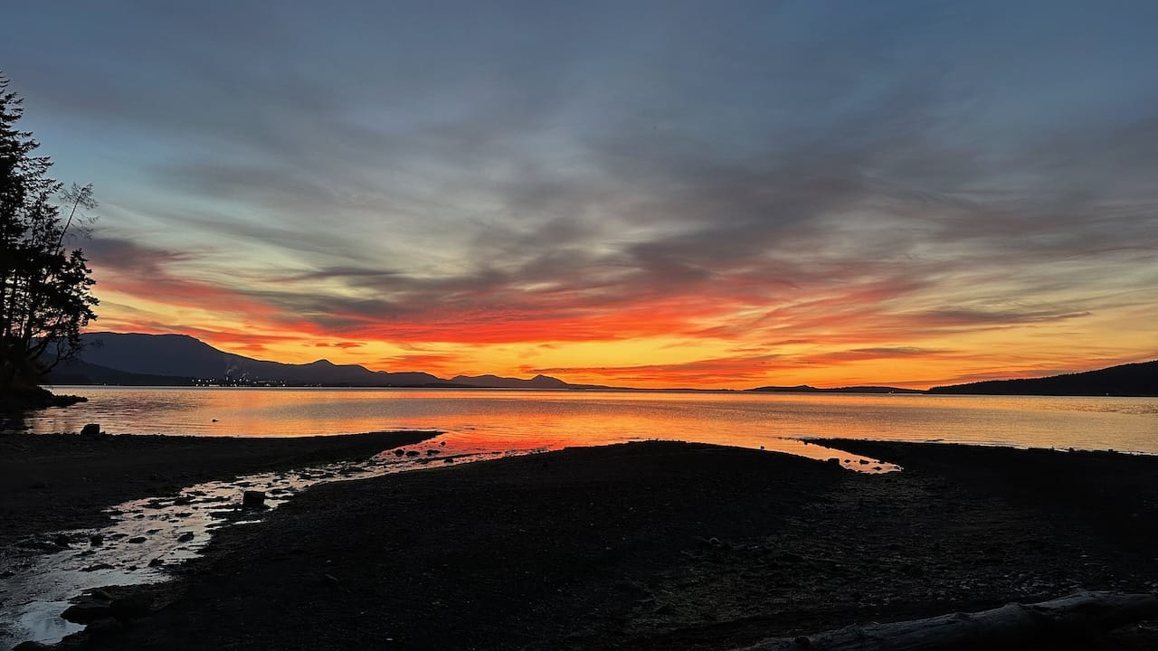
We were terribly lucky with the weather. The temperature was still so pleasant, so after dinner we drove south to find a nice spot for sunset. We drove down to Bader’s Beach, where a family of three and a dog were the only other people. The mom pushed a little boat into the water and paddled around with the dog swimming after her. The kid played in the sand on the beach. And the dad? He opened a little suitcase and out came a violin. He started playing and that was our background music while we sat down on some rocks further down the beach. It was so scenic out there, and we watched as the sky changed colors.

enjoy lunch in Ganges

Ganges has a bunch of nice food options. We decided to go to Auntie Pesto’s for a pasta as fuel for our afternoon activity. We sat on the patio and enjoyed the view over the water and harbour.
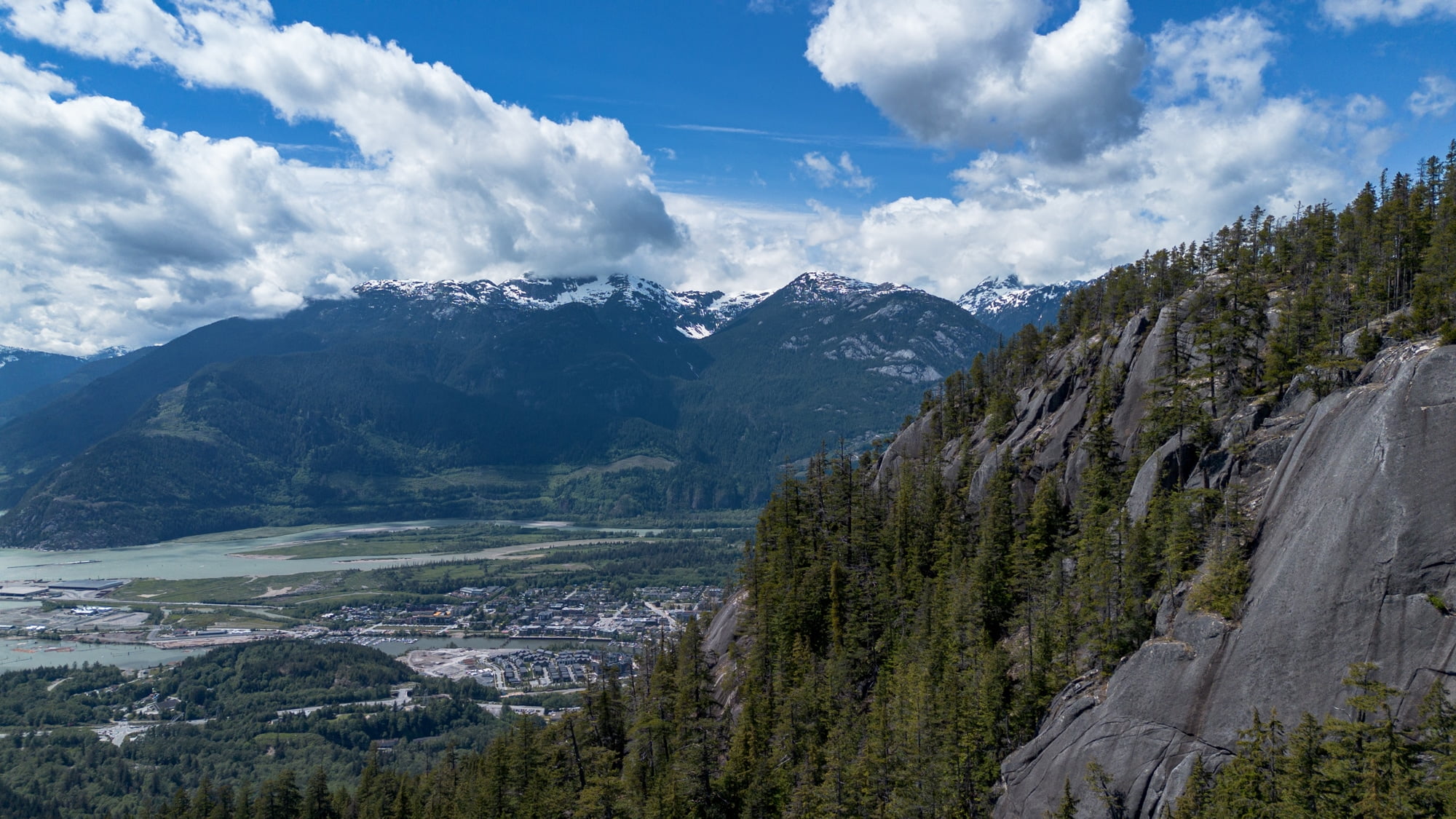
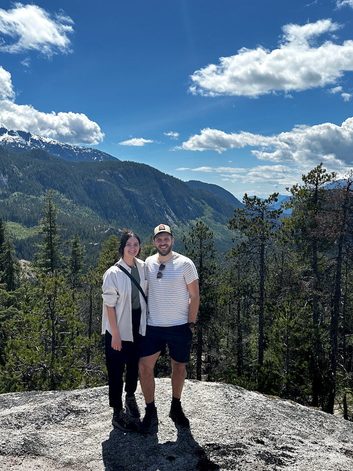
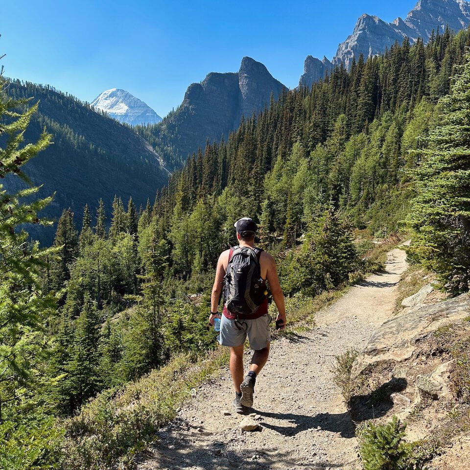
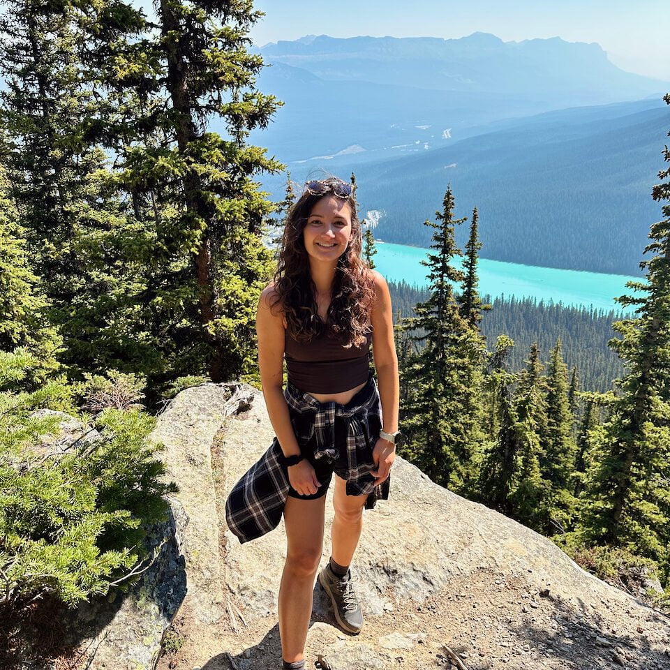
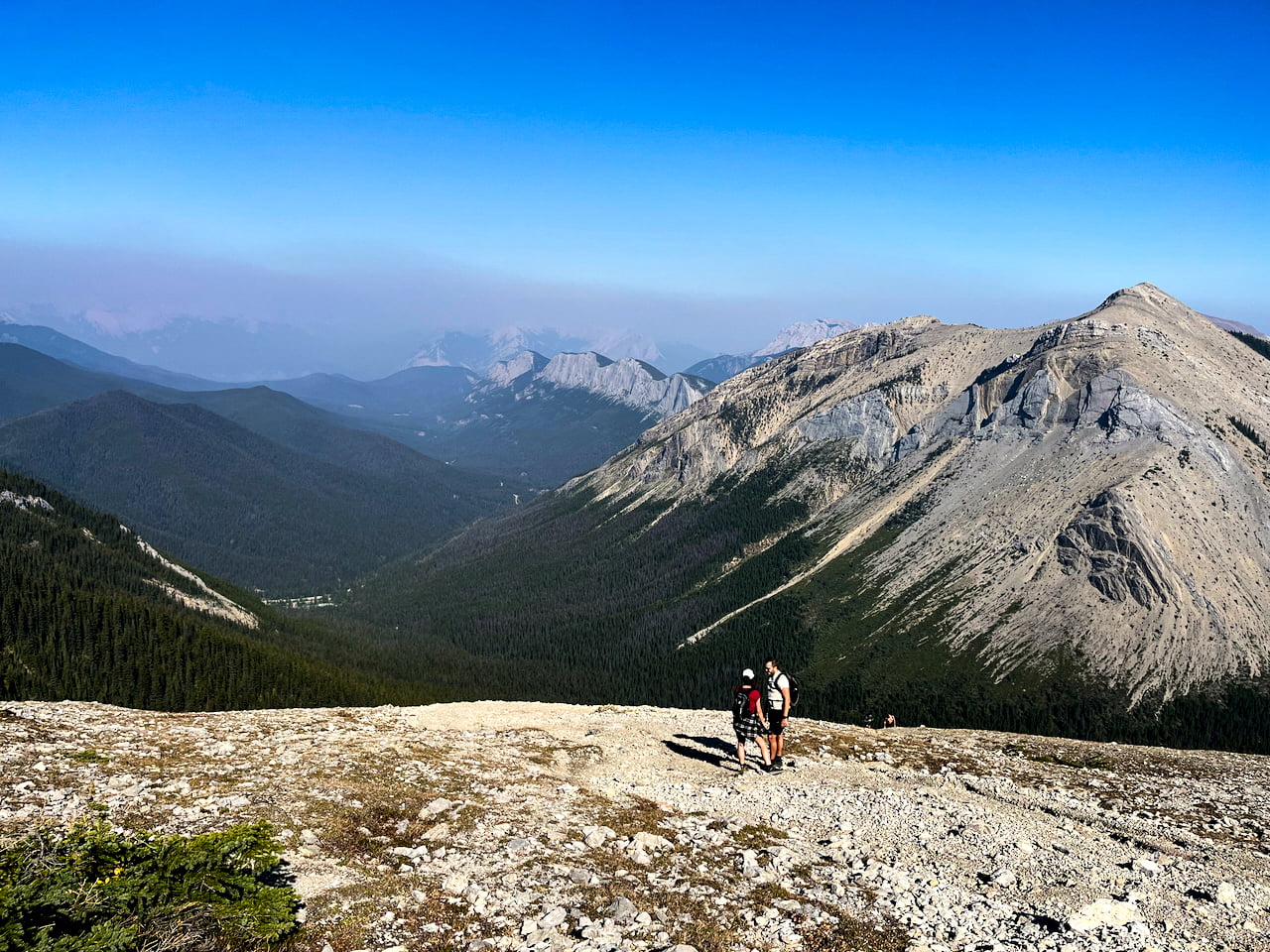
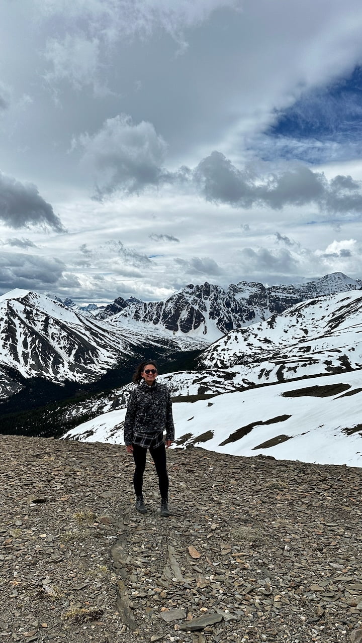
go for a hike

There are plenty of nice trails on Salt Spring Island. We looked for a trail around Mount Maxwell:

🥾 Baynes Peak via Rim Trail and Gary Trail Loop (4.8km, 1h5) – we did this one, an enjoyable easy to moderate hike
🥾 Girlfriend Trail Lookout (4km, 2h13) – the waitress at Autie Pesto’s recommended this one if we wanted to do a bit of a grind. At 27 degrees, we didn’t 😉
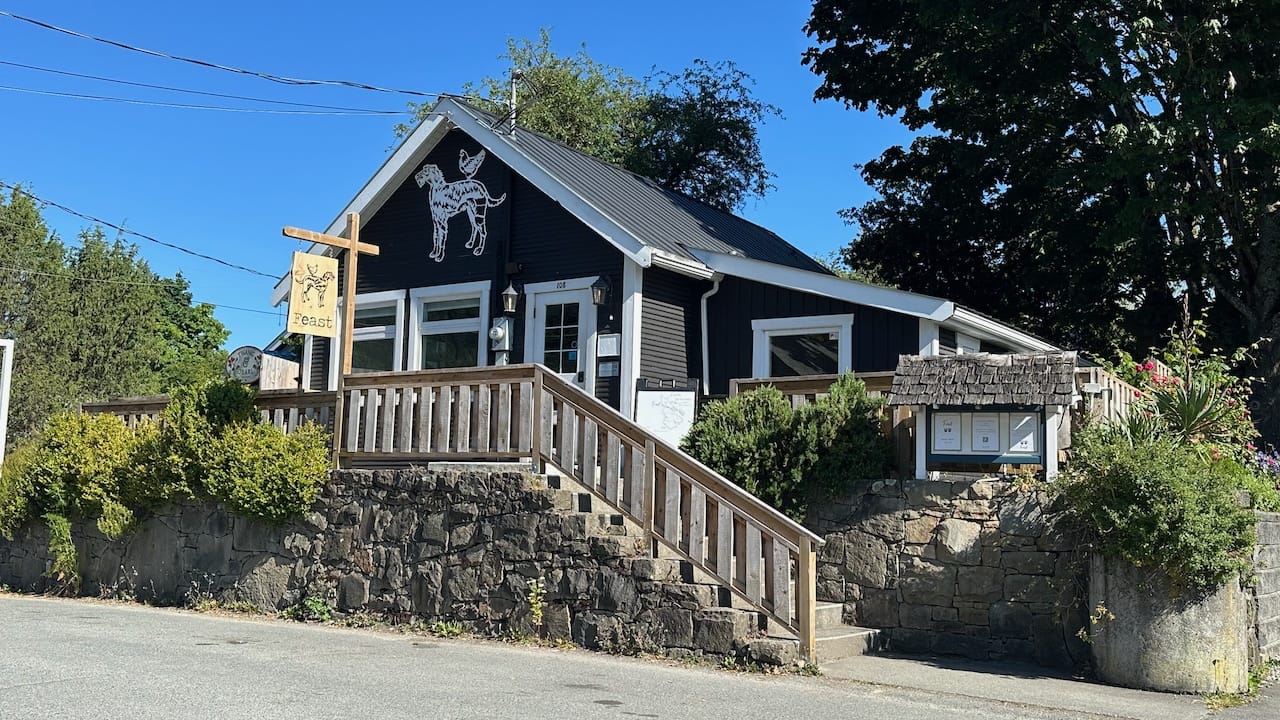
have a feast dinner

We booked a table at Feast, a farm-to-table restaurant in Ganges focused on local and seasonal-sourced food. They serve beautiful, large shareable plates. Definitely recommened!

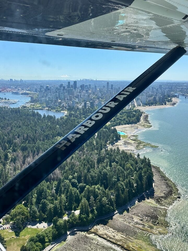
take the seaplane back to Vancouver

Going back to Vancouver was a treat, because we got to go on the seaplane again! Flying over the Gulf Islands is gorgeous, but it was also really awesome getting closer to Vancouver. Seeing Stanley Park from this angle, and the city towering behind it, landing in Coal Harbour… Just wow! I feel like we’re so spoiled now and wouldn’t ever want to take the ferry again. I hope to have another chance to do this and explore one of the other islands in the future!

A couple weeks into my marathon training, my schedule showed it was time to run a half marathon in the last weekend of February. It happened to coincide with a Vancouver Island weekend trip we were planning, so I searched for some running trails in the Ucluelet and Tofino area. To my delight, I learned that a multi-use path of 25 kilometers between the two beach towns had been opened in 2022. Challenge accepted: run a half marathon on the ʔapsčiik t̓ašii in the Pacific Rim National Park Reserve!

After the Christmas holidays of 2024, I sat myself down for 2025 goal setting and decided it was time to kick off my marathon training. I crafted a 16-week schedule that put me on a regime of four runs per week, with Sunday marked as my long-run day. Having a solid plan really helped me bring back some discipline, and my progress has been steady and motivating so far. Week 6 was going to be a milestone: the half marathon. 

The thing with marathon training is that at some point, you can’t just ‘go for a quick run’. The weekly long run entails setting an alarm, have a power breakfast, give the stomach about 45 minutes to process, then push out that long run, shower, and have a recovery lunch. Long story short: it takes up a whole morning. But you know what, that doesn’t mean we have to be stuck at the apartment every weekend, does it? We had been chatting about planning a weekend trip in February, and just as I completed booking our Ucluelet accommodation on Vancouver Island, we realized that weekend was half-marathon-weekend.

Tom running the ʔapsčiik t̓ašii

ʔapsčiik t̓ašii, upscheek tashee

I searched running trails near Ucluelet as well as running trails near Tofino and was just about to give up when I read something about a new ‘MUP’ between Tofino and Ucluelet. Crossing my fingers, I went on to figure out whether it was suitable for a run.

The ʔapsčiik t̓ašii (pronounced ups-cheek ta-shee) pathway was developed as part of a long-term vision to enhance sustainable transportation, safety, and cultural connection in Pacific Rim National Park Reserve. The idea of a multi-use trail had been discussed for decades, but planning and construction took several years (as it usually tends to).

The need for a safe cycling and walking route was recognized as early as the early 2000s, as Highway 4 connecting Tofino and Ucluelet was too dangerous for non-motorized travelers. Parks Canada, in collaboration with the Tla-o-qui-aht First Nation and Yuułuʔiłʔatḥ Government, began planning a trail that would respect the ecological and cultural importance of the land. Community engagement and environmental assessments helped shape the project, ensuring minimal impact on sensitive ecosystems.

Building began in 2018, and in the early summer of 2022, the 25 km pathway opened to provide a safe, eco-friendly, and super scenic connection through the national park. The name means “going the right way together” in the Nuu-chah-nulth language and honours the partnership between Indigenous communities and Parks Canada.

ʔapsčiik t̓ašii (Upscheek Tashee) | Source: ACEC BC Awards

In addition to 25-kms of new 2-way multi-use path, the fully constructed project includes: 3 bridges over fish bearing streams, 370 lineal meters of elevated boardwalks over sensitive wetlands, 4 new highway culverts, 8 highway culvert extensions, 60 amphibian culverts, 180 pathway culverts, 7 major retaining walls (up to 5m in height), 700 lineal meters of highway widening & slope stabilization, 11 Fisheries Enhancement sites, & mitigation of former slides & general slope stabilization of a 20m high foreshore slope to facilitate trail switchbacks. (ACEC BC Awards)

Running the ʔapsčiik t̓ašii, upscheek tashee

My reference point was this route from AllTrails: from the Radar Hill trailhead parking, it’s a straightforward route that has you run parallel to the coast, passing Radar Beaches, Schooner Cove Beach, Long Beach, Combers Beach, Wickaninnish Beach, and finally, Florencia Beach. 

The logistics had us torture our brain a little bit. Recovering from a injury, but still hoping to run the marathon in May, Tom wasn’t too sure if he’d join the run. If he can’t, do I still go? Is it not too creepy by myself? Are the bears awake yet? How do we get there? How do we get back to the car at the end of the 21 km? Google Maps doesn’t give any public transit options. What does a cab cost? Excuse me HOW MUCH you say? Never mind that. What if Tom rented a bike? What if we drove our car to the endpoint and found a ride to Radar Hill somehow? 

What the trail looks like most of the way

Here’s how we made it work in the end:

💛 West Coast Transit Service | There’s a local (not known on Google Maps) transit service that you can find on the Alberni-Clayoquot Regional District website. The West Coast Transit Service page included a schedule which showed that on weekends, there would be a bus going from Ucluelet to Tofino twice in the morning and twice in the afternoon. We also need the Token Transit App (App Store / Google Play) to pay for the ride.

💛 Weather check | It was forecasted to be a very rainy weekend; especially Saturday it was just pouring and pouring all day. Checking our trusted weather apps, we decided Sunday morning looked a lot better. 

💛 Double check | We went into the Pacific Rim Visitor Centre which is just at the junction right before you enter Ucluelet, to ask if this bus is really going every day and at this time of year. She confirmed, and pointed at a little pole that said ‘Transit’ just there on the parking lot.

💛 Prep & Gear up | We got ourselves some groceries the day before to ensure we could have some pre-run breakfast and post-run lunch. Our alarm went off at 6.30 AM, we prepared our peanut butter toast, and got into our running outfits. I packed one gel each, and Builder Bar for Tom. I forgot my little flexible water bottles at home, but thank goodness Tom had packed his running vest and water bladder.

💛 DO IT!

So there we went… We drove to the Pacific Rim Visitor Centre, parked the car, and waited for the 7.45 AM bus. When he arrived and we got on, the driver asked where we were planning to get off. “The Radar Hill parking lot please,” I asked. His eyebrows shot up, and he said, “Wow, you’re the first to ever ask me for a drop-off at that stop.” He went on to ask us if we would be taking a ride back to Ucluelet later in the day. “Well…” I began, “The plan is actually to run back”.

RUN back?,” he went, “Ahhh, what’s it like to be YOUNG?!”

We hopped out at the Radar Hill Parking Lot and immediately saw the entrance to the trail. “Look out for me on the road in case you get injured or something,” the friendly driver told us. We did some stretching, got the GPS tracking on our watch going, and started our 21 KM run. Thankfully, it was only drizzling rain, not pouring like it did the day before. It was actually the perfect weather for such a long forest run! 

The trail was perfect for our run. It’s paved through rain forest with a total of 128 meters elevation – good practice for our marathon in Vancouver, which will also have some hilly sections. Full disclosure: I am terrible at running upwards – I walked those steep bits of the trail asking my upper legs to please not die and asking the universe why I was doing this. At 5K, we were rewarded for finishing the first quarter with an impressive view of Long Beach. Unfortunately, it was very foggy from the drizzle, but it looked incredible nonetheless. Impossible to capture well, but here’s a photo I quickly snapped before catching up with Tom.

Long Beach on the Tofino side

Apart from that beautiful bit of beach, you don’t actually see more of the coast because of all the forest. The path switches between being surrounded on either side by forest, to having the road on your side. That allowed our bus driver to check in on us twice; he honked and waved at us as he continued his bus service back and forth between Ucluelet and Tofino. We waved back reassuringly – we’re still going, all good!

Two hours and ten minutes is how long it took us. The last 3Ks were gruelling though – why do those last kilometers always feel like it’s taking ages? Everything was hurting at that point and I was terribly thirsty. After high-fiveing and gulping down what little water was left, we walked the last bit back to the car, where two glorious water bottles were waiting for us.

And heated seats.

But the next bit was even more like heaven – our Airbnb had a hot tub, which was the perfect way to relax those angry muscles.

Looking out over the bay from our beautiful Airbnb

And that was it! I hope that the next time we come here, we’ll finally see it with sunny weather… And who knows, we might find ourselves on the trail again in the future. But maybe just for a walk or a bike ride 🥲

Hello friends! I’m sitting at our kitchen table with a hot mug of tea while it’s pouring rain outside – and by pouring rain I mean an ‘atmospheric river’ has hit Metro Vancouver. If anything is going to symbolically announce that summer is long gone and those shy initial stages of fall are over, it’s this. Time to look back and tell you about my summer months.

It’s been a bit quiet over here, sorry about that! I’ll make it up to you with a little (or not so little) summary of what this past summer was like. Officially, summer starts on June 20th, but let me cheat a little bit and start at the end of May, when we had our first summer-ish activity.

Half Corked Marathon

At the end of May, we drove to the Okanagan for a very special event: a half marathon through the vineyards of Osoyoos. We ran 21 kilometer and stopped at 18 wineries for a tasting sample (or two). The theme was “Now That’s The 90s” – it was hilarious to see what everyone was wearing. We went as Baywatch and high fived a bunch of other life guards as well 😉

May 25, 2024 | The Half Corked Marathon, 21km of running through vineyards and tasting wine

Special guests 🇳🇱

When we got back to Vancouver, we quickly dropped our stuff and hopped back in the car to head to the airport… Because Vera and Melissa were about to land! They stayed with us in Vancouver a couple of days, took the ferry to Vancouver Island while I worked during the week, and when they returned the girls and I left the city for a road trip. I wish we’d had more time in Vancouver and some better weather, but hopefully better luck next time? 😉

May 27, 2024 | Melissa and Vera are here! We did Deep Cove to keep them awake
June 5, 2024 | Wine touring in the Okanagan

That road trip took us from Vancouver to Calgary! More about that in my other post from this week: ✍🏼 A Vancouver to Calgary roadtrip itinerary through the Canadian Rockies, and here’s a few more photos below.

June 8, 2024 | Patricia Lake in Jasper National Park
June 11, 2024 | Peyto Lake with snow
June 11, 2024 | Me sneaking another quick photo before we leave Peyto Lake

Camping on Vancouver Island

In July, we went camping with Anienke and Smit on Vancouver Island. For all of us, it was our first time sleeping in a tent in Canada. We had so much fun and had amazing weather. We camped in Strathcona National Park for a night and went to find Myra Falls there, a beautiful place used as a filming location in the Apple tv show “See”. What an incredible place. The water was ice cold and super refreshing! The next day, it was time to pack up and move to another camp site a little south of Port Alberni. So lovely driving around and getting to know the island a little bit better. The second campground was a bit smaller, but still very nice and located conveniently by a river, so we hung out there to cool off.

July 5, 2024 | Myra Falls on Vancouver Island
July 5, 2024 | Enjoying the view of our friends on camping dinner duty
July 5, 2024 | Hello from Strathcona Park
July 6, 2024 | The view just beside the campground
July 6, 2024 | Tom fishing in the Stamp River

special guests part 2 🇳🇱

My two dear friends Fanny and Franka came to visit. It was rather last minute, which made it all the more special to have them. They joined us and our friends for Symphony in the Park in Burnaby, we swam in the Lynn Canyon, we paddle boarded on Buntzen Lake, I got to show them Joffre Lakes, sent them to Squamish for The Chief, and so much more.

July 15, 2024 | Joffre Lakes with Franka and Fanny
July 18, 2024 | Dinner with Franka & Fanny
July 14, 2024 | Waving bye at Buntzen Lake after a day of picnic, swimming, and paddling

Sooke

We couldn’t get enough of Vancouver Island, so thankfully, we had another tripped planned 😊 No camping this time, but a lovely Airbnb in Sooke. We visited several beautiful beaches, cooked delicious meals in our kitchen, and went on an unforgettable whale watching tour.

August 30, 2024 | Waiting for the ferry to Vancouver Island
August 31, 2024 | Anienke and I on French Beach
September 1, 2024 | We saw two killer whales on our whale watching tour
September 2, 2024 | Visit to Victoria on our way back home

Chelan County in Washington State

Our last trip this summer was a road trip to Washington State. I love that place so much! It was a bit of a long wait at the border, but it’s worth the trouble. Our destination was Cashmere, a small town in the Chelan County, which is just south of the Okanogan County. That made us laugh a bit, because north of that is the Canadian Okanagan (you know, where the wine comes from).

On our way to our Airbnb, we stopped in Leavenworth, a Bavarian-style town that was terribly crowded but quite charming. Once we got to Cashmere, we could quickly freshen up and only briefly catch our breath before continuing our journey, because we were going to see the Imagine Dragons perform at what must be one of the most beautiful concert venues in the world… The Gorge Amphitheatre. Oh man, what a special place and what a great show!

After the concert, we spent the rest of the weekend exploring this beautiful area of the state a little bit, which included a 5 hour hike to Colchuck Lake (that was a really nice one!). The way back to Vancouver was such a treat – we took the northern scenic mountain route and it felt like we were driving in the Rockies.

September 29, 2024 | Hiking to Colchuck Lake
September 30, 2024 | Ross Lake
September 29, 2024 | Hiking to Colchuck Lake
September 29, 2024 | Colchuck Lake
September 30, 2024 | Chelan

and everything in between

These highlights make me miss summer so much! And that wasn’t even everything yet. Vancouver is so amazing in the summer, there’s so much to do and everyone around us is always up for getting together, because what better way to enjoy the season than with great company 💛
  • We did another day out on the boat. The water was pretty rough that day, but Tom and Jo were great captains and ensured both boats returned in one piece and delivered our group back on Granville Island safe and sound.
  • We did an overnight backpacking trip to Watersprite Lake for Lara’s birthday. In case you missed it, I posted about that adventure here.
  • We went to the Abbotsford Air Show again this year. We were better prepared for the intense heat this time, but still, whoo, it was just as bloody hot as last year. The air shows were as impressive, too. So were all the soldiers around that somehow didn’t faint from being in uniform all day.
  • August is our birthday month, so Tom and I threw a birthday party. The bbq was delicious and the company was even better 💛 Alexander and Sif were in town after moving back to Denmark last September, so it was extra special.
  • Just after my birthday, I finally finished my Invisalign treatment! I wore aligners for about 8 months and am super happy with the results.
  • This summer also included some apartment viewings, because we decided to look for a different place. A couple of viewings and a number of grey hairs later, we found a nice new apartment in the same neighbourhood. We moved in on October 1st and felt at home quickly. We gave our car an appreciative pat on the trunk – we were able to move everything in our own car, including the couch and bed. Don’t ask how, but we succeeded!
July 28, 2024 | Hiking to Watersprite Lake
August 3, 2024 | Spontaneous salmon on the beach
August 10, 2024 | Abbotsford Air Show
August 25, 2024 | Done with Invisalign, woo!
August 17, 2024 | Birthday peeps

And now? Now we hibernate 😴

Obviously I am biased at this point, but if there’s one road trip I would recommend anyone to put on their bucket list, it’s the drive between Vancouver (British Columbia) and Calgary (Alberta). I’ve had the pleasure of driving it twice, once from Calgary to Vancouver and once from Vancouver to Calgary. In this post I’ll share a 10-day itinerary for you to copy or to draw inspiration from for your own trip.

If you are planning a vacation to Western Canada, please consider a roadtrip through the Canadian Rockies! Let me help you by outlining an example itinerary with some of my personal favourites and recommendations. 

Where to start?

If you’re planning to fly to Canada, you might be wondering which city to start from. A couple of considerations:

  • Coming here in the summer (end of June to end of August)? Then I would recommend to start in Calgary and make your way to Vancouver. Vancouver gives you mountains as well as beaches and the ocean, which makes summer in this area a dream. You’ll have more options for activities here. Calgary is… Eh, I don’t like Calgary as a city that much 🙂
  • For the shoulder seasons, it might be nicer to start in Vancouver and end in Calgary instead. There’s more rain in Vancouver, which may impact your experience. 
  • Something to keep in mind for budgeting is that renting a car in one city and returning it in the other is pretty expensive. If you have the time, doing it as a loop (start and end in the same city) might turn out to be cheaper. Do your research, and/or consider camping to lower costs. 
  • If you’re a camper kind of traveller, that’s definitely a popular choice, but it might not be cheaper than doing Airbnbs, hotels, and/or car camping. Again, do your research, and see what suits you best!

My most recent trip was early June from Vancouver to Calgary. This itinerary will be based on that route.

Day 1 | Vancouver to Kelowna

I’m going to start this itinerary with the first bit of driving toward the Rockies, but if you are starting (or ending) your vacation in Vancouver and have the time, please do consider taking a couple of days to explore Vancouver and the area! If you only have one day, here’s one way to spend it: One day in Vancouver: False Creek Ferries. For this post though, I’ll focus on the roadtrip-part.

For your first day of driving, you’re going to be headed to Kelowna. You’ve got two options here:

  • If you have the time, I recommend taking the southern route: Vancouver – Hope – Princeton – Penticton – Kelowna. Without traffic, this will take you about 4-5 hours. (457 km). What a drive. 
  • For a quicker route to Kelowna, take the route through Merritt: Vancouver – Hope – Merritt – Kelowna. This will be about 3-4 hours (391 km)

As you can see, both routes go through Hope. It’s a great place to stop for a pit stop. 

Blue Moose Coffee House

Make sure to make a stop at the Blue Moose Coffee House in Hope. I've stopped here for every trip to Kelowna. Great spot to order a coffee and a quick bite to eat. They have great sandwiches and pastries. Address: 322 Wallace Street, Hope, BC V0X1L0.

Day 2 | Morning hike and afternoon wine

After a good night’s sleep, get in your comfy walking or hiking gear. On the north side of Kelowna, Knox Mountain gives you a nice opportunity to see the surroundings from above. If you’re up for a workout, this 7K (2,5 hour) hike is a nice introduction to the area: 🥾 Paul’s Tomb, Ogopogo, Pavilion, and Apex Trails. I’d recommend doing this in the morning, then go and refresh yourself. Next, go to Sprout or Curious Café for lunch. Make it a big lunch, because you need to fuel up. Why? Because wine.

The Okanagan region is known for its great wines. I recommend booking a wine tour for the afternoon – I’ve done it three times and can’t wait to go again! It’s great fun being brought from one winery to the other, trying a few different wines at each stop. You visit a set of curated places, each one offering a different kind of wine experience. I’ve seen everything from fancy and decadent vibes (such as FRIND) to rural and quirky (such as Off The Grid where you can pet the goats and bunnies, or The Hatch which is like a shed/barn) and even Peaky Blinders vibey (specifically Crown & Thieves). If you go for a 3 PM tour, you’ll be brought back to your hotel/Airbnb by 6 or 7. From there, see how you’re feeling about food! The first time I came back from a wine tour with VIVID Tours, we went on Uber Eats and had a pizza delivered to our Airbnb.

The second time I did a wine tour, I actually stayed in Vernon, a bit north from Kelowna, and toured with Sip Happens. There are various businesses offering tours in different areas in the Okanagan, such as West Kelowna, East Kelowna, or Lake Country. Depending on where you stay, choose one that does pick up in the town your hotel or Airbnb is located in.

If you’d rather not go on a full tour, you can pick out specific wineries to visit and do tastings. There are also beer/cider tours, if you prefer that more.

June 5, 2024 | Sipping wine at Crown & Thieves
Vivid Tours

I've done a wine tour three times, two of those with Vivid Tours. They pick you up at your hotel or Airbnb and drive you to a selection of wineries. I've done a West Kelowna wine tour and an East Kelowna wine tour. The last time I did one in June 2024, I called them just a day before and they happily accommodated us for the next day. Us three girls got picked up by Fred in his bus that seated about 12 people. He took care of us and three other groups. As you can imagine, the last ride from the final winery back into Kelowna involved lots of laughter and singing to the music Fred let us play in the bus. Great time!

Day 3 | Chase waterfalls in Wells Grey Provincial Park

After your time in the Okanagan, you’re going to get up early and drive north west for a bit, into the heart of British Columbia: Wells Grey Provincial Park. Known for its stunning waterfalls, I was excited to go into this area for the first time! 

We picked out a place on Booking.com in the town of Clearwater. On the way there, we left highway 5 to go onto Dunn Lake Road. After a bumpy ride with no cell reception whatsoever, we finally made it to the Dunn Lake North Recreation Site. When the lake came into view, my mouth dropped. It was so quiet, serene, and humungous. There was not a soul around, just us and this huge chunk of nature. The sheer size is impossible to capture on camera, but below is my beautiful friend Melissa on the Dunn Lake dock. 

June 6, 2024 | Dunn Lake North Recreation Site

The drive from Kelowna to Dunn Lake is 3.5 hours. From here, it’s another 40 minutes to Clearwater. After checking into your place, it’s time to chase some waterfalls!

🥾 Spahat Falls | Not really a hike, just find the parking lot and follow the signs to the falls and lookout. You’ll feel as small as an ant standing up there

🥾 Helmcken Falls Rim Trail | When I was there, the north side was closed. We did a different trail on the other side of the water which was a nice trail. Fantastic views over the waterfall!

If you’d like to go for a more elaborate waterfall adventure, there are plenty of hikes around. I haven’t done this one, but this 4 hour hike looks pretty cool: 🥾 Birch Bluffs Trail, and this is a 1,5 hour loop that goes by Bailey’s Chute and Marcus Falls: 🥾 West Lake Loop via Bailey’s Chute.

Hop 'n Hog

Done exploring and worked up an appetite? If you're into meat and barbecue, go to Hop 'n Hog for dinner. You might find a queue when you arrive, but it's worth the wait!

June 7, 2024 | Helmcken Falls
June 7, 2024 | Spahat Falls
June 7, 2024 | The view from the Spahat Falls platform

Day 4 | Drive to Jasper

Wells Grey Provincial Park is pretty cool, but it’s time to jump back into the car and go on route to the real deal… The Canadian Rockies! You’re going to drive north and cross the border from British Columbia into Alberta. When you do, keep in mind that you’ll move into a different time zone, so you’ll lose an hour of your day here.

On your way to Jasper, make a stop in Valemount, a cute railroad town. We had a delicious baguette at thee Valemount Bakery (1020 Main St, Valemount, BC V0E 2Z0). Not long after this town, you’ll take a right turn past Mount Robson and into Jasper National Park.

Going into the National Park, you’ll reach what looks like border control booths where you’ll be required to purchase a pass for the duration of your stay in the area. Just tell them how many days you’ll be spending time in Jasper and Banff, and then hang your pass on your rearview mirror.

You may have heard that Jasper suffered devastating wildfires in the summer of 2024. One-third of the town of Jasper burned down in what was the largest wildfire in Jasper National Park in over 100 years. By August, the fire covered 34,000 hectares and firefighters lost a brave colleague and friend. As the community, town, and nature recovers, please do your research before you go. I’ll share my recommendations based on my trip, but unfortunately I am not sure for all these locations how things are there at the moment. For hikes, check reviews on AllTrails to find out what recent hikers have said about the trails and surroundings.

Where to stay?

Staying in and around Jasper is terribly expensive. We stayed in Hinton (Days Inn by Wyndham Hinton) which meant lots of driving back and forth, but it was cheaper and gas was also very cheap there. With the changed circumstances in Jasper, check what's available and feasibly for you - if you can, consider supporting the locals by staying and/or eating and shopping local.

Day 5 | visit Maligne Lake

Jasper National Park is a one of Canada’s most renowned natural treasures, known for its stunning landscapes and wildlife. It’s the largest national park in the Canadian Rockies and a UNESCO World Heritage Site. As you can imagine, it’s a wonderland for hikers. I prefer Jasper National Park over Banff National Park, but it’s hard to put my finger on why that is. Something you’ll have to go and see for yourself! 

On my second trip to Jasper, I saw Maligne Lake for the first time. I couldn’t believe my eyes when we pulled up on this little bridge on our way to the hike we wanted to do. It looked like a painting, but to prove I was really there, here’s me blocking the view as I look over the Maligne River. 

June 9, 2024 | Maligne Lake Road. If you want to find this bridge, use these coordinates: 52.72831836460089, -117.64423761194111

From here, you can take a boat ride on the lake, enjoy the restaurant by the lake, take in the beauty around you… For us, the activity was going to be a hike.

From this bridge, it was just about a minute further to the Bald Hills Trail, which we chose after considering several other options. It was still early in the season, which meant many hikes were still covered in snow. Based on reviews on AllTrails, we decided to go for Bald Hills – we knew there would be snow and we might not be able to do the full thing, but we agreed to go up as far as we could and just turn back if it got too challenging – the views on the way would be great either way. 

🥾 Bald Hills Loop on AllTrails

In the end, we managed to get to the Overlook point and then looped back down. The hike to the summit was impossible for us to complete without snow gear. But that was fine, because this view was already such a treat! 

Funny story, when we reached this viewpoint, a German couple also arrived, and we offered to take pictures of each other. As I was focusing the man’s camera on them, I said “wait a minute… haven’t I taken a photo of you before?” Turned out, just a few days prior we also met this couple in Wells Grey Provincial Park and we took photos for each other there too! 

June 9, 2024 | The view from the Bald Hills hike. This is not the summit though!

Day 6 | spend another day in and around Jasper

June 10, 2024 | On Whistlers Mountain in Jasper

Take the Jasper Skytram

The Jasper SkyTram is an aerial tramway that takes you from the valley floor near the town of Jasper to the upper station on Whistlers Mountain. The tramway is the longest and highest guided aerial tramway in Canada with panoramic views of the surrounding mountains, lakes, and valleys. On our 7.5 minute ride up, a charming 20-year old English guy performed his well-timed and joke-filled presentation about the tram, the area, and the mountain.

🚡 Jasper Skytram (Whistlers Road, Jasper, Alberta, Canada T0E 1E0)

One of the interesting facts he shared was how this mountain gets its name from the whistling sounds made by the hoary marmots that inhabit the area. They use their whistling calls as a form of communication, particularly to alert others of potential danger. But how do they survive here? The mountain is pretty rocky and bald save for some sparse spurts of grass… The guide requested everyone to stay on the trail – hoary marmots are well-adapted to the alpine environment of Whistlers Mountain, but let’s not make it any harder for them by stepping all over what little vegetation there is. (Just a note that this place should not be confused by the town Whistler, which is a skiing/mountain biking paradise 2 hours north from Vancouver, though that place is probably also named after the marmots 🙃).

Tickets for the Skytram are $67.00 for adults. Pretty steep, but we wanted to do one gondola on our trip and picked this one over the Banff gondola. The views were incredible. Looking at these pictures again, I can’t believe I was up there. 

June 10, 2024 | On Whistlers Mountain in Jasper, overlooking the town and the lakes

Day 7 | Drive the Icefields Parkway toward Banff

Here comes another highlight! The Icefields Parkway is often referred to as (one of) the most scenic drives in the world. I can’t say it’s an exaggeration – really, it is pretty incredible. On this route, there are many note-worthy places for you to stop. I’ll share here a few of my faves in chronological order as you make your way from Jasper down to Banff. 

September 1, 2023 | Valley of the Five Lakes

Valley of the Five Lakes

If you’re starting in Jasper, this would be one of the first things you pass. A very accessible and easy start of the long drive, the Valley of the Five Lakes is a family-friendly hike, looping along 5 beautiful lakes. They’re relatively small, the walk doesn’t have much elevation, and yet you can enjoy and marvel at the gorgeous shades of blue and emerald 💚

🥾 Valley of the Five Lakes | Make sure you check if it’s open when you go. It’s directly south of Jasper town so it was affected by the wildfires.

Athabasca Falls

“The 23-metre Athabasca Falls is not very high by Canadian Rockies standards, but the size of the river makes it one of the most powerful falls to be found in the mountain national parks.” (Parks Canada)

Your next stop could be the Athabasca Falls; if not to be impressed by the waterfall, then just to get to know the main river that flows along this route. The river starts at the Columbia Glacier, which you will drive past later on. Here, at the falls, it has another 1425 kms to go until it reaches Lake Athabasca (wayyyyy north in Alberta), where the river ends. 

You won’t spend all that much time here; after all, this is only 30 minutes from the Valley of the Five Lakes. Take it in, take some pics, and hop back into your car. On to the next stop!

June 11, 2024 | Athabasca Falls
September 1, 2024 | Goats & Glacier Lookout

Random stops

Keep your eyes peeled for viewpoints where you can pull over for a bit to enjoy the views.

This one was called the Goats & Glaciers Lookout, absolutely loved this scenic spot! You can get out and do a little short trail. Keep your AllTrails app handy to check where some nice trail opportunities are hiding off the highway,

From here, you’ll pass Sunwapta Falls, and a bunch more other scenic spots. You might notice that the weather starts to turn though. Or at least that happened twice when I was there; the closer you get to the Athabasca glacier, the colder and potentially wetter it seems to get. The direct area around the glacier is very touristy, with buses driving onto the glacier (which I really wish they didn’t do that). There’s a skywalk and some other tour options. 

Peyto Lake

This is one of my favourites. When you arrive at the parking lot for Peyto Lake and follow the signage to the busy viewpoint deck, don’t be too quick to leave. There’s a really cool other viewpoint more to the left of the deck which is where this photo was taken. 

If you need some help locating it, use the AllTrails link below.

🥾 Peyto Lake Panorama View

From here, you’re very close to Lake Louise and Banff. The thing is, Banff is such an expensive place – kind of like Jasper – and so I recommend finding accommodation options in surrounding towns. For me, that was Golden, which is 1,5 hours from Peyto Lake and – surprise! – is located in British Columbia. Don’t worry though, as it’s so close to Alberta, Golden follows Alberta’s timezone, so you don’t have to go back and forth when it comes to your clock.

June 11, 2024 | Peyto Lake
Where to eat?

If you're staying in Golden, The Wolf's Den is a nice and cozy place to eat! We went twice, because the other restaurants we looked at couldn't beat the menu 😊 I also had dinner at Reposados the first time I was in Golden, which was a nice Mexican place with a lovely patio.

Day 8 | Hike in Banff National Park

You’ve now made it to the Banff side of the Icefields Parkway. And when you’re in Banff, you visit Lake Louise. Sigh… What can I say? It’s incredibly touristy, but it’s popular for a reason. If you’re reasonably fit and up for a little more adventure, here’s what I recommend: don’t go to just see the lake. You’ll be one of hundreds, you’ll get frustrated with how many people there are and how people won’t get out of the way as you try to take your photo. Instead, prepare for a hike visit that goes further than the rest of the crowd. 

Getting a Lake Louise shuttle bus pass

To control the big crowds, visitors need a shuttle bus pass to be able to get to Lake Louise. You can reserve a pass two days prior to your visit, at 8 AM local time, so you will have to decide when you go exactly. Remember, if you are not in the Alberta time zone yet, you need to double check what time time slot reservations open. The slots can be gone in just a few minutes. The link you need is: https://parks.canada.ca/pn-np/ab/banff/visit/parkbus/louise

Scroll down to Parks Canada Shuttles, hit the Reserve Now button. On the white box you get next, click on “Day Use” and pick “Shuttle to Lake Louise and Moraine Lake”. Next, you’ll get a map. Click on Shuttle.

Next, you’ll get time slots for Lake Louise and for Moraine Lake. Pick the morning OR midday option, but preferably the morning. If the Lake Louise options are full by the time you get to this screen, an alternative is to start at Moraine Lake (again, morning or midday). In this case, you will take the shuttle to Moraine first, have a look around, and then hop on the shuttle to Lake Louise. This option is more than fine as well. 

If you ask me, Moraine Lake is even more beautiful. It’s gor-geous. For that reason, I’d recommend to save it for after Lake Louise, but it’s not terrible to start at Moraine. Lake Louise just suddenly might seem a tad less impressive. But that’s just my opinion 😊

Getting to Lake Louise

On the day, drive to the Lake Louise Park & Ride. Make sure you have your reservation ready on your phone, avoid having no reception to load your shuttle booking! Once you’re there, try not to wince too much at how many cars are already parked. From the parking lot, make your way to the tents, where you can line up to check in and join the queue for the next shuttle to Lake Louise. 

Enjoy a hike

Lake Louise is a wonderful sight to see. When you arrive, the first thing you’ll want to do is stare at it and take some photos. That’s what everyone else is doing too, you’ll see 😉 Here are some of my photos from August 2023 and June 2024. When I was there in June, the lake had only just melted, so it was super clear and crisp and there was still lots of snow in the background. What you don’t see on these photos is that behind the photographer there’s a huge Fairmont hotel that looks like a Disney castle.

August 29, 2023 | At Lake Louise with Agniezska, Erik, and Tom
June 13, 2024 | At Lake Louise with Vera and Melissa

Walk alongside the lake toward the right, and follow the signs for the Lake Agnes Trail. The first lake you’ll reach is Mirror Lake. It’s pretty steep, so you’ll work up a sweat quite quickly. You’ll notice that until here, it can be quite busy. Most people continue the trail toward Lake Agnes, perhaps followed by the Big Beehive. However, what we did was go further up to Mount St. Piran.

🥾 Mount St. Piran Loop

A challenging hike with 937m elevation, but 100% worth the effort. We followed the advice of many reviews on AllTrails and turned back the same way after reaching the top. Apparently, going down the other side is very steep and dangerous. On the way back, we stopped at Lake Agnes before making our way further down back to the parking area. Though it was a tough one, the scenery on this hike was amazing as you can tell from the pictures below.


The shuttle pass gives you access to both Lake Louise and Moraine Lake, so after Piran we hopped on the shuttle to Moraine Lake. Exhausted from the hike, I didn’t go up onto the rocks that first time in August 2023, but strolled by the side of the lake. Wonderful views, and with the early evening glow the light was so beautiful. 

The second time around, we only went up to Mirror Lake and then turned back around (it started to get tricky with patches of snow from that point), so plenty of energy left this time to see Moraine Lake from a higher angle. I was baffled by the color of the water in June; it’s soooooo bright! Just like Lake Louise, the lake had only recently melted, so it really had that icy blue quality to it. And seeing the backdrop with the snow… Magical. If you have the chance to go twice, do it and go experience the difference! The pictures don’t do it justice at all.

August 29, 2023 | Moraine Lake from the side of the lake, end of summer
June 13, 2024 | Moraine Lake from the viewpoint, late spring/early summer

Day 9 | Yoho National Park

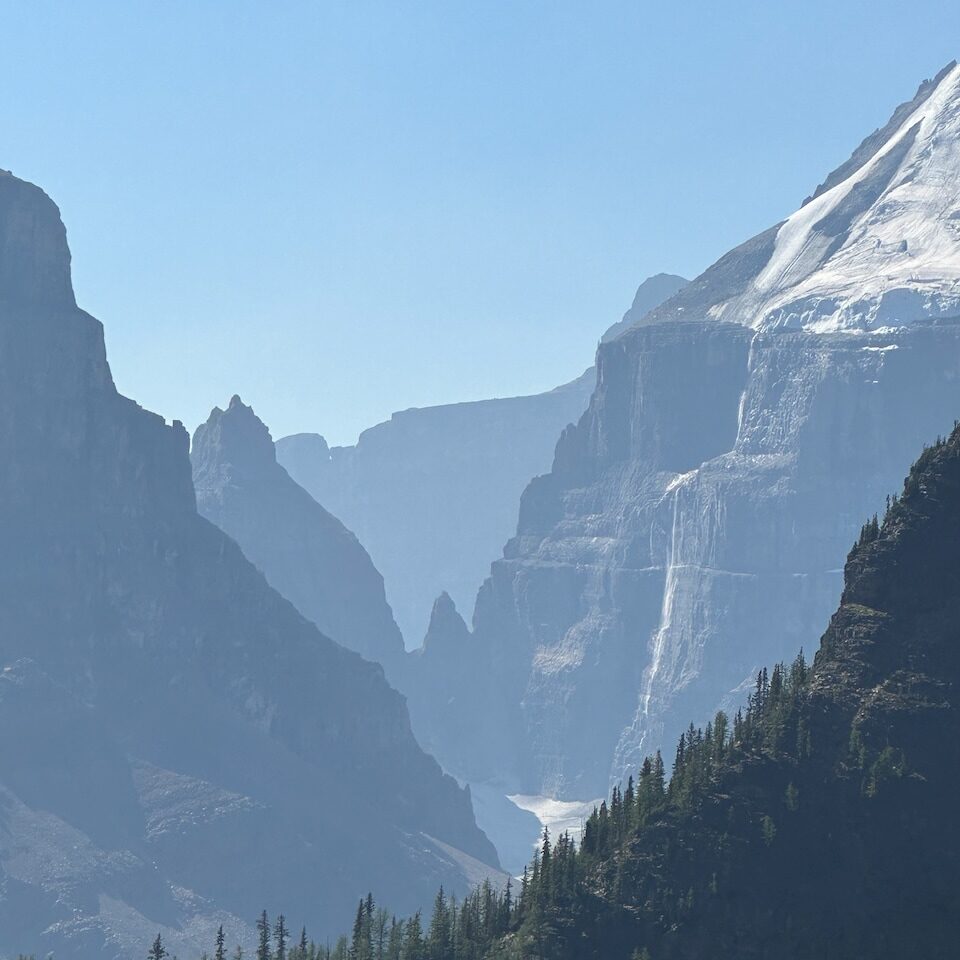
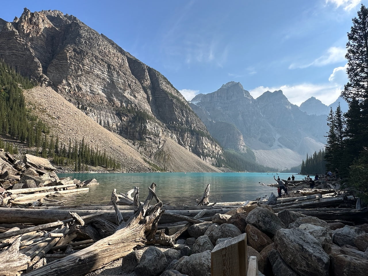
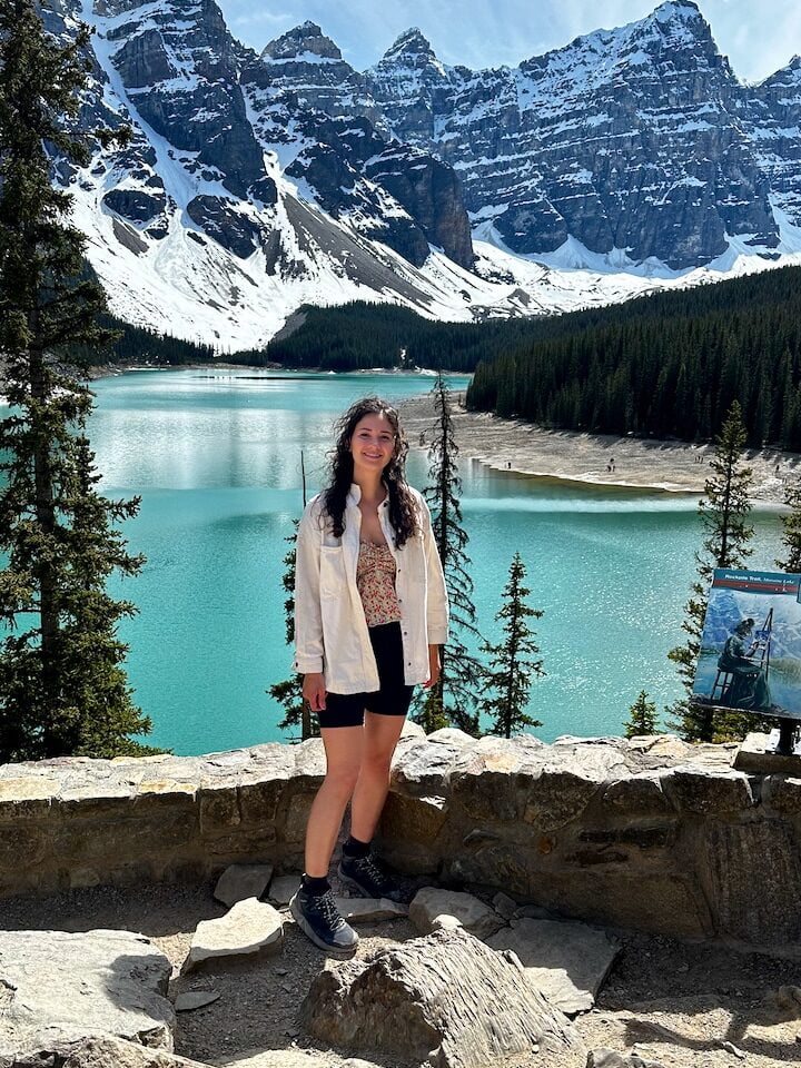
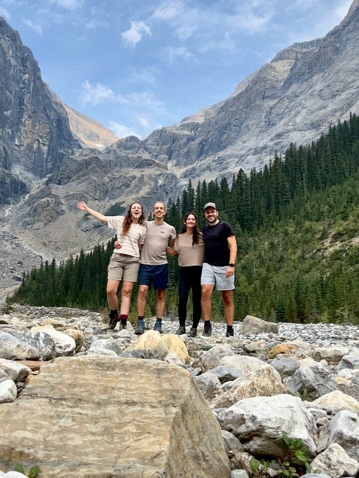
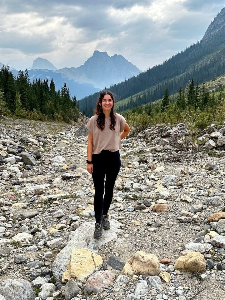
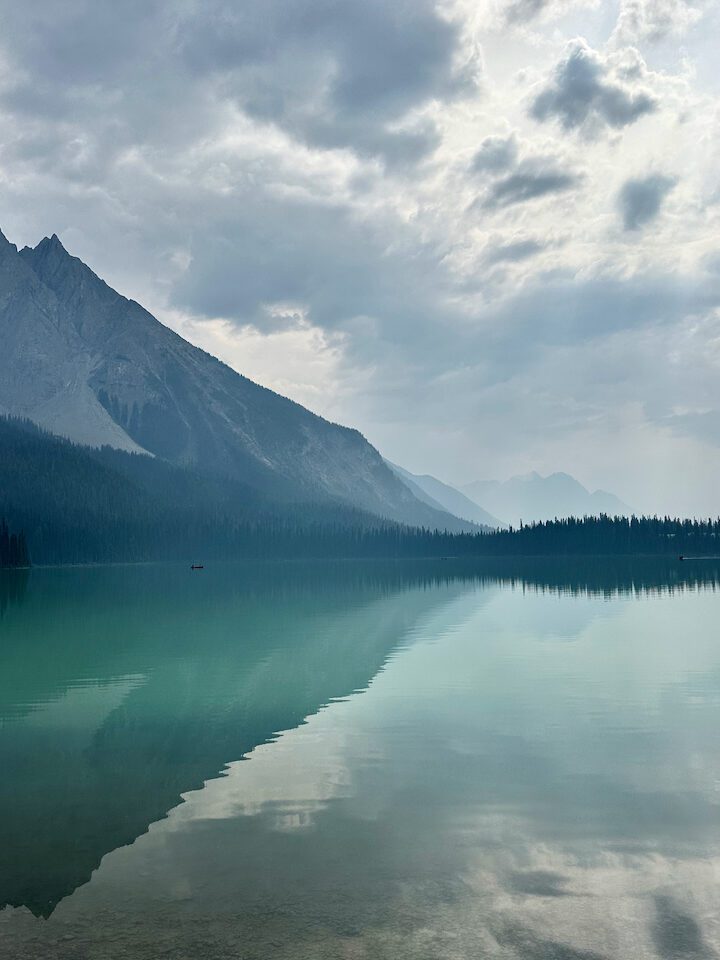
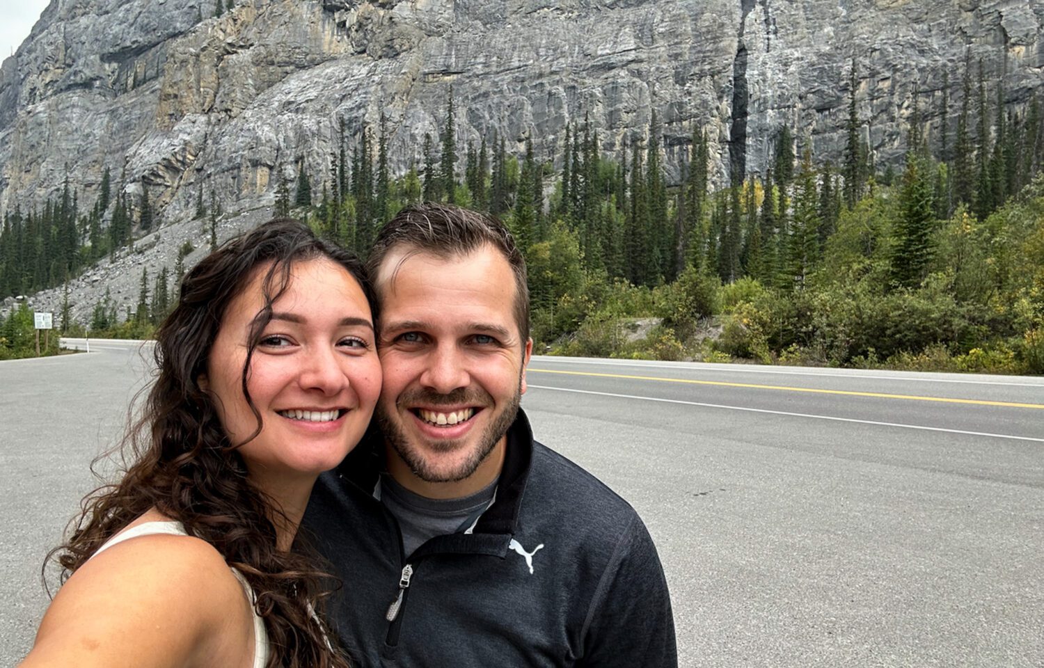
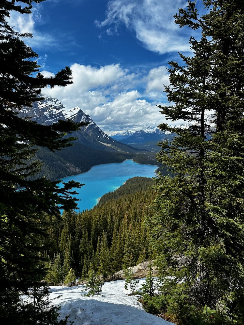
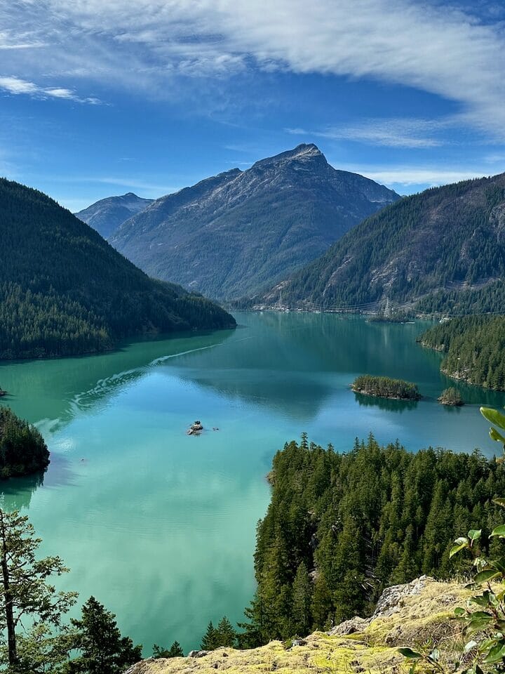
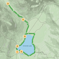
A highlight of Yoho National Park is Emerald Lake. Especially on a sunny day, the color of this lake is just so special! You can choose to just do a loop around the lake, but if you want to see a bit more, there are several trails surrounding the lake.

🥾 Emerald Basin and Emerald Lakeshore 

We chose the Emerald Basin Trail, which got us up close to the Emerald Glacier.

August 30, 2023 | With my fellow Rocky adventurers
August 30, 2023 | On the Emerald Basin Trail

Day 10 | visit banff & Drive to Calgary

Visit Banff

Now that you’re in Banff National Park, of course you can’t skip Banff itself. Banff is a resort town with a population of about 8,000 people. It’s also one of Canada’s most popular tourist destinations, so it’s always pretty busy around there. That said, it’s a cute place, and nice to explore for its restaurants and shops. When you’re there, consider paying a visit to the Fairmont Banff Springs Hotel too – it’s a gorgeous castle-like luxury hotel. Even though you’re probably not going to be sleeping there ever, you can still go in and look around. You’ll feel a little bit like you’re walking the halls of the Harry Potter castle. Definitely something to experience!

June 12, 2024 | Lake Minnewanka

Lake Minnewanka

Just 20 minutes away from the Fairmont Banff Springs Hotel you’ll find Lake Minnewanka, a glacial lake with one of those super picturesque mini islands on the water. Another gorgeous place! We did a short trail there in the canyon to the south west of the lake, but if you have a bit more time, try the lakeside trail instead.

🥾 Stewart Canyon Trail (5.8 km)
🥾 Lake Minnewanka Lakeside Trail (15.6 km)

You can also take a cruise on the lake and learn more about the history of the place. 

Drive to Calgary… Vancouver to Calgary roadtrip complete!

All good things come to an end… Are you ready to leave the mountains? As you head from Banff to Calgary you’ll pretty quickly see your surroundings change to flat lands.

I can’t say much about Calgary as I haven’t spent much time there. I think a day or two would be more than enough if you want to end with a little city trip – if not, then just go for the airport 😉

As I mentioned at the start of this post, if you have a longer vacation you could loop back to Vancouver from here, so you can return your rental car at the same place. If not, it’s time to say goodbye to the most beautiful side of Canada!

If you’re going to venture out here, please feel free to shoot me a message for more recommendations. Happy trip planning!

When a friend of ours said her dream was to celebrate her birthday hiking to a hut with a group of friends, of course we said we’d be there. And so one weekend in July, we put on our hiking shoes and packed our backpacks for an overnight hike to Watersprite Lake.

Getting geared up for Watersprite Lake

That sounds simpler than it really was though. We had gone camping once before and got ourselves a proper tent for it, but that’s not a tent that you can carry up a mountain with 700 meters elevation. Likewise, we got one sleeping bag that was big enough to share, and a two-person air mattress – both items unsuitable for backpacking.

Thankfully, we were assigned a spot in the hut, so we didn’t need another tent. We did, however, need sleeping mats, sleeping bags, and pillows, all small enough to fit into a backpack. After visiting Mountain Warehouse, Canadian Tire, and Mountain Equipment Company, we had all the stuff we needed for this adventure.

At the trailhead for the Watersprite Lake hike
Mountainous view over the valley as we hike toward Watersprite Lake

The ride up to Watersprite Lake Trailhead

We bought a car a few months ago and chose a vehicle that would allow us to go on adventures like these. A bit older, some scratches so we’re not too worried about scratching it more, 4-wheel drive, and enough space to transport stuff like tents, paddle boards… Or in this case, a bunch of backpacks from people driving with us. Given that our car would be suitable for the bumpy drive to the trailhead, we offered to drive, so we picked up a few members of the birthday crew and made our way up to Squamish. 

The Watersprite Lake Trailhead is located roughly 20 kilometers up a bunch of Forestry Service Roads. Once we got to the start of the road, our navigation said it would be a 50 minute drive to the trailhead. And what a drive it was. We were bumping and shaking to and fro in the car. Tom had his eyes peeled on the road, with full focus, while us ladies chatted to calm the nerves. We made it through steep inclines and over enormous holes in the road. We arrived safely, apart from the high heart rate and possibly some bruises from bumping our heads to the windows and doors and each other.

Birthday girl was there already, along with the peeps that were with her in Car #1. We were the second vehicle to arrive, Car #2. It wasn’t long until Car #3 arrived with familiar faces. Great, we just needed to wait for one more, and we’d be ready to go.

Car trouble

We waited. And waited. And waited some more. Until it didn’t make sense any longer – where were they? With no cell reception, there was no way of knowing the location of #4, and we could not contact them to find out if they were okay. Other cars arrived at the trailhead, so we asked them if they had seen anyone stranded on the way here. “Yes,” one driver eventually answered. “Yes, there was a car on the side of the road. Transmission problems.”

Darn it! So Car #3 went to go find them. Based on the description of where they had seen the stranded car, he set out to go find them. Meanwhile, we waited, and waited. And waited some more. Until suddenly, a random car arrived, and the folks we were waiting for got out of the car, celebrating their arrival…

Wait a minute?

Turns out, a friendly couple had offered them a ride up to the trailhead. The stranded group decided to split up: the driver would go back and take care of Car #4 – it couldn’t possible continue up the steep road, but driving down seemed okay. Unfortunately, it meant he had to skip the hike. The rest of the group accepted the friendly help and took the ride to the trailhead. 

Which was great. Here they were! But… our rescuer in Car #3 didn’t know any of this, and was still out there searching for them!

We waited. And waited. Until eventually he returned, sad faced, feeling bad for not finding our remaining hiking buddies. But of course, he was relieved to find out they had found their way up after all!

Hiking to Watersprite Lake

With a 1,5-2 hour delay, we finally started to make our way up. To get to Watersprite Lake, you’re in for a 9km hike with about 700 meters of elevation. It’s quite a long one – we took about 5 hours to get up, including one lunch break and a few short breaks to drink some water and confirming we’re all still here (16-person group!). 

You’ll need a good amount of bug spray (gosh bugs flying around EVERYWHERE) and you’ll work up a serious sweat… But in return, you get beautiful meadows, waterfalls, beautiful forests. There are still snowy peaks around you, you’ll see glaciers, gorgeous views over the valley and river. It was quite a warm day, so we brought lots of water. We refilled our bottles when we passed a waterfall with fresh water.

When we arrived, I was surprised to see that the hut was quite large and had a really nice deck overlooking the mountains. We explored our home for the night, then went to the lake to swim and refresh. The water was cold, but very rewarding and refreshing after the tiring journey. Half of our group had to hike a little bit further and set up their tents on the campground across the water. They took a refreshing swim, too!

AllTrails labels the hike as Hard; I’d say it’s moderate with a hard part at the end where you have to scramble a bit over 3 sections of large rockslides. After being treated to all that beauty on the way, Watersprite Lake itself is quite the climax. What a gorgeous place. I don’t know how many wonderful shades of blue my eyes have been treated to since arriving in Canada, but this lake was a magnificent addition. It was so crystal clear that it had a gorgeous reflection, great material for some impressive photos.

Wonderful evening

Time to cook! The hut was well equipped. We connected our propane tanks, and soon everyone was cooking the meals they brought. From dehydrated hiking meals to fresh veggies for couscous salads, everyone come out of the kitchen with their own creations. Tom and I brought 4 packs of Pancit Canton noodles, and managed to bring 2 fresh eggs to add on top. Thankfully they didn’t break on the way up the mountain 😉

Apart from dinner, most of our group brought some birthday surprises, including a massive 7 liter bag of red wine (imagine the weight of that in their backpack!), cupcakes and birthday candles, birthday decorations, and… a silent disco set.

Plenty of fun!

Until we went to sleep on those sleeping mats. That was less fun. But oh well, it is what it is.

The way back

The next morning, some went for another swim in the lake, and we each made breakfast, spent a bit more time enjoying the hut with the group… Then cleared out everything and packed up all our stuff to make our way back to the cars. It took us about 3 hours to venture down. The views were fantastic again, but with barely any sleep, the hike was a bit more challenging in terms of energy. The hike required a lot of attention and strong knees. Thankfully, the hardest part was right at the beginning, so after we had climbed and bouldered our way through the big rocky part, the forest paths were a lot more manageable.

Getting home

Once we finally reached the car, we were all very tired. With only breakfast and a few snacks, our fuel was low. Once we had reception, it was clear that there was quite a lot of traffic on the Sea to Sky Highway back to Vancouver. Would we suck it up and get home asap, or go into Squamish first to get a decent lunch first? We decided on the latter, and I’m so glad we did. That burger was much needed to make us feel like ourselves again, and made the way back a lot more pleasant. Tom drove us home safely.

By the time the clock hit 9 pm, my eyes hit 6 o’ clock. I slept like a heavy log in the sky-blue water of Watersprite Lake, on my deliciously thick and soft mattress and familiar pillow. 

A weekend to never forget!

It was the May long weekend, and we wanted to go out for a nice hike! We meant to go to do the Tunnel Bluffs hike, but when we got there we couldn’t for the life of us find a parking spot… So we decided to drive on, further up toward Squamish, and look for an alternative. I browsed my AllTrails app and found a promising one… The Slhanay Peak Trail didn’t disappoint!

Way less well-known than the famous Stawamus Chief, Slhanay Peak can be found just north from it in the Coast Mountains, close to the town of Squamish. At about 650 meters, the peak offers gorgeous views of the town and an opportunity to see the much-hiked Chief from a different vantage point. It overlaps a little bit with the Chief hike, so if you’ve done that one before, you’ll see some familiar rocks that you need to navigate over.

I find the names of areas here very intriguing, and have been wondering for a while not only how to pronounce Slhanay (‘slah-nay’) but also what its meaning is. I learned that originally, the peak was disrespectfully called the Stawamus Squaw. “Squaw” is a rather controversial word, used by early European settlers and traders in North America to describe Native American women. 

Though the word had a neutral meaning originally, over time it was used in very negative ways to imply inferiority and dehumanization of (indigenous North American) women. Transformed into such a derogatory and racist term, the name of this peak needed to change. This place is situation on traditional territory with significant cultural importance to the Sḵwx̱wú7mesh nation; renaming it was long overdue. In 2009, the new name Slhanay (woman), was introduced in consultation with the local First Nations.

You’ll find the start of the Slhanay Peak Trail on a gravel road, just past the Stawamus Chief trail but before you reach the town of Squamish. The gravel road is the same one you would take if you wanted to drive up to the Mamquam Falls.

Keep in mind that this hike is classified as Hard – I’d say moderately hard – so make sure you are well prepared. Wear proper walking shoes, consider bringing poles (we were fine without them but I can see how they may be useful), bring plenty of water if you go on a warm day, and I recommend using the AllTrails navigation. It saved us a couple of times when we were about to get lost; my phone started buzzing when we missed a turn onto a trail that was hard to see. Thank you AllTrails. 

The trail is about 6 KM and it took us just over 4 hours. This included two breaks to fly my new drone for the first time 💛

The trail has some really fun variety that made it an interesting and worth the four hour work-out. The trail is a bit of an 8-shape, so it’s out-and-back but with a few loops that prevent you from having to take the exact same route back. There’s steep inclines, beautiful forest, also sections of more relaxed walking, flowers, impressive granite rock, a bit of technical climbing/scrambling… A little bit of everything.

Doing those steep sections made me a bit weary for the way back, especially considering there was some scrambling involved… As expected, the way back was quite challenging and straining on the knees and ankles. We were glad that we built up some experience and some hiking muscle; I don’t think I would have been able to do it in the first months we were here 😅

The route had 4 main lookout points, such amazing views. Looking out over Squamish and being able to see so far into the valley was incredible! Still a little bit of snow on the peaks around us… And The Chief. Gosh. It’s just such a unique peak to look at!

At the top of the trail, a couple was enjoying the view, and they offered to snap a photo of us. The guy was born here in Vancouver, the girl was from Toronto. We talked about how amazing it is to us to be able to just drive out on a Monday morning and be in this incredible mountainous place. I keep saying this, but I hope I’ll never get used to it – love this incredulous feeling!

Hello again! February has arrived. Winter season has us cooped up at home a little more than I’d like. The days are dark, short, humid, and very varied in terms of temperature. After a gruellingly busy week, today I was desperate for some mountain time and vitamin D. Today’s mountain flavour was Golden Ears Provincial Park, and it was just what I needed. Here are some photos and some updates on how it’s been going here in Vancouver.

I’ve been told that January and February are quite depressing in Vancouver. Last year, these were my first months here, and with all the excitement and good luck in terms of weather, I had no idea what they meant.

Not to be dramatic, but yeah, I get it now.

We’re just coming out of a 2-3 week period of near constant rain. Weather warnings about risk of flooding and ‘atmospheric rivers’ kept popping up on our phones. We had a wonderful time night skiing mid-January, but this rainy period started soon afterward. Along with heavy rain, the little snow that had finally accumulated (including 3 days of snow and -15 degrees celsius in the city) has been melting for some time now. As you can tell, it’s been very, very wet here! And as you can imagine, people with season passes for the ski mountains surrounding Vancouver (like Tom) are very bummed.

But rain will eventually be followed by sunshine, and it looks like we’ll finally have some dry days the coming week(s). As you can imagine, whenever the sun does come out, people are desperate to go outside… Me included! 

a week of learning

This week kicked my butt: I started a three-module course this past week. Two days of class were followed by a three-day company visit where I got to apply the tools and learnings and work on an improvement case. It was super interesting, very intense, and incredibly valuable and rewarding. Had a great time with a team of people from various fields, and it will be followed up with another two modules at the end of February and March. Very exciting!

Simultaneously, I started another professional development course. This one is online, and it started yesterday… So I had a 6-day week completely dedicated to learning. Hence, my kicked butt. 

You might ask what I have gotten myself into, but you know what, it’s February. It’s dark and cold and wet, so this is the perfect time to be a student. Super grateful for these learning opportunities and the good timing!

Combined with salsa lessons every Thursday night plus my keyboard (LOVE IT), I’m making the most of the dark winter season 🙂

Golden Ears

Today is Sunday, my only day of weekend, and so I wanted to make sure I make the most of it. After spending the whole week with 30+ people, I was socially exhausted. Seeing the great weather forecast, it was clear that this was going to be a mountain day. Time for a hike, some nice views, some peace and quiet!

Indira in front of a beautiful mountain backdrop at Golden Ears Provincial Park

After a coffee and a video call this morning, we claimed an Evo (car sharing) and packed up a backpack with some water and a sweater (just in case). At an hour and fifteen minutes distance from Vancouver, two very distinct peaks grace the air: the Golden Ears. The surrounding area was named after these peaks. One day, we’d love to climb all the way to the summit, but let’s wait until the warmer season arrives! For today, we picked an easy out-and-back hike, considering we only had the afternoon and it gets dark so early.

Though it was just 10 degrees, the sweater was not necessary. The hike had some open areas where we could let our skin soak up the sun rays. Felt so good. Needed the vitamin D so badly. It had been a while since I took out my mirrorless camera, so this was a nice opportunity to get some good quality photos again. 

No drone today, unfortunately (empty batteries), but with some better weather on the horizon and the days getting a bit longer, I’m excited to find some opportunities to get some nice footage again. Can’t wait to be spending more time outdoors again!

Until next time, with more nature photos and more stories – and more brain capacity left to write something more interesting for you.

The last week of July, we packed up a weekend bag and hopped in the car with our dear friends A & S. It was time for our weekend getaway in which we would hike the much anticipated Joffre Lakes Trail. Our Airbnb was in Pemberton – new to us, but we now have many fond memories of that beautiful town!

Pemberton is a picturesque town situated in the Coast Mountains of British Columbia, just 2 hours north of Vancouver. With Mount Currie as a back drop, and Joffre Lakes Park and several lakes and rivers around, it was the perfect place to pick an Airbnb.

Friday after work, we made our way through traffic to the Sea to Sky Highway. We stopped in Squamish first to have dinner. We’d spent so much time together at this point, but realized this was our first sit-down dinner out with the four of us! 

We made our way further up north, passing Garibaldi and Whistler before arriving in the small town of Pemberton. The Airbnb was a cozy upstairs apartment above someone’s garage. We spent the first night getting settled into our place, having drinks over games.

It had been a busy few weeks for all of us, so we had barely planned anything yet. The most important part was arranging our hike at Joffre Lakes. For many parks, you need to secure a parking pass two days in advance at 7 AM. Generally, these parking passes sell out in minutes after registration opens. We managed to get a pass for Sunday.

On Saturday morning, we went into Pemberton in search of some groceries and cooked a lovely breakfast together. The Airbnb had an outdoor patio, perfect with the warm weather! Our host walked by to say hello, so we asked him for some recommendations. Any lakes around he’d recommend for paddle boarding?

For a visual summary of the weekend, check out the reel I made on Instagram!

lilloeet lake

We decided to drive to the super scenic Lillooet Lake. It stretches approximately 33 kilometers and is surrounded by forests and mountains. We drove along it until we found an area with parking and good access to the water. We took out the paddle boards, got the electric pump started, and found a spot on the beach to hang out.

The lake is so, so beautiful – such clear and crystalline water! We had brought our camping chairs and picnic mats. While S. and I chilled and snoozed on the beach, Tom and A. went out on the water. It was such a beautiful setting, we spent hours just chatting and enjoying the views. And of course, playing with the drone a bit for great photos and videos.

High vantage point view of Lilloeet Lake with the beach on the left and mountains all around.
Tom and our friend A. paddle boarding on Lilloeet Lake.
High vantage point view of Lilloeet Lake with the winding road on the left.

After a lovely afternoon there, we made our way to the supermarket again to grab ingredients for a delicious home cooked meal.  We spent the evening cooking, eating, and playing board games.

Joffre Lakes

The next morning, we geared up for the Joffre Lakes Trail. After another yummy breakfast, we packed some lunch, tidied up the Airbnb, and packed up the car. As we drove out of the driveway and into the garden leading off the property, we suddenly saw a young bear right in front of us in the garden! It was the very first time we saw a bear, so it was such a special moment! I loved how it moved so clumsily and cartoonishly, looking left and right using its whole body, deciding which direction to head into. It ran off to the left, and we didn’t see it again.

That was a great start of our adventure. We drove about 30 minutes to the Joffre Lakes parking area, showed our parking pass to the park rangers, and started the 8 km hike along three stunning turquoise lakes: Lower, Middle, and Upper Joffre Lakes. 

The first lake you stumble upon on this trail - gorgeous place!
What a beauty, that second lake!

The hike is very doable, but you’ll definitely find yourself needing to catch your breath a few times. That’s all good though – the trail ascends through such picturesque forest, just take in all the beauty! There’s something to see everywhere. That includes wildlife, particularly two-legged creatures with backpacks. This is a very popular hike, and despite the parking pass which limits how many people can be there, it does get quite crowded on the narrow trails.

I particularly liked the Middle Lake; the colour  was so, so beautiful. It has that backdrop of snowy mountains and rocks but still lots of green forests and meadows.

The second lake on the Joffre Lakes Trail
Tom and Indira at the Upper Lake of the Joffre Lakes Trail with the glacier behind them
At the Upper Lake; it was quite chilly there but great glacier views

As we neared the Upper Lake, the surroundings got more rocky. At the end of the trail, we sat on huge rocks to enjoy the glacier surroundings, eat a sandwich, watch the birds and chipmunks around us… We considered going further up on a new trail – we were told doing that would get you a view of all three lakes in a row. But considering, time, cold, and not enough food for an additional few hours, we made our way back down. 

The weather was fantastic, so the boys mentally prepared for swimming in the glacier cold water. Though I think the second lake would have been the most beautiful for it, walking the rest of the way back with icy cold wet shorts would be a bit uncomfortable. So we decided on the Lower Lake. Though I didn’t swim myself, dipping my warm and tired feet in the water was incredibly refreshing!

It was just another 20 minutes or so back to the car. After a short pit stop, we hopped in the car again and started the drive back to Vancouver.

Indira on the Joffre Lakes hike with the Middle Lake behind her
Overlooking the Middle Lake

North Arm Farm

On the way, we wanted to make one more stop, and we read about a nice farm somewhere around Pemberton. We decided to go find it, and wow, I’m so glad we did! North Arm Farm is a 60+ acres organic farm with fruits, vegetables, and flowers. It’s particularly know for offering farm-to-table experiences such as berry picking. Though we didn’t do any of that, as visitors we were welcome to roam around. I loved it there so much – the mountains around, the gorgeous trees, the incredible barn (wedding location, anyone!?)… At the shop, we got ourselves some ice cream, and I bought a couple of artsy post cards for my collection.

Unfortunately, it was time to go… Back home, over the gorgeous Sea To Sky Highway. Back to work the next day!

North Arm Farm in Pemberton, I LOVE that place so much. Tipping this as a fantastic barn wedding location!

It was my first summer living in British Columbia. What are we going to fill up this wonderful season with? Without a doubt, the Canadian Rockies just had to be part of our summer. When Tom’s brother Erik and his girlfriend Aga planned for a visit, it wasn’t long until we decided to make it a trip with the four of us.

The Canadian Rockies span across the provinces of Alberta and British Columbia. It’s a majestic mountain range, renowned for its pristine lakes, towering mountain peaks and glaciers, and overall rugged beauty. The area counts multiple national parks – for this trip, we travelled through Banff, Jasper, and Yoho. There’s such an abundance of hiking trails – it took some effort to make a selection of what to do and where to go! In any case, end of August we headed up to Calgary to pick E & A up at the airport. Here’s how we ended up filling our 9-day trip.

wine touring with sip happens

The drive up to Calgary is about 11 hours from Vancouver. I wasn’t too keen on doing that long distance all in one go, so it was the perfect excuse to stop halfway, which is in the Okanagan Valley! Known for its sunny and relatively dry climate, the area is filled with vineyards and gorgeous lakes with lots of activity on the water. I had been on a wine tour before with a visiting friend – now I was eager to repeat and share the experience with Tom.

This time would be a little bit different though, because for quite some time Kelowna was dealing with devastating wild fires. We were hesitant to go; people had lost their homes and/or were on evacuation orders, so they needed Airbnbs and hotels way more than anyone else. We asked our host up in Vernon how things were, and she reassured us that in that area things were okay and we were welcome. 

The wine tour would cover another area though, so we weren’t too sure what to do. We figured we’d let it depend on the locals: if the wineries appreciate the business, we’re all for it, but if not, it’s all good. The organizer, Sip Happens, gave us a call to talk about it, checked in with some wineries, and decided to proceed with the tour. It was the first tour in a little while, and not all wineries were reopened yet, so they changed the Lake Country tour into an East Kelowna tour for us and two more people. There were still smoky skies, but at least we could see across the lake, which according to our guide was a huge improvement to just the day before.

reunited

The next morning, we continued our drive up to the province of Alberta. The drive was incredible; we already drove a bit through the rockies, so it was a little taster of what was to come! Once we reached Calgary, we checked into our Airbnb, freshened up, and went out to dinner. Our friends had recommended a Japanese restaurant ran by Darren MacLean, a top-rated Canadian chef that appeared in The Final Table on Netflix. It certainly was an incredible meal at Shokunin!

Meanwhile, E & A were getting closer to Calgary as well, so we made our way to the airport and picked them up. It was so nice seeing them again after 7 months! We were all pretty beat, so not too long after reaching our Airbnb again, we called it a night and rested up for the big trip.

The next morning we explored sunny Calgary and had brunch. Knowing what was in store, we were eager to get out of the city rather quickly, so off we went to our next stop: Cochrane. It was not a long drive yet, just about 30 minutes in the direction of the mountains. This first day was all about catching up, relaxing, and planning out further details for the trip. Our Airbnb had a big grill that we could use, so we collected some groceries and handed Tom the barbecue pincers. He’s the chef, so it was only fair!

into the rockies

The next day, it was time to head to Banff National Park. I had heard about Banff many, many years ago, way before I ever even imagined living in Canada. I’m not sure I even realized it was in Canada or that it was part of the Canadian Rockies when I first saw pictures of it and thought: I must go there once. Actually being headed there now was a weird realization. It was time for our very first hike in the rockies! We located the parking lot for Lake Louise, went up to the shuttle bus, and before we knew it, we laid eyes on that gorgeous lake.

Lake Louise, a very popular lake! You have no idea how many people were swarming around here.
Can't leave without a little group pic

It’s quite a touristy place, which we had been warned about, but the trick was to go on a longer hike. Sure enough, at some point after a couple of kilometers we took a left to follow our 12K trail up Mount Piran, and noticed everyone else was just going straight ahead on a shorter, more popular trail.

It was a warm day, so it was tough starting off with a hike with almost 1000 meters elevation gain. But man it was worth it! Gorgeous views over Lake Louise, and just so wild to think this was just the beginning.

Look at those peaks in the background. The views were just incredible.
Lake Louise in the background!
Finally at the top of Mount Piran!
All good things come to an end - here's my crowd on the way back.

On the way back, we still had some time to take the shuttle bus to Moraine Lake as well. I thought this lake was even more beautiful – it just has an incredible backdrop. Initially, we thought we’d have to choose between Lake Louise and Moraine Lake, so we were all so glad we got to do both on the same day thanks to the shuttle bus (and good timing finishing  our hike).

So glad we were able to see Lake Moraine on the same day as Lake Louise

emerald lake at yoho national park

Next up was a drive to Yoho National Park for a big bucket list item: Emerald Lake. Yoho is situated on the western slopes of the rockies. From all these incredible places we’ve see, I do think Emerald Lake was my favourite lake. It was a cloudy day, but that actually just made the views even more interesting. The hike we did was a loop around the lake but also had a out-and-back section to the glacier. Enjoyed this one so much!

Emerald Lake, for sure a favourite from our trip!
The glacier is at my back, but I just loved this view as well!

traumatized by a wild animal

Apart from amazing photographs and memories, I got another special souvenir from that day. After our hike to the glacier, we decided to go on second hike to a waterfall that was on the way to our Airbnb. I was just minding my own business when I was suddenly attacked by a vile, evil, very dangerous animal.

A mosquito.

No no, don’t laugh now. It was a monstrous mosquito with serious super venom. It bit into me in two delicate places – my left hamstring and my right butt cheek. I distinctly remember feeling getting stung, slapping the back of my leg, and having blood on my finger. It kept feeling sensitive for a bit, and then I didn’t think about it again.

Until the next morning, when it itched so badly and I noticed the two spots had gotten terribly swollen. Especially the one on the butt cheek. Seriously, it was like my butt grew a butt. It was like it would only be a matter of time before it would start speaking and ask for food. So I called it my tamagotchi for the rest of the trip. (A good excuse to get extra snacks.)

I carried these huge marks not just for the rest of the trip. The swelling went away terribly slowly, and after that it was still dark for weeks

Anyways, enough about my butt.

so many sights

The next day was more of a Banff drive day with several stops on the way to see some highlights of the area. It’s too much to mention it all, but a favourite was definitely the Peyto Lake Lookout. The weather again not super clear – a combination of cloudy and smoky from wild fires in the area, but still the colour of the water was gorgeous! 

We did another hike that day and it ended with a sighting of a mother bear and two cubs. We first saw them from a distance as we were descending from the mountain and were on our way  back to the car. Exhausted when we reached the car, I didn’t think the odds were great of still seeing those bears. The others went looking though, and yep, they saw them up close!


Peyto Lake
On another hike - we saw a momma bear and two cubs here!
Can't even remember where we stopped here, but a quick pic with my Tom!

jasper national park

After seeing Banff and Yoho, it was time to go further north toward Jasper National Park. On the way, we stopped for a hike in the Valley of the Five Lakes, where the boys jumped into the emerald blue water and were dried up soon enough by the sun. Our two days in the Jasper area were filled with yet more such hikes, paddle boarding, and driving around in that mind blowing landscape.

One of the lakes at the Valley of the Five Lakes
So many places to stop!
Jasper National Park was my favourite to drive through - such huge, wide landscapes!
We brought our paddle board on the trip, were happy to take it out on Edith Lake!

sulphur skyline

For our last day in Jasper and the Canadian Rockies, of course we had to do one last epic hike! Recommended by our Dutch friends here in Vancouver, we went for the Sulphur Skyline Trail. It was a rough ascent to the top – once we got closer to the top it was so, so windy! There were a few people with small dogs and I just couldn’t help but visualize all those dogs flying up like kites.

Almost at the top of the Sulphur Skyline Trail
Made it! It was so windy up there, it was hard to take photos. This is a rare one where my hair is not standing up straight.

The views up here, man… Mind blowing. Just peak after peak, endless mountain views. Similar to our experience in the Okanagan Valley, it was rather smoky, which gave the view such an interesting quality. I was just glad we could still see something – incredible to think that on a clearer day, you can see even farther in the distance.

Leaving the Rockies via Pemberton

After Jasper, we had two options: drive down back via the Okanagan and spend our last overnight stay there, or take the coastal route back to Vancouver with an Airbnb somewhere along that route. The wild fire smoke wasn’t looking too good in the Okanagan area, so we decided to head the other direction.

From Jasper, we went down to Valemount, Kamloops, and stopped in Pemberton. We knew an amazing farm in Pemberton that we wanted to show E & A. After a pit stop there with some ice cream, we continued down to Whistler (Creekside) for our last stay. We booked something last minute and it was just the perfect place! It had a pool, hot tubs, pool table, and – yes – a barbecue. So we collected some groceries again and Tom cooked us an incredible meal once again.

On the beach by the Lost Lake in Whistler

running into friends

The next morning marked our last day of our trip. We spent that day in Whistler: E & A went on a list hike while Tom and I took it easy and strolled through the village and picked a lake to go and see. Since we couldn’t see Lost Lake the last time we were here due to all the snow, we tried again now and succeeded. Oh, and fun bonus, when we were having a coffee in town, we ran into my work friend! Such a funny moment that also made me feel at home. You know, we were getting closer to Vancouver, and we ran into someone we know. It gave a sense of belonging to this place which I just really appreciated.

We waited for E & A to finish their hike. From there, it was time to get ready for the last stretch of our drive. It would just be another 2 hours south.

Back to Vancouver

The way back from Whistler was much more familiar territory for us, so it was nice showing our special guests what our own area looked like. We stopped at Porteau Cove just to look out over the ocean for a bit. Seeing Vancouver appear in the distance soon after was such a nice moment – as much as I loved the trip, going back home is always such a pleasure. Though it’s different from the rockies, we’re still surrounded by so many gorgeous mountains here, too. And this is where we live. WE LIVE HERE! WHOO! 

The next part of their visit would start here – exploring Vancouver and getting a sense of what our life is like here – and why we love it so much. But I guess the first part, having all that majestic nature relatively close by… Probably already explained everything to them.

Porteau Cove has a wonderful backdrop. It's a gem on the Sea to Sky highway!

July was a very special month, because Tom’s parents came to visit! We had such a lovely time showing them around and giving them a sense of what life is like here in Vancouver. But it was also a chance for us to go on a trip and explore something new! We decided to book a ferry to the Sunshine Coast, an island we had heard good stories about. In particular, something called the ‘skookumchuck narrows’ was at the top of our list of things to experience there.

reaching the skookumchuck narrows

“Skookumchuck” is a word of Chinook Jargon origin, an indigenous trade language used in the Pacific Northwest. It translates to “strong water” or “turbulent water.” Located on the Sunshine Coast of British Columbia, the Skookumchuck Narrows is a natural marvel where the tides of the Pacific Ocean converge with the waters of the Sechelt Inlet.

This sounds very familiar to me now, but before going on this hike, all I knew is that we would see a ‘narrow’ place where water does something special when the tides change. I had no concept of what it might look like, nor had I had time prior to our getaway to research it. For me, this preamble 100% added to the experience, because I was so in awe when I reached the water!

The moderate-level hike was approximately 8 kilometers round trip through lush coastal rainforest, and took us* through a diverse landscape of ancient trees, ferns, and moss-covered rocks. On this Sechelt Inlet Trail, you can expect some rough paths with exposed rocks and roots. With the elevation changes, you’ll find yourself needing to catch your breath here and there.

*By ‘us’ I mean Tom, his parents, myself, and several other hikers. There was one man in particular, let’s call him John, who brought our hike enjoyment to the next level! He walked with us for several kms on the way there and back. 

the rapids

Prior to the hike, Tom had figured out that that particular night at 8.20 PM, the tide would be at its strongest. The statistics told us the rapids would be ‘XL’ in size tonight. Still not fully understanding what that meant, we followed the schedule and timed our hike accordingly. With a steady pace, we kept following the trail, and listened to John’s previous experiences. As a resident of the island, he had walked this trail many times before. He promised we would not be disappointed.

The sound of silence, hiker conversations, and birdsong suddenly changed into a roaring sound of rushing water. I remember being surprised by how much louder it grew as we approached the furthest point of the hike. It makes you step up your pace in anticipation of finally seeing what the fuss is all about.

The trail ends on a large rocky area which you can safely stand on. As we emerged from the forest onto this ‘observation deck’, our mouths dropped and all we could say was, “wow!”

what a place!

What a spectacle – churning waves, whirlpools, heaps and heaps of water surging. As the tides shift, the water rushes through the narrows with incredible force. The waves are much larger in person than it seems in the video above. Apparently, the waves can get up to 5.5 meters high!

My expectation was some kind of narrow passage that water would rush through, but it looked like quite a wide river. If you look it up on Google Maps though, you’ll see it’s indeed the narrowest section the water from the ocean goes through as it travels into the Sechelt Inlet. 

taking it all in

John explained that this place is popular to professional kayakers and surfers. Cool as that may sound, it does not always end well. Several people have died, including search and rescue volunteers. 

Once you have a chance to peel your eyes away from the water, you’ll see that the views are also stunning. As you can see in this picture, I particularly liked that section where two mountain dip and bring a mountain top further away into view. The picture here is basically: Indira: Tom, can you take a picture of that bit there? / Tom: What bit? / Indira: That bit! / Tom: What bit? / Indira: THAT B… / Tom: *Takes pic*.

It was getting late and it would get dark soon, so we had to start making the journey way back to the car. Not to fear though, John cheerfully joined us with his daughter, sharing not just nice conversation but also his spare flashlight.

Another experience richer, we returned to our Airbnb to rest up for the next day on the Sunshine Coast. If you’re ever making the trip… Don’t skip this hike and make sure to check the tidal schedule to see when the best time would be to see the Skookumchuck Narrows!