Tag

mountains

Browsing

Obviously I am biased at this point, but if there’s one road trip I would recommend anyone to put on their bucket list, it’s the drive between Vancouver (British Columbia) and Calgary (Alberta). I’ve had the pleasure of driving it twice, once from Calgary to Vancouver and once from Vancouver to Calgary. In this post I’ll share a 10-day itinerary for you to copy or to draw inspiration from for your own trip.

If you are planning a vacation to Western Canada, please consider a roadtrip through the Canadian Rockies! Let me help you by outlining an example itinerary with some of my personal favourites and recommendations. 

Where to start?

If you’re planning to fly to Canada, you might be wondering which city to start from. A couple of considerations:

  • Coming here in the summer (end of June to end of August)? Then I would recommend to start in Calgary and make your way to Vancouver. Vancouver gives you mountains as well as beaches and the ocean, which makes summer in this area a dream. You’ll have more options for activities here. Calgary is… Eh, I don’t like Calgary as a city that much 🙂
  • For the shoulder seasons, it might be nicer to start in Vancouver and end in Calgary instead. There’s more rain in Vancouver, which may impact your experience. 
  • Something to keep in mind for budgeting is that renting a car in one city and returning it in the other is pretty expensive. If you have the time, doing it as a loop (start and end in the same city) might turn out to be cheaper. Do your research, and/or consider camping to lower costs. 
  • If you’re a camper kind of traveller, that’s definitely a popular choice, but it might not be cheaper than doing Airbnbs, hotels, and/or car camping. Again, do your research, and see what suits you best!

My most recent trip was early June from Vancouver to Calgary. This itinerary will be based on that route.

Day 1 | Vancouver to Kelowna

I’m going to start this itinerary with the first bit of driving toward the Rockies, but if you are starting (or ending) your vacation in Vancouver and have the time, please do consider taking a couple of days to explore Vancouver and the area! If you only have one day, here’s one way to spend it: One day in Vancouver: False Creek Ferries. For this post though, I’ll focus on the roadtrip-part.

For your first day of driving, you’re going to be headed to Kelowna. You’ve got two options here:

  • If you have the time, I recommend taking the southern route: Vancouver – Hope – Princeton – Penticton – Kelowna. Without traffic, this will take you about 4-5 hours. (457 km). What a drive. 
  • For a quicker route to Kelowna, take the route through Merritt: Vancouver – Hope – Merritt – Kelowna. This will be about 3-4 hours (391 km)

As you can see, both routes go through Hope. It’s a great place to stop for a pit stop. 

Blue Moose Coffee House

Make sure to make a stop at the Blue Moose Coffee House in Hope. I've stopped here for every trip to Kelowna. Great spot to order a coffee and a quick bite to eat. They have great sandwiches and pastries. Address: 322 Wallace Street, Hope, BC V0X1L0.

Day 2 | Morning hike and afternoon wine

After a good night’s sleep, get in your comfy walking or hiking gear. On the north side of Kelowna, Knox Mountain gives you a nice opportunity to see the surroundings from above. If you’re up for a workout, this 7K (2,5 hour) hike is a nice introduction to the area: 🥾 Paul’s Tomb, Ogopogo, Pavilion, and Apex Trails. I’d recommend doing this in the morning, then go and refresh yourself. Next, go to Sprout or Curious Café for lunch. Make it a big lunch, because you need to fuel up. Why? Because wine.

The Okanagan region is known for its great wines. I recommend booking a wine tour for the afternoon – I’ve done it three times and can’t wait to go again! It’s great fun being brought from one winery to the other, trying a few different wines at each stop. You visit a set of curated places, each one offering a different kind of wine experience. I’ve seen everything from fancy and decadent vibes (such as FRIND) to rural and quirky (such as Off The Grid where you can pet the goats and bunnies, or The Hatch which is like a shed/barn) and even Peaky Blinders vibey (specifically Crown & Thieves). If you go for a 3 PM tour, you’ll be brought back to your hotel/Airbnb by 6 or 7. From there, see how you’re feeling about food! The first time I came back from a wine tour with VIVID Tours, we went on Uber Eats and had a pizza delivered to our Airbnb.

The second time I did a wine tour, I actually stayed in Vernon, a bit north from Kelowna, and toured with Sip Happens. There are various businesses offering tours in different areas in the Okanagan, such as West Kelowna, East Kelowna, or Lake Country. Depending on where you stay, choose one that does pick up in the town your hotel or Airbnb is located in.

If you’d rather not go on a full tour, you can pick out specific wineries to visit and do tastings. There are also beer/cider tours, if you prefer that more.

June 5, 2024 | Sipping wine at Crown & Thieves
Vivid Tours

I've done a wine tour three times, two of those with Vivid Tours. They pick you up at your hotel or Airbnb and drive you to a selection of wineries. I've done a West Kelowna wine tour and an East Kelowna wine tour. The last time I did one in June 2024, I called them just a day before and they happily accommodated us for the next day. Us three girls got picked up by Fred in his bus that seated about 12 people. He took care of us and three other groups. As you can imagine, the last ride from the final winery back into Kelowna involved lots of laughter and singing to the music Fred let us play in the bus. Great time!

Day 3 | Chase waterfalls in Wells Grey Provincial Park

After your time in the Okanagan, you’re going to get up early and drive north west for a bit, into the heart of British Columbia: Wells Grey Provincial Park. Known for its stunning waterfalls, I was excited to go into this area for the first time! 

We picked out a place on Booking.com in the town of Clearwater. On the way there, we left highway 5 to go onto Dunn Lake Road. After a bumpy ride with no cell reception whatsoever, we finally made it to the Dunn Lake North Recreation Site. When the lake came into view, my mouth dropped. It was so quiet, serene, and humungous. There was not a soul around, just us and this huge chunk of nature. The sheer size is impossible to capture on camera, but below is my beautiful friend Melissa on the Dunn Lake dock. 

June 6, 2024 | Dunn Lake North Recreation Site

The drive from Kelowna to Dunn Lake is 3.5 hours. From here, it’s another 40 minutes to Clearwater. After checking into your place, it’s time to chase some waterfalls!

🥾 Spahat Falls | Not really a hike, just find the parking lot and follow the signs to the falls and lookout. You’ll feel as small as an ant standing up there

🥾 Helmcken Falls Rim Trail | When I was there, the north side was closed. We did a different trail on the other side of the water which was a nice trail. Fantastic views over the waterfall!

If you’d like to go for a more elaborate waterfall adventure, there are plenty of hikes around. I haven’t done this one, but this 4 hour hike looks pretty cool: 🥾 Birch Bluffs Trail, and this is a 1,5 hour loop that goes by Bailey’s Chute and Marcus Falls: 🥾 West Lake Loop via Bailey’s Chute.

Hop 'n Hog

Done exploring and worked up an appetite? If you're into meat and barbecue, go to Hop 'n Hog for dinner. You might find a queue when you arrive, but it's worth the wait!

June 7, 2024 | Helmcken Falls
June 7, 2024 | Spahat Falls
June 7, 2024 | The view from the Spahat Falls platform

Day 4 | Drive to Jasper

Wells Grey Provincial Park is pretty cool, but it’s time to jump back into the car and go on route to the real deal… The Canadian Rockies! You’re going to drive north and cross the border from British Columbia into Alberta. When you do, keep in mind that you’ll move into a different time zone, so you’ll lose an hour of your day here.

On your way to Jasper, make a stop in Valemount, a cute railroad town. We had a delicious baguette at thee Valemount Bakery (1020 Main St, Valemount, BC V0E 2Z0). Not long after this town, you’ll take a right turn past Mount Robson and into Jasper National Park.

Going into the National Park, you’ll reach what looks like border control booths where you’ll be required to purchase a pass for the duration of your stay in the area. Just tell them how many days you’ll be spending time in Jasper and Banff, and then hang your pass on your rearview mirror.

You may have heard that Jasper suffered devastating wildfires in the summer of 2024. One-third of the town of Jasper burned down in what was the largest wildfire in Jasper National Park in over 100 years. By August, the fire covered 34,000 hectares and firefighters lost a brave colleague and friend. As the community, town, and nature recovers, please do your research before you go. I’ll share my recommendations based on my trip, but unfortunately I am not sure for all these locations how things are there at the moment. For hikes, check reviews on AllTrails to find out what recent hikers have said about the trails and surroundings.

Where to stay?

Staying in and around Jasper is terribly expensive. We stayed in Hinton (Days Inn by Wyndham Hinton) which meant lots of driving back and forth, but it was cheaper and gas was also very cheap there. With the changed circumstances in Jasper, check what's available and feasibly for you - if you can, consider supporting the locals by staying and/or eating and shopping local.

Day 5 | visit Maligne Lake

Jasper National Park is a one of Canada’s most renowned natural treasures, known for its stunning landscapes and wildlife. It’s the largest national park in the Canadian Rockies and a UNESCO World Heritage Site. As you can imagine, it’s a wonderland for hikers. I prefer Jasper National Park over Banff National Park, but it’s hard to put my finger on why that is. Something you’ll have to go and see for yourself! 

On my second trip to Jasper, I saw Maligne Lake for the first time. I couldn’t believe my eyes when we pulled up on this little bridge on our way to the hike we wanted to do. It looked like a painting, but to prove I was really there, here’s me blocking the view as I look over the Maligne River. 

June 9, 2024 | Maligne Lake Road. If you want to find this bridge, use these coordinates: 52.72831836460089, -117.64423761194111

From here, you can take a boat ride on the lake, enjoy the restaurant by the lake, take in the beauty around you… For us, the activity was going to be a hike.

From this bridge, it was just about a minute further to the Bald Hills Trail, which we chose after considering several other options. It was still early in the season, which meant many hikes were still covered in snow. Based on reviews on AllTrails, we decided to go for Bald Hills – we knew there would be snow and we might not be able to do the full thing, but we agreed to go up as far as we could and just turn back if it got too challenging – the views on the way would be great either way. 

🥾 Bald Hills Loop on AllTrails

In the end, we managed to get to the Overlook point and then looped back down. The hike to the summit was impossible for us to complete without snow gear. But that was fine, because this view was already such a treat! 

Funny story, when we reached this viewpoint, a German couple also arrived, and we offered to take pictures of each other. As I was focusing the man’s camera on them, I said “wait a minute… haven’t I taken a photo of you before?” Turned out, just a few days prior we also met this couple in Wells Grey Provincial Park and we took photos for each other there too! 

June 9, 2024 | The view from the Bald Hills hike. This is not the summit though!

Day 6 | spend another day in and around Jasper

June 10, 2024 | On Whistlers Mountain in Jasper

Take the Jasper Skytram

The Jasper SkyTram is an aerial tramway that takes you from the valley floor near the town of Jasper to the upper station on Whistlers Mountain. The tramway is the longest and highest guided aerial tramway in Canada with panoramic views of the surrounding mountains, lakes, and valleys. On our 7.5 minute ride up, a charming 20-year old English guy performed his well-timed and joke-filled presentation about the tram, the area, and the mountain.

🚡 Jasper Skytram (Whistlers Road, Jasper, Alberta, Canada T0E 1E0)

One of the interesting facts he shared was how this mountain gets its name from the whistling sounds made by the hoary marmots that inhabit the area. They use their whistling calls as a form of communication, particularly to alert others of potential danger. But how do they survive here? The mountain is pretty rocky and bald save for some sparse spurts of grass… The guide requested everyone to stay on the trail – hoary marmots are well-adapted to the alpine environment of Whistlers Mountain, but let’s not make it any harder for them by stepping all over what little vegetation there is. (Just a note that this place should not be confused by the town Whistler, which is a skiing/mountain biking paradise 2 hours north from Vancouver, though that place is probably also named after the marmots 🙃).

Tickets for the Skytram are $67.00 for adults. Pretty steep, but we wanted to do one gondola on our trip and picked this one over the Banff gondola. The views were incredible. Looking at these pictures again, I can’t believe I was up there. 

June 10, 2024 | On Whistlers Mountain in Jasper, overlooking the town and the lakes

Day 7 | Drive the Icefields Parkway toward Banff

Here comes another highlight! The Icefields Parkway is often referred to as (one of) the most scenic drives in the world. I can’t say it’s an exaggeration – really, it is pretty incredible. On this route, there are many note-worthy places for you to stop. I’ll share here a few of my faves in chronological order as you make your way from Jasper down to Banff. 

September 1, 2023 | Valley of the Five Lakes

Valley of the Five Lakes

If you’re starting in Jasper, this would be one of the first things you pass. A very accessible and easy start of the long drive, the Valley of the Five Lakes is a family-friendly hike, looping along 5 beautiful lakes. They’re relatively small, the walk doesn’t have much elevation, and yet you can enjoy and marvel at the gorgeous shades of blue and emerald 💚

🥾 Valley of the Five Lakes | Make sure you check if it’s open when you go. It’s directly south of Jasper town so it was affected by the wildfires.

Athabasca Falls

“The 23-metre Athabasca Falls is not very high by Canadian Rockies standards, but the size of the river makes it one of the most powerful falls to be found in the mountain national parks.” (Parks Canada)

Your next stop could be the Athabasca Falls; if not to be impressed by the waterfall, then just to get to know the main river that flows along this route. The river starts at the Columbia Glacier, which you will drive past later on. Here, at the falls, it has another 1425 kms to go until it reaches Lake Athabasca (wayyyyy north in Alberta), where the river ends. 

You won’t spend all that much time here; after all, this is only 30 minutes from the Valley of the Five Lakes. Take it in, take some pics, and hop back into your car. On to the next stop!

June 11, 2024 | Athabasca Falls
September 1, 2024 | Goats & Glacier Lookout

Random stops

Keep your eyes peeled for viewpoints where you can pull over for a bit to enjoy the views.

This one was called the Goats & Glaciers Lookout, absolutely loved this scenic spot! You can get out and do a little short trail. Keep your AllTrails app handy to check where some nice trail opportunities are hiding off the highway,

From here, you’ll pass Sunwapta Falls, and a bunch more other scenic spots. You might notice that the weather starts to turn though. Or at least that happened twice when I was there; the closer you get to the Athabasca glacier, the colder and potentially wetter it seems to get. The direct area around the glacier is very touristy, with buses driving onto the glacier (which I really wish they didn’t do that). There’s a skywalk and some other tour options. 

Peyto Lake

This is one of my favourites. When you arrive at the parking lot for Peyto Lake and follow the signage to the busy viewpoint deck, don’t be too quick to leave. There’s a really cool other viewpoint more to the left of the deck which is where this photo was taken. 

If you need some help locating it, use the AllTrails link below.

🥾 Peyto Lake Panorama View

From here, you’re very close to Lake Louise and Banff. The thing is, Banff is such an expensive place – kind of like Jasper – and so I recommend finding accommodation options in surrounding towns. For me, that was Golden, which is 1,5 hours from Peyto Lake and – surprise! – is located in British Columbia. Don’t worry though, as it’s so close to Alberta, Golden follows Alberta’s timezone, so you don’t have to go back and forth when it comes to your clock.

June 11, 2024 | Peyto Lake
Where to eat?

If you're staying in Golden, The Wolf's Den is a nice and cozy place to eat! We went twice, because the other restaurants we looked at couldn't beat the menu 😊 I also had dinner at Reposados the first time I was in Golden, which was a nice Mexican place with a lovely patio.

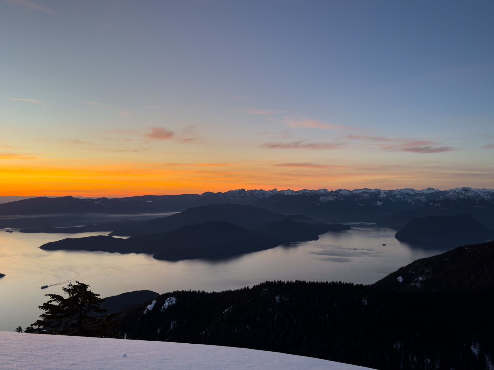
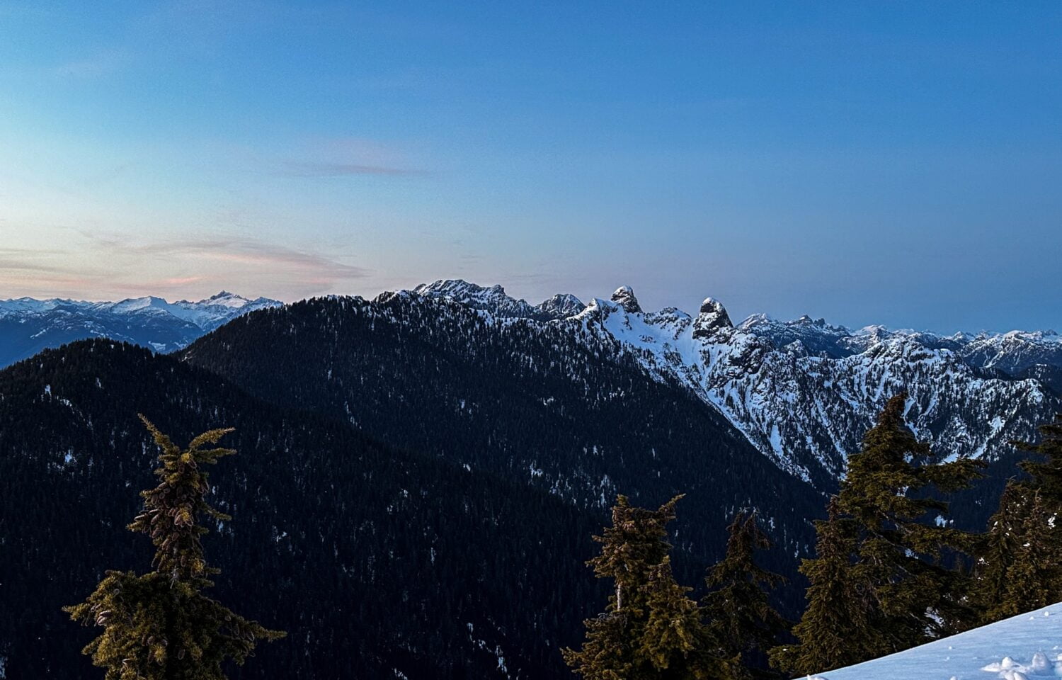
Day 8 | Hike in Banff National Park

You’ve now made it to the Banff side of the Icefields Parkway. And when you’re in Banff, you visit Lake Louise. Sigh… What can I say? It’s incredibly touristy, but it’s popular for a reason. If you’re reasonably fit and up for a little more adventure, here’s what I recommend: don’t go to just see the lake. You’ll be one of hundreds, you’ll get frustrated with how many people there are and how people won’t get out of the way as you try to take your photo. Instead, prepare for a hike visit that goes further than the rest of the crowd. 

Getting a Lake Louise shuttle bus pass

To control the big crowds, visitors need a shuttle bus pass to be able to get to Lake Louise. You can reserve a pass two days prior to your visit, at 8 AM local time, so you will have to decide when you go exactly. Remember, if you are not in the Alberta time zone yet, you need to double check what time time slot reservations open. The slots can be gone in just a few minutes. The link you need is: https://parks.canada.ca/pn-np/ab/banff/visit/parkbus/louise

Scroll down to Parks Canada Shuttles, hit the Reserve Now button. On the white box you get next, click on “Day Use” and pick “Shuttle to Lake Louise and Moraine Lake”. Next, you’ll get a map. Click on Shuttle.

Next, you’ll get time slots for Lake Louise and for Moraine Lake. Pick the morning OR midday option, but preferably the morning. If the Lake Louise options are full by the time you get to this screen, an alternative is to start at Moraine Lake (again, morning or midday). In this case, you will take the shuttle to Moraine first, have a look around, and then hop on the shuttle to Lake Louise. This option is more than fine as well. 

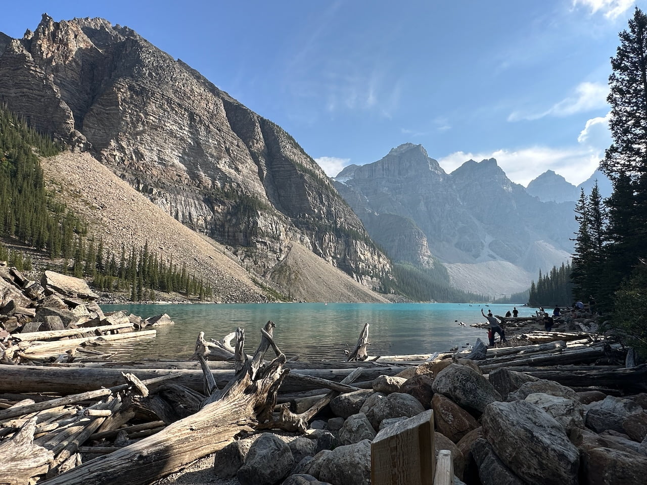
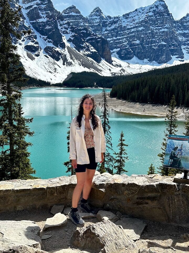
If you ask me, Moraine Lake is even more beautiful. It’s gor-geous. For that reason, I’d recommend to save it for after Lake Louise, but it’s not terrible to start at Moraine. Lake Louise just suddenly might seem a tad less impressive. But that’s just my opinion 😊

Getting to Lake Louise

On the day, drive to the Lake Louise Park & Ride. Make sure you have your reservation ready on your phone, avoid having no reception to load your shuttle booking! Once you’re there, try not to wince too much at how many cars are already parked. From the parking lot, make your way to the tents, where you can line up to check in and join the queue for the next shuttle to Lake Louise. 
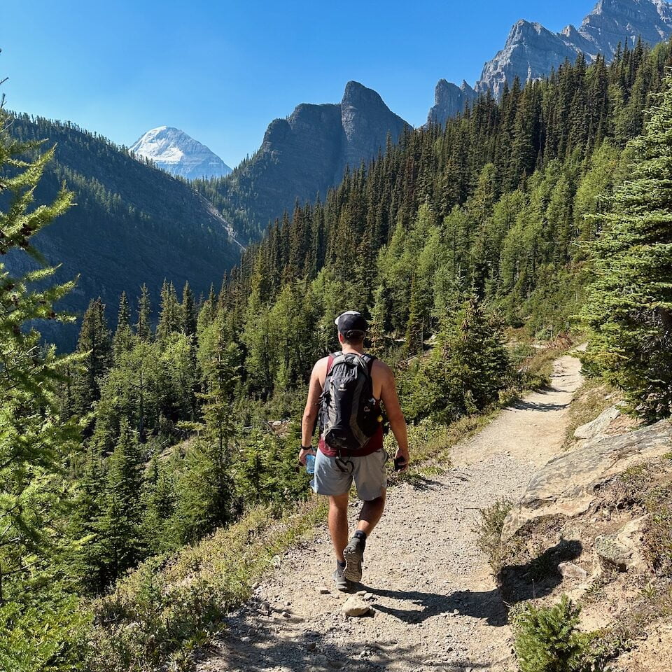
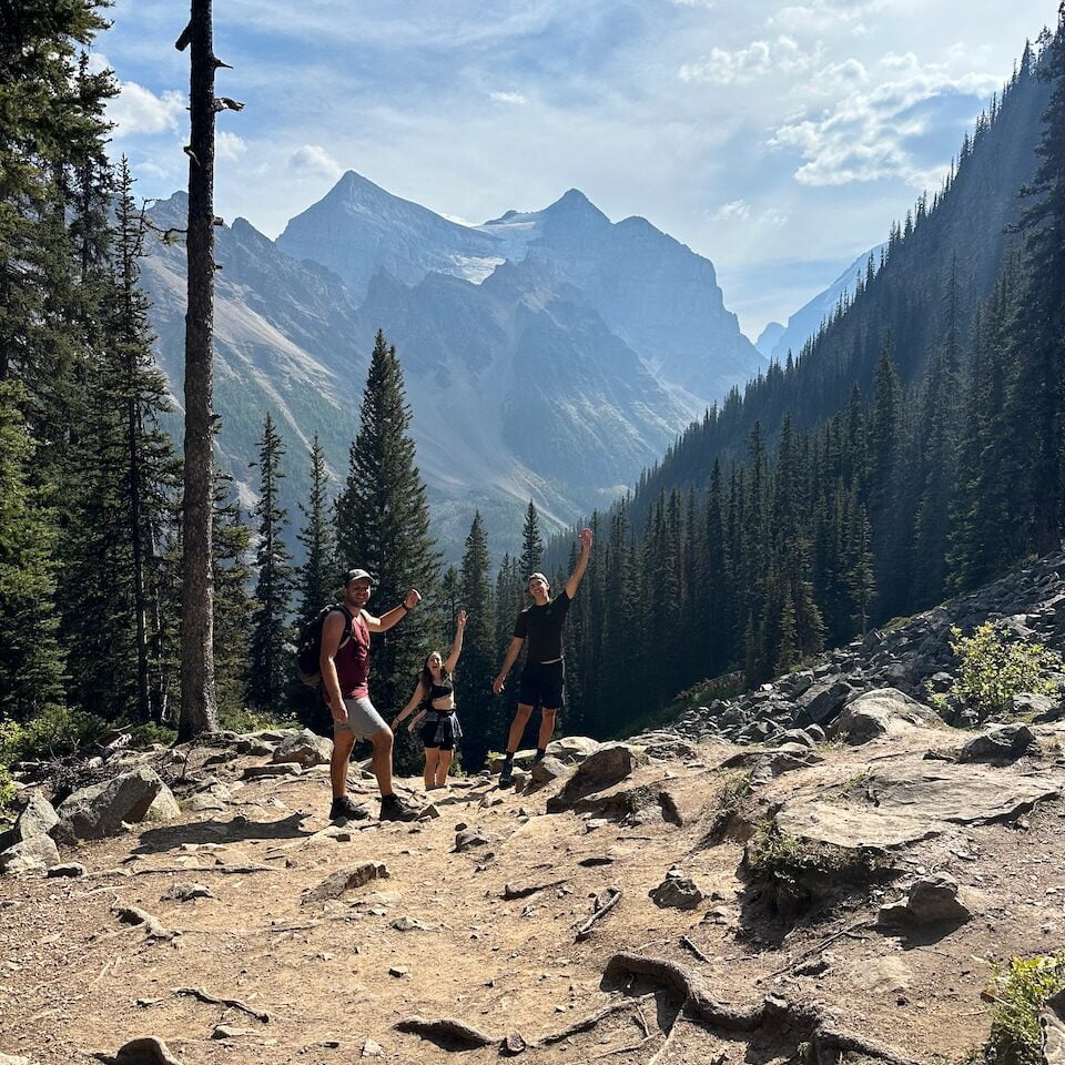
Enjoy a hike

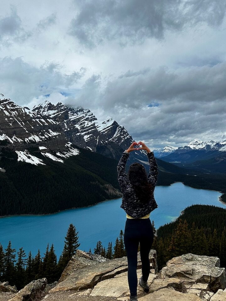
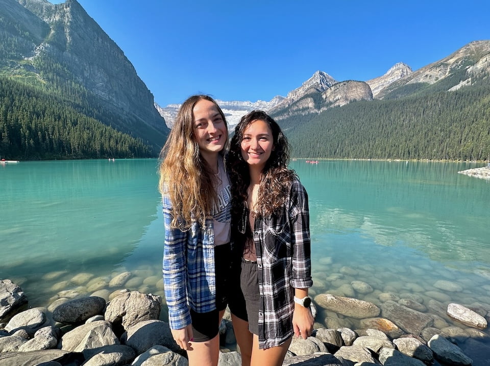
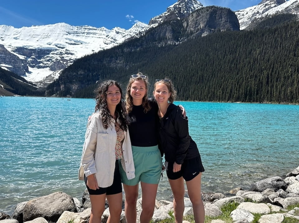
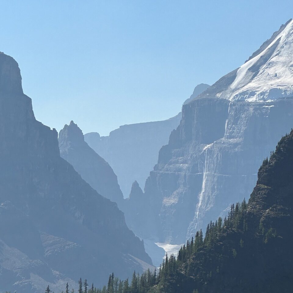
Lake Louise is a wonderful sight to see. When you arrive, the first thing you’ll want to do is stare at it and take some photos. That’s what everyone else is doing too, you’ll see 😉 Here are some of my photos from August 2023 and June 2024. When I was there in June, the lake had only just melted, so it was super clear and crisp and there was still lots of snow in the background. What you don’t see on these photos is that behind the photographer there’s a huge Fairmont hotel that looks like a Disney castle.

August 29, 2023 | At Lake Louise with Agniezska, Erik, and Tom
June 13, 2024 | At Lake Louise with Vera and Melissa

Walk alongside the lake toward the right, and follow the signs for the Lake Agnes Trail. The first lake you’ll reach is Mirror Lake. It’s pretty steep, so you’ll work up a sweat quite quickly. You’ll notice that until here, it can be quite busy. Most people continue the trail toward Lake Agnes, perhaps followed by the Big Beehive. However, what we did was go further up to Mount St. Piran.

🥾 Mount St. Piran Loop

A challenging hike with 937m elevation, but 100% worth the effort. We followed the advice of many reviews on AllTrails and turned back the same way after reaching the top. Apparently, going down the other side is very steep and dangerous. On the way back, we stopped at Lake Agnes before making our way further down back to the parking area. Though it was a tough one, the scenery on this hike was amazing as you can tell from the pictures below.


The shuttle pass gives you access to both Lake Louise and Moraine Lake, so after Piran we hopped on the shuttle to Moraine Lake. Exhausted from the hike, I didn’t go up onto the rocks that first time in August 2023, but strolled by the side of the lake. Wonderful views, and with the early evening glow the light was so beautiful. 

The second time around, we only went up to Mirror Lake and then turned back around (it started to get tricky with patches of snow from that point), so plenty of energy left this time to see Moraine Lake from a higher angle. I was baffled by the color of the water in June; it’s soooooo bright! Just like Lake Louise, the lake had only recently melted, so it really had that icy blue quality to it. And seeing the backdrop with the snow… Magical. If you have the chance to go twice, do it and go experience the difference! The pictures don’t do it justice at all.

August 29, 2023 | Moraine Lake from the side of the lake, end of summer
June 13, 2024 | Moraine Lake from the viewpoint, late spring/early summer

Day 9 | Yoho National Park

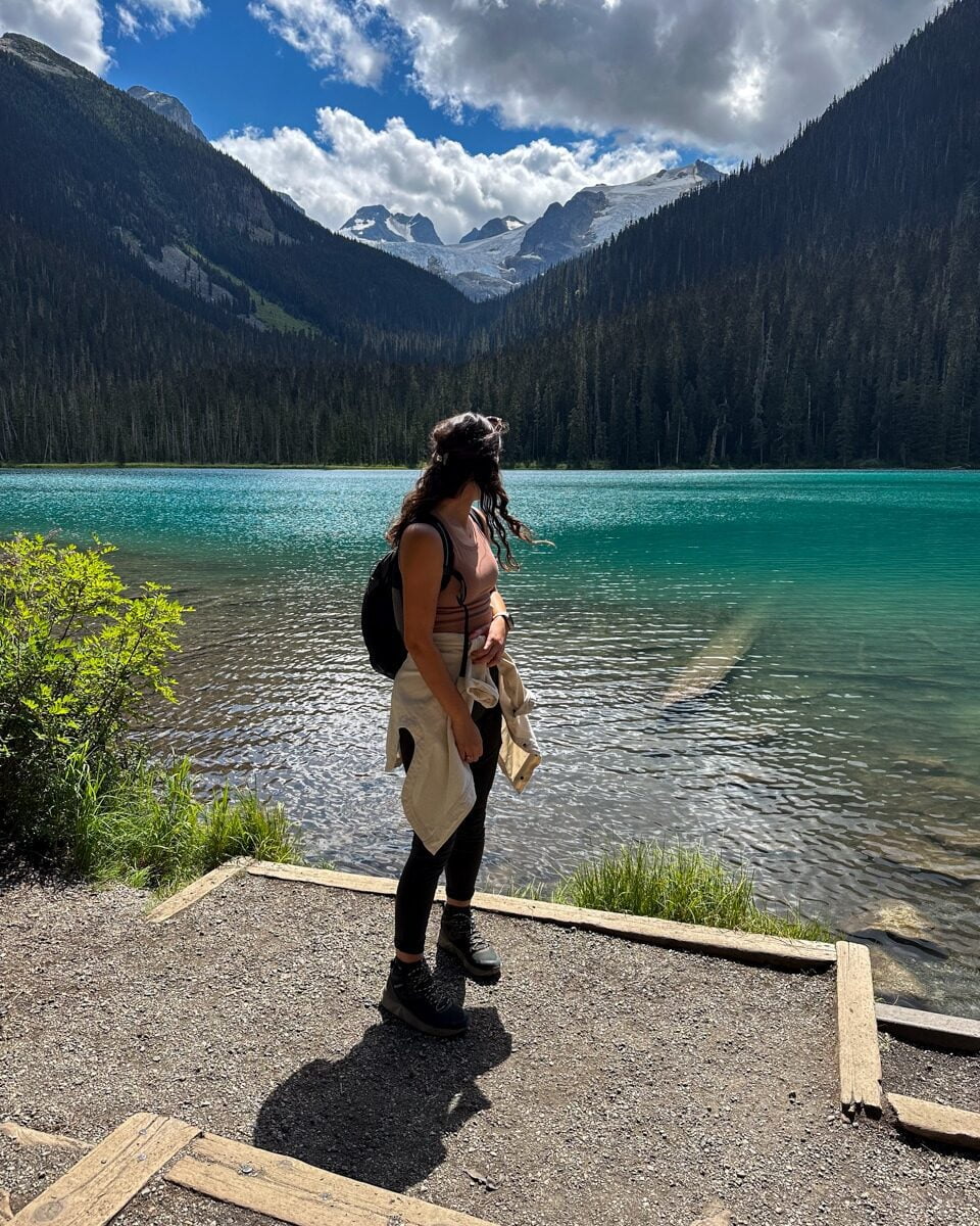
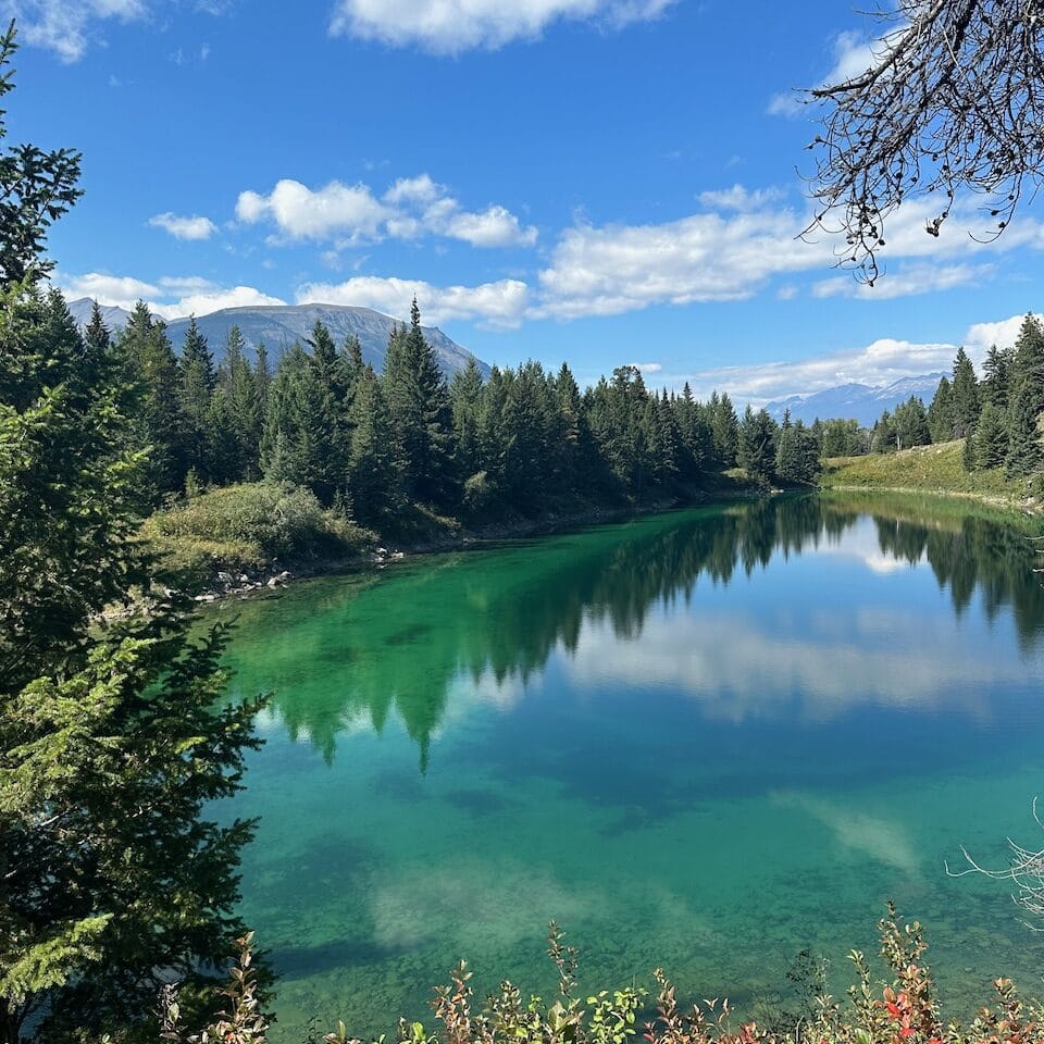
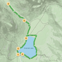
A highlight of Yoho National Park is Emerald Lake. Especially on a sunny day, the color of this lake is just so special! You can choose to just do a loop around the lake, but if you want to see a bit more, there are several trails surrounding the lake.

🥾 Emerald Basin and Emerald Lakeshore 

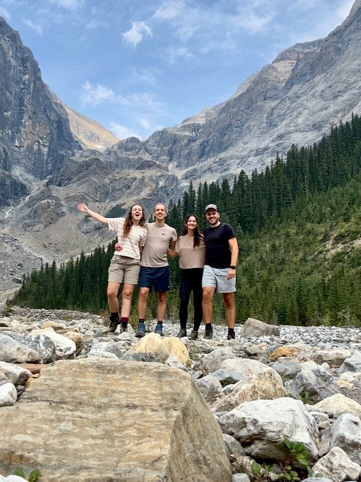
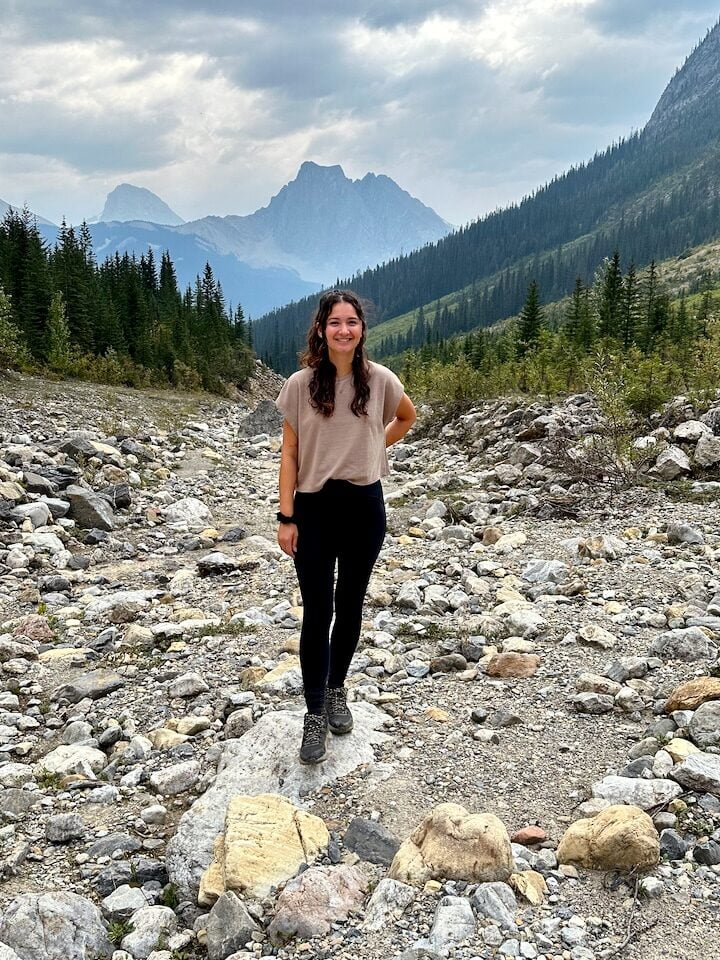
We chose the Emerald Basin Trail, which got us up close to the Emerald Glacier.

August 30, 2023 | With my fellow Rocky adventurers
August 30, 2023 | On the Emerald Basin Trail

Day 10 | visit banff & Drive to Calgary

Visit Banff

Now that you’re in Banff National Park, of course you can’t skip Banff itself. Banff is a resort town with a population of about 8,000 people. It’s also one of Canada’s most popular tourist destinations, so it’s always pretty busy around there. That said, it’s a cute place, and nice to explore for its restaurants and shops. When you’re there, consider paying a visit to the Fairmont Banff Springs Hotel too – it’s a gorgeous castle-like luxury hotel. Even though you’re probably not going to be sleeping there ever, you can still go in and look around. You’ll feel a little bit like you’re walking the halls of the Harry Potter castle. Definitely something to experience!

June 12, 2024 | Lake Minnewanka

Lake Minnewanka

Just 20 minutes away from the Fairmont Banff Springs Hotel you’ll find Lake Minnewanka, a glacial lake with one of those super picturesque mini islands on the water. Another gorgeous place! We did a short trail there in the canyon to the south west of the lake, but if you have a bit more time, try the lakeside trail instead.

🥾 Stewart Canyon Trail (5.8 km)
🥾 Lake Minnewanka Lakeside Trail (15.6 km)

You can also take a cruise on the lake and learn more about the history of the place. 

Drive to Calgary… Vancouver to Calgary roadtrip complete!

All good things come to an end… Are you ready to leave the mountains? As you head from Banff to Calgary you’ll pretty quickly see your surroundings change to flat lands.

I can’t say much about Calgary as I haven’t spent much time there. I think a day or two would be more than enough if you want to end with a little city trip – if not, then just go for the airport 😉

As I mentioned at the start of this post, if you have a longer vacation you could loop back to Vancouver from here, so you can return your rental car at the same place. If not, it’s time to say goodbye to the most beautiful side of Canada!

If you’re going to venture out here, please feel free to shoot me a message for more recommendations. Happy trip planning!

When a friend of ours said her dream was to celebrate her birthday hiking to a hut with a group of friends, of course we said we’d be there. And so one weekend in July, we put on our hiking shoes and packed our backpacks for an overnight hike to Watersprite Lake.

Getting geared up for Watersprite Lake

That sounds simpler than it really was though. We had gone camping once before and got ourselves a proper tent for it, but that’s not a tent that you can carry up a mountain with 700 meters elevation. Likewise, we got one sleeping bag that was big enough to share, and a two-person air mattress – both items unsuitable for backpacking.

Thankfully, we were assigned a spot in the hut, so we didn’t need another tent. We did, however, need sleeping mats, sleeping bags, and pillows, all small enough to fit into a backpack. After visiting Mountain Warehouse, Canadian Tire, and Mountain Equipment Company, we had all the stuff we needed for this adventure.

At the trailhead for the Watersprite Lake hike
Mountainous view over the valley as we hike toward Watersprite Lake

The ride up to Watersprite Lake Trailhead

We bought a car a few months ago and chose a vehicle that would allow us to go on adventures like these. A bit older, some scratches so we’re not too worried about scratching it more, 4-wheel drive, and enough space to transport stuff like tents, paddle boards… Or in this case, a bunch of backpacks from people driving with us. Given that our car would be suitable for the bumpy drive to the trailhead, we offered to drive, so we picked up a few members of the birthday crew and made our way up to Squamish. 

The Watersprite Lake Trailhead is located roughly 20 kilometers up a bunch of Forestry Service Roads. Once we got to the start of the road, our navigation said it would be a 50 minute drive to the trailhead. And what a drive it was. We were bumping and shaking to and fro in the car. Tom had his eyes peeled on the road, with full focus, while us ladies chatted to calm the nerves. We made it through steep inclines and over enormous holes in the road. We arrived safely, apart from the high heart rate and possibly some bruises from bumping our heads to the windows and doors and each other.

Birthday girl was there already, along with the peeps that were with her in Car #1. We were the second vehicle to arrive, Car #2. It wasn’t long until Car #3 arrived with familiar faces. Great, we just needed to wait for one more, and we’d be ready to go.

Car trouble

We waited. And waited. And waited some more. Until it didn’t make sense any longer – where were they? With no cell reception, there was no way of knowing the location of #4, and we could not contact them to find out if they were okay. Other cars arrived at the trailhead, so we asked them if they had seen anyone stranded on the way here. “Yes,” one driver eventually answered. “Yes, there was a car on the side of the road. Transmission problems.”

Darn it! So Car #3 went to go find them. Based on the description of where they had seen the stranded car, he set out to go find them. Meanwhile, we waited, and waited. And waited some more. Until suddenly, a random car arrived, and the folks we were waiting for got out of the car, celebrating their arrival…

Wait a minute?

Turns out, a friendly couple had offered them a ride up to the trailhead. The stranded group decided to split up: the driver would go back and take care of Car #4 – it couldn’t possible continue up the steep road, but driving down seemed okay. Unfortunately, it meant he had to skip the hike. The rest of the group accepted the friendly help and took the ride to the trailhead. 

Which was great. Here they were! But… our rescuer in Car #3 didn’t know any of this, and was still out there searching for them!

We waited. And waited. Until eventually he returned, sad faced, feeling bad for not finding our remaining hiking buddies. But of course, he was relieved to find out they had found their way up after all!

Hiking to Watersprite Lake

With a 1,5-2 hour delay, we finally started to make our way up. To get to Watersprite Lake, you’re in for a 9km hike with about 700 meters of elevation. It’s quite a long one – we took about 5 hours to get up, including one lunch break and a few short breaks to drink some water and confirming we’re all still here (16-person group!). 

You’ll need a good amount of bug spray (gosh bugs flying around EVERYWHERE) and you’ll work up a serious sweat… But in return, you get beautiful meadows, waterfalls, beautiful forests. There are still snowy peaks around you, you’ll see glaciers, gorgeous views over the valley and river. It was quite a warm day, so we brought lots of water. We refilled our bottles when we passed a waterfall with fresh water.

When we arrived, I was surprised to see that the hut was quite large and had a really nice deck overlooking the mountains. We explored our home for the night, then went to the lake to swim and refresh. The water was cold, but very rewarding and refreshing after the tiring journey. Half of our group had to hike a little bit further and set up their tents on the campground across the water. They took a refreshing swim, too!

AllTrails labels the hike as Hard; I’d say it’s moderate with a hard part at the end where you have to scramble a bit over 3 sections of large rockslides. After being treated to all that beauty on the way, Watersprite Lake itself is quite the climax. What a gorgeous place. I don’t know how many wonderful shades of blue my eyes have been treated to since arriving in Canada, but this lake was a magnificent addition. It was so crystal clear that it had a gorgeous reflection, great material for some impressive photos.

Wonderful evening

Time to cook! The hut was well equipped. We connected our propane tanks, and soon everyone was cooking the meals they brought. From dehydrated hiking meals to fresh veggies for couscous salads, everyone come out of the kitchen with their own creations. Tom and I brought 4 packs of Pancit Canton noodles, and managed to bring 2 fresh eggs to add on top. Thankfully they didn’t break on the way up the mountain 😉

Apart from dinner, most of our group brought some birthday surprises, including a massive 7 liter bag of red wine (imagine the weight of that in their backpack!), cupcakes and birthday candles, birthday decorations, and… a silent disco set.

Plenty of fun!

Until we went to sleep on those sleeping mats. That was less fun. But oh well, it is what it is.

The way back

The next morning, some went for another swim in the lake, and we each made breakfast, spent a bit more time enjoying the hut with the group… Then cleared out everything and packed up all our stuff to make our way back to the cars. It took us about 3 hours to venture down. The views were fantastic again, but with barely any sleep, the hike was a bit more challenging in terms of energy. The hike required a lot of attention and strong knees. Thankfully, the hardest part was right at the beginning, so after we had climbed and bouldered our way through the big rocky part, the forest paths were a lot more manageable.

Getting home

Once we finally reached the car, we were all very tired. With only breakfast and a few snacks, our fuel was low. Once we had reception, it was clear that there was quite a lot of traffic on the Sea to Sky Highway back to Vancouver. Would we suck it up and get home asap, or go into Squamish first to get a decent lunch first? We decided on the latter, and I’m so glad we did. That burger was much needed to make us feel like ourselves again, and made the way back a lot more pleasant. Tom drove us home safely.

By the time the clock hit 9 pm, my eyes hit 6 o’ clock. I slept like a heavy log in the sky-blue water of Watersprite Lake, on my deliciously thick and soft mattress and familiar pillow. 

A weekend to never forget!

Remember when I said the snow has been terrible this year? Well, it has, but after I last posted there were a couple of good snow dumps on the mountains, so we made the most of it and went night skiing a few times. Our goal was to gain confidence in skiing, and to hopefully enjoy some beautiful views. The latter turned out to be harder than we thought!

Living in the West End of downtown Vancouver is great for many reasons, and one of them is how close we are to the Lions Gate Bridge. Getting to the North Shore is so quick from here! A 30 minute drive brings you to Cypress Mountain Resort, one of the three skiing spots directly around Vancouver. Unfortunately, it wasn’t until January that the snow was good enough to hit the slopes. Here’s our short story of how it was for us this mini skiing season.

learning without the views

The first few times we went skiing here in Canada, the conditions weren’t great. Our first time at Big White Mountain in the Okanagan (Feb 2022); it was snowing and fully overcast, but it was our first-ever lesson, so we were too focused on not breaking our knees to be fussed about not having clear blue skies. Our second time was in Whistler (Dec 2023) – we did quite well in that lesson, but unfortunately it was another overcast day. We didn’t get to see Whistler in its full glory.

Our third time was an evening at Cypress Mountain in January, but the sun goes down at 4 PM in that period, so it was pitch black once we were up there. We were still getting used to skiing, so we stayed in the Easy Rider section, while our lovely Dutch friends did their own thing on the black runs. They gave us their stamp of approval when they came to check us out, so we thought next time we’d try and ‘graduate’ to the green runs.

First time on Cypress Mountain, 16 January 2024
Second time night skiing on Cypress Mountain, 1 March 2024

Getting the hang of it (and the views)!

‘Next time’ took a bit long though, mostly due to poor snow conditions. On 1 March, we made our way to the Easy Rider hill again for a few practice runs before trying the green run. We were so excited to finally have a chance to look out over the ocean and the city! Sure enough, that night we could see the pretty city lights in the distance. 

We were back a week later, rushing after work to try and have some sunlight left! On 7 March we brought up the courage to take the higher lift, up to the top, so we could go to the sunset spot. We were on time for the sunset, but unfortunately a big misty cloud blocked the view (see our last post). OH well. At least we had a chance to practice going down all the way from the top. It went pretty well, so it was really encouraging! After the sun had gone down, it cleared up very nicely, so once again we had some really pretty city lights to marvel at. Will we still get to see the real thing, with the ski season coming to an end this month?

A few days later, Tom gave it another try. He video called me to show me the GORGEOUS view. And so I joined him a few days later when the weather forecast was looking pristine. And oh my gosh. It was so beautiful. 15 March, on the top, incredible visibility, fantastic sunset. Seeing this place from the ground is already so amazing – the Sea to Sky highway is mind-blowingly beautiful. Absolutely loved seeing these surroundings from above! Skiing back down, the sky kept its vivid red and yellow colour for another 20 minutes. Gorgeous!

View over The Lions, also known as the Two Sisters
Heading down after the sunset was so pretty with the vivid colours!

Unfortunately, that was also the last time I was up there. It’s 12 April now, and night skiing is no longer available. Cypress Mountain is preparing for the summer season, and so am I. The thick winter clothes have been swapped for the spring and summer wardrobe, and my helmet and ski clothes are tucked away in a box. It’s too bad that the conditions were so limited this year, and that we didn’t get to try Whistler again. But hey. Another chance next season, which hopefully starts as ‘normal’ in November/December.

Hello again! February has arrived. Winter season has us cooped up at home a little more than I’d like. The days are dark, short, humid, and very varied in terms of temperature. After a gruellingly busy week, today I was desperate for some mountain time and vitamin D. Today’s mountain flavour was Golden Ears Provincial Park, and it was just what I needed. Here are some photos and some updates on how it’s been going here in Vancouver.

I’ve been told that January and February are quite depressing in Vancouver. Last year, these were my first months here, and with all the excitement and good luck in terms of weather, I had no idea what they meant.

Not to be dramatic, but yeah, I get it now.

We’re just coming out of a 2-3 week period of near constant rain. Weather warnings about risk of flooding and ‘atmospheric rivers’ kept popping up on our phones. We had a wonderful time night skiing mid-January, but this rainy period started soon afterward. Along with heavy rain, the little snow that had finally accumulated (including 3 days of snow and -15 degrees celsius in the city) has been melting for some time now. As you can tell, it’s been very, very wet here! And as you can imagine, people with season passes for the ski mountains surrounding Vancouver (like Tom) are very bummed.

But rain will eventually be followed by sunshine, and it looks like we’ll finally have some dry days the coming week(s). As you can imagine, whenever the sun does come out, people are desperate to go outside… Me included! 

a week of learning

This week kicked my butt: I started a three-module course this past week. Two days of class were followed by a three-day company visit where I got to apply the tools and learnings and work on an improvement case. It was super interesting, very intense, and incredibly valuable and rewarding. Had a great time with a team of people from various fields, and it will be followed up with another two modules at the end of February and March. Very exciting!

Simultaneously, I started another professional development course. This one is online, and it started yesterday… So I had a 6-day week completely dedicated to learning. Hence, my kicked butt. 

You might ask what I have gotten myself into, but you know what, it’s February. It’s dark and cold and wet, so this is the perfect time to be a student. Super grateful for these learning opportunities and the good timing!

Combined with salsa lessons every Thursday night plus my keyboard (LOVE IT), I’m making the most of the dark winter season 🙂

Golden Ears

Today is Sunday, my only day of weekend, and so I wanted to make sure I make the most of it. After spending the whole week with 30+ people, I was socially exhausted. Seeing the great weather forecast, it was clear that this was going to be a mountain day. Time for a hike, some nice views, some peace and quiet!

Indira in front of a beautiful mountain backdrop at Golden Ears Provincial Park

After a coffee and a video call this morning, we claimed an Evo (car sharing) and packed up a backpack with some water and a sweater (just in case). At an hour and fifteen minutes distance from Vancouver, two very distinct peaks grace the air: the Golden Ears. The surrounding area was named after these peaks. One day, we’d love to climb all the way to the summit, but let’s wait until the warmer season arrives! For today, we picked an easy out-and-back hike, considering we only had the afternoon and it gets dark so early.

Though it was just 10 degrees, the sweater was not necessary. The hike had some open areas where we could let our skin soak up the sun rays. Felt so good. Needed the vitamin D so badly. It had been a while since I took out my mirrorless camera, so this was a nice opportunity to get some good quality photos again. 

No drone today, unfortunately (empty batteries), but with some better weather on the horizon and the days getting a bit longer, I’m excited to find some opportunities to get some nice footage again. Can’t wait to be spending more time outdoors again!

Until next time, with more nature photos and more stories – and more brain capacity left to write something more interesting for you.

The last week of July, we packed up a weekend bag and hopped in the car with our dear friends A & S. It was time for our weekend getaway in which we would hike the much anticipated Joffre Lakes Trail. Our Airbnb was in Pemberton – new to us, but we now have many fond memories of that beautiful town!

Pemberton is a picturesque town situated in the Coast Mountains of British Columbia, just 2 hours north of Vancouver. With Mount Currie as a back drop, and Joffre Lakes Park and several lakes and rivers around, it was the perfect place to pick an Airbnb.

Friday after work, we made our way through traffic to the Sea to Sky Highway. We stopped in Squamish first to have dinner. We’d spent so much time together at this point, but realized this was our first sit-down dinner out with the four of us! 

We made our way further up north, passing Garibaldi and Whistler before arriving in the small town of Pemberton. The Airbnb was a cozy upstairs apartment above someone’s garage. We spent the first night getting settled into our place, having drinks over games.

It had been a busy few weeks for all of us, so we had barely planned anything yet. The most important part was arranging our hike at Joffre Lakes. For many parks, you need to secure a parking pass two days in advance at 7 AM. Generally, these parking passes sell out in minutes after registration opens. We managed to get a pass for Sunday.

On Saturday morning, we went into Pemberton in search of some groceries and cooked a lovely breakfast together. The Airbnb had an outdoor patio, perfect with the warm weather! Our host walked by to say hello, so we asked him for some recommendations. Any lakes around he’d recommend for paddle boarding?

For a visual summary of the weekend, check out the reel I made on Instagram!

lilloeet lake

We decided to drive to the super scenic Lillooet Lake. It stretches approximately 33 kilometers and is surrounded by forests and mountains. We drove along it until we found an area with parking and good access to the water. We took out the paddle boards, got the electric pump started, and found a spot on the beach to hang out.

The lake is so, so beautiful – such clear and crystalline water! We had brought our camping chairs and picnic mats. While S. and I chilled and snoozed on the beach, Tom and A. went out on the water. It was such a beautiful setting, we spent hours just chatting and enjoying the views. And of course, playing with the drone a bit for great photos and videos.

High vantage point view of Lilloeet Lake with the beach on the left and mountains all around.
Tom and our friend A. paddle boarding on Lilloeet Lake.
High vantage point view of Lilloeet Lake with the winding road on the left.

After a lovely afternoon there, we made our way to the supermarket again to grab ingredients for a delicious home cooked meal.  We spent the evening cooking, eating, and playing board games.

Joffre Lakes

The next morning, we geared up for the Joffre Lakes Trail. After another yummy breakfast, we packed some lunch, tidied up the Airbnb, and packed up the car. As we drove out of the driveway and into the garden leading off the property, we suddenly saw a young bear right in front of us in the garden! It was the very first time we saw a bear, so it was such a special moment! I loved how it moved so clumsily and cartoonishly, looking left and right using its whole body, deciding which direction to head into. It ran off to the left, and we didn’t see it again.

That was a great start of our adventure. We drove about 30 minutes to the Joffre Lakes parking area, showed our parking pass to the park rangers, and started the 8 km hike along three stunning turquoise lakes: Lower, Middle, and Upper Joffre Lakes. 

The first lake you stumble upon on this trail - gorgeous place!
What a beauty, that second lake!

The hike is very doable, but you’ll definitely find yourself needing to catch your breath a few times. That’s all good though – the trail ascends through such picturesque forest, just take in all the beauty! There’s something to see everywhere. That includes wildlife, particularly two-legged creatures with backpacks. This is a very popular hike, and despite the parking pass which limits how many people can be there, it does get quite crowded on the narrow trails.

I particularly liked the Middle Lake; the colour  was so, so beautiful. It has that backdrop of snowy mountains and rocks but still lots of green forests and meadows.

The second lake on the Joffre Lakes Trail
Tom and Indira at the Upper Lake of the Joffre Lakes Trail with the glacier behind them
At the Upper Lake; it was quite chilly there but great glacier views

As we neared the Upper Lake, the surroundings got more rocky. At the end of the trail, we sat on huge rocks to enjoy the glacier surroundings, eat a sandwich, watch the birds and chipmunks around us… We considered going further up on a new trail – we were told doing that would get you a view of all three lakes in a row. But considering, time, cold, and not enough food for an additional few hours, we made our way back down. 

The weather was fantastic, so the boys mentally prepared for swimming in the glacier cold water. Though I think the second lake would have been the most beautiful for it, walking the rest of the way back with icy cold wet shorts would be a bit uncomfortable. So we decided on the Lower Lake. Though I didn’t swim myself, dipping my warm and tired feet in the water was incredibly refreshing!

It was just another 20 minutes or so back to the car. After a short pit stop, we hopped in the car again and started the drive back to Vancouver.

Indira on the Joffre Lakes hike with the Middle Lake behind her
Overlooking the Middle Lake

North Arm Farm

On the way, we wanted to make one more stop, and we read about a nice farm somewhere around Pemberton. We decided to go find it, and wow, I’m so glad we did! North Arm Farm is a 60+ acres organic farm with fruits, vegetables, and flowers. It’s particularly know for offering farm-to-table experiences such as berry picking. Though we didn’t do any of that, as visitors we were welcome to roam around. I loved it there so much – the mountains around, the gorgeous trees, the incredible barn (wedding location, anyone!?)… At the shop, we got ourselves some ice cream, and I bought a couple of artsy post cards for my collection.

Unfortunately, it was time to go… Back home, over the gorgeous Sea To Sky Highway. Back to work the next day!

North Arm Farm in Pemberton, I LOVE that place so much. Tipping this as a fantastic barn wedding location!

July was a very special month, because Tom’s parents came to visit! We had such a lovely time showing them around and giving them a sense of what life is like here in Vancouver. But it was also a chance for us to go on a trip and explore something new! We decided to book a ferry to the Sunshine Coast, an island we had heard good stories about. In particular, something called the ‘skookumchuck narrows’ was at the top of our list of things to experience there.

reaching the skookumchuck narrows

“Skookumchuck” is a word of Chinook Jargon origin, an indigenous trade language used in the Pacific Northwest. It translates to “strong water” or “turbulent water.” Located on the Sunshine Coast of British Columbia, the Skookumchuck Narrows is a natural marvel where the tides of the Pacific Ocean converge with the waters of the Sechelt Inlet.

This sounds very familiar to me now, but before going on this hike, all I knew is that we would see a ‘narrow’ place where water does something special when the tides change. I had no concept of what it might look like, nor had I had time prior to our getaway to research it. For me, this preamble 100% added to the experience, because I was so in awe when I reached the water!

The moderate-level hike was approximately 8 kilometers round trip through lush coastal rainforest, and took us* through a diverse landscape of ancient trees, ferns, and moss-covered rocks. On this Sechelt Inlet Trail, you can expect some rough paths with exposed rocks and roots. With the elevation changes, you’ll find yourself needing to catch your breath here and there.

*By ‘us’ I mean Tom, his parents, myself, and several other hikers. There was one man in particular, let’s call him John, who brought our hike enjoyment to the next level! He walked with us for several kms on the way there and back. 

the rapids

Prior to the hike, Tom had figured out that that particular night at 8.20 PM, the tide would be at its strongest. The statistics told us the rapids would be ‘XL’ in size tonight. Still not fully understanding what that meant, we followed the schedule and timed our hike accordingly. With a steady pace, we kept following the trail, and listened to John’s previous experiences. As a resident of the island, he had walked this trail many times before. He promised we would not be disappointed.

The sound of silence, hiker conversations, and birdsong suddenly changed into a roaring sound of rushing water. I remember being surprised by how much louder it grew as we approached the furthest point of the hike. It makes you step up your pace in anticipation of finally seeing what the fuss is all about.

The trail ends on a large rocky area which you can safely stand on. As we emerged from the forest onto this ‘observation deck’, our mouths dropped and all we could say was, “wow!”

what a place!

What a spectacle – churning waves, whirlpools, heaps and heaps of water surging. As the tides shift, the water rushes through the narrows with incredible force. The waves are much larger in person than it seems in the video above. Apparently, the waves can get up to 5.5 meters high!

My expectation was some kind of narrow passage that water would rush through, but it looked like quite a wide river. If you look it up on Google Maps though, you’ll see it’s indeed the narrowest section the water from the ocean goes through as it travels into the Sechelt Inlet. 

taking it all in

John explained that this place is popular to professional kayakers and surfers. Cool as that may sound, it does not always end well. Several people have died, including search and rescue volunteers. 

Once you have a chance to peel your eyes away from the water, you’ll see that the views are also stunning. As you can see in this picture, I particularly liked that section where two mountain dip and bring a mountain top further away into view. The picture here is basically: Indira: Tom, can you take a picture of that bit there? / Tom: What bit? / Indira: That bit! / Tom: What bit? / Indira: THAT B… / Tom: *Takes pic*.

It was getting late and it would get dark soon, so we had to start making the journey way back to the car. Not to fear though, John cheerfully joined us with his daughter, sharing not just nice conversation but also his spare flashlight.

Another experience richer, we returned to our Airbnb to rest up for the next day on the Sunshine Coast. If you’re ever making the trip… Don’t skip this hike and make sure to check the tidal schedule to see when the best time would be to see the Skookumchuck Narrows!

Panorama Ridge is a breath-taking ridgeline snugly situated between Squamish and Whistler. It’s a challenging 30 km hike in the Garibaldi Provincial Park, just an hour and 15 minutes from downtown Vancouver. This hike caught my eye early on in February, but it’s not something you’ll want to do in that time! Conditions were perfect at the beginning of July: most of the snow melted, temperatures were outstanding, and a group of colleagues presented the idea to go with a group. Couldn’t say no to that!

As a relative newcomer to British Columbia and a first-timer when it comes to summer in Vancouver, I collected as much information and tips and tricks from people around me as I could. This is a hike you need to really prepare for!  Here’s what my experience preparing for and hiking Panorama Ridge was like.


preparation #0: experience

Before Vancouver, on average I probably went on a mountain hike about 4 times per year. For BC standards that’s not a lot, but combined with being a runner I guess this gave me enough experience and fitness to take this one on. To tell my legs to get ready for this endeavour, I went on a 15 KM hike the weekend before Panorama Ridge. The Diez Vistas & Lake Buntzen Loop was pretty good prep – would recommend it. 

preparation #1: day pass

First things first: get your hands on a day pass. To spend the day in Garibaldi Provincial Park, you need to set your alarm at 6:55 AM two days before you plan to be there. At 7 AM, the battle for day passes starts. After about 15 minutes, availability of passes was already low. Don’t forget about this important step! No pass = no hike. We went for the parking pass for the Rubble Creek parking lot.

preparation #2: hiking necessities

We went to the Mountain Equipment Company (MEC) to grab some very necessary items for this adventure. This is not an unpleasant errand – this store is amazing! It’s hard to spend only a little bit of time here. 

We went particularly for bear spray and bug spray, both very helpful to prevent getting eaten alive 🙂 Water treatment tablets were a much appreciated recommendation – you can expect some mountain water streams on the way, which means you don’t have to carry too much water (heavy bag!). We took about 2 liters nonetheless, just to make sure we’d not feel dehydrated before we’d reach the first water source.

equipment list

  • hiking boots with ankle support
  • water bottles
  • water treatment tablets
  • DEET bug spray
  • bear spray
  • sunscreen (body)
  • sunscreen (face)
  • hat
  • gloves
  • first aid kit (including blister bandaids)
  • toilet paper
  • wet wipes
  • camera of choice
  • energy bars

preparation #3: food plan

The next step is to spend the day(s) prior to your hike putting together your food plan. When we got back from the MEC, we baked a pile of pancakes (bacon & raisins, my fave!) as well as omelettes for some buns. More on our list: a couple of handfuls of nuts, energy bars, a stroopwafel (extra high on caramel, from the MEC as well), and most importantly: Pringles. The red, original can. Can’t go on a long hike without.

getting there

Set your alarm super early. You’re going to want to have the whole day for this hike. We were on our way at around 5.45 AM. 

The sea to sky highway is an incredibly scenic drive, so if you ask me, the day starts there already! Once we reached Squamish, we grabbed a hearty breakfast at the A&W (McDonald’s-ish), and then went on to Rubble Creek, the start of the trail to Garibaldi Lake and Panorama Ridge.

When our group was complete and everyone was ready to go, it was somewhere between 7 and 7.30 AM. Let’s do this, people!

Squamish is so beautifully located!

panorama ridge hike

The hike starts with a steep introduction – your calfs are immediately confronted with quite steep trail in old-growth forest. After about 2 km, you’ll be treated with some switchbacks (17 of them, if I counted right). At the last switchback, you’ll have covered 4,6 km in distance and 661 m of elevation gain.

Not long after that last switchback, there’s an option to go left or right. The route on AllTrails goes right, sending you to the lake. Instead, we took a left, to the Taylor Meadows campsite. This would save us a little bit of time. On the way back, we would decide if we want to go back the same way, or make the trip to the lake. This would all depend on how much time we’d take covering the distance.

I particularly liked the part after that first junction, because after about 6 km in the forest, our surroundings changed and we could finally see the sky and look out more into the distance. The views were so, so nice.

A bit after our lunch break, at about 8 KM, we decided to split up into two groups. One group would double the pace and push to reach the ridge at no later than 3 PM, and the other group would turn right at the second junction to go and see Garibaldi Lake from up close. Both are incredible hikes, but the ridge would be an additional 10 KM to cover.

Joined by two guys from our group, Tom and I rolled up our figurative sleeves and made for the ridge. We felt pretty good and were positive we could do it! Lots of credit for that goes to the pancakes and omelettes 🙂

OEM02412-2
IMG_2756

The hike from Taylor Meadows to the ridge was absolutely gorgeous. It was an incredibly bright day and visibility was super high. Stunning mountain views all around us. Alpine meadows, wildflowers, lakes, creeks… But man, it was tough. AllTrails was not kidding when it set the level to Hard for this hike. Below is a little video impression. Remember to keep breathing when you watch it!

Getting closer to the top, we found ourselves slowing down because we had to go through snow. 

And let me tell you a secret. I don’t like snow.

As we ascended further, we reached very rocky terrain and had to pretty much scramble for what was probably 45 minutes. At some point, I passed the snow, and only had rocks left to climb. Looking up, all I could see was bright blue sky and black rocks. So. Many. Black. Rocks. That all needed to be climbed to get to the ridge. For a second there, I wondered how many people tripped or accidentally stepped on a loose rock and fell all the way back down to the start of this hellish end game of the hike.

That thought was followed by a brief flashback to particularly unenjoyable Scottish munro hike in Glen Coe where I thought about 5 times that ‘this bit must be the peak’. Only to find out it’s NOT the peak and there’s more… THERE’S BLOODY MORE.

Anyways, it wasn’t as bad as that. There was only ‘bloody more’ twice this time. Then, with just a little bit more scrambling, it wasn’t just the blue of the sky, but a different out-of-this-world version of blue. Here we are. Panorama Ridge. When you see it, with the sprawling glaciers as a backdrop, you’re just rendered speechless. Can’t tell you for sure if it’s from sheer exhaustion or the utter beauty of that place. It’s just so surreal. You get an incredible 360 degrees view. If I had any breath left I would shout “Hello, Garibaldi Lake! You look fantastic from up here!” Instead, I just whispered it internally, sighed, and high-fived my husband.

four more hours

Looking back, my shoulders kind of droop realizing that after that whole journey, there’s another four hours in front of us to get back down. In the moment though, it was alright. I guess it’s that high and adrenaline of reaching that amazing view that got us back to the parking lot. 

Avoiding having to take all of those rocks again on the way down, we actually slid down a big patch of snow, which was kind of fun. (Despite the fact that it was snow.) My hands hurt from the cold snow I balanced myself on, but then I remembered I brought gloves, so the second section was easier – scrambling down over rocks and snow, I could hold myself upright with my hands without freezing my fingers off. I like to think the gloves saved my life, because without them, I probably would have fallen multiple times. It was so, so slippery! 

Once we were out of the snow and rocks and reached Black Tusk Lake (a beautiful lake just at the bottom of the climb to Panorama Ridge), we decided to take a bit of a break. It was much needed – we ate what we called an early dinner, and soaked our feet in the gloriously fresh water. Ahhhh that felt so good!

After that, the way back was very pleasant, but we decided not to take the route to Garibaldi Lake. I’ll have to come back to do that hike another time when we have hours to spare. The last 4km were gruelling. At that point, my knees, my ankles, my hips were all screaming at me – asking what on earth I was doing to my body. How much more of this torture? How much longer of this abuse to the knees, walking down hill for hours? Looking in front of me and behind me, I just saw my three hiking buddies having the same internal battle. Straight, focused faces. Nobody chatting anymore. Just focusing on getting this thing over with.

When we finally reached the parking lot, I was pure heaven taking my feet out of those hiking shoes. But it was so worth the blisters and sore muscles! They say we’re true Vancouverites now, with Panorama Ridge crossed of our list.

We reached home at around 10 PM, took a much needed shower, and then slept like the dead. 

When you think of the United States, which states would be on your bucket list? I’ll bet that Washington State was not part of your considerations. With Washington State being just 2 hours away from Vancouver, we ventured out to Seattle about a months ago and noticed how nice and green the drive was. For the long weekend in May, we decided to see more of it and pay a proper visit to the capital of Washington. Which, surprisingly, is not Seattle. It’s Olympia. Right. Never knew that, either.

olympia in washington

After work on Friday, we picked up a car and drove south. This time, we tried a different spot to cross the border and it was indeed smoother and faster than the last time we went into the US. With only a three-cars queue in front of us and a friendly border officer, we were able to drive into Washington quickly. We stopped in Bellingham for dinner before driving further south.

It was pitch black, total darkness, but our Airbnb just north of Olympia on a little peninsula was a lovely spot when we finally arrived late at night. It had a cute beach theme, which certainly set the tone for the rest of the weekend!

The next morning, we walked to a little harbour in search of breakfast. We didn’t really find it at Boston Harbor Marina, but kept the place in mind for later that day. We got the car and drove into Olympia to try again there. 

Our intro to Olympia was the Olympia Farmers Market – a lovely spot to start! After getting some food, we walked further into Olympia in search of the Washington State Capitol.

Me in Olympia, Washington State with the Capitol Building behind me.
That's the Capitol Building of Washington State in the distance.

paddle boarding with sea creatures

The weather was fantastic, so we were excited to head back for our afternoon activity. Our new paddle boards were waiting for us to try them for the first time! We pumped them up (or, rather, the fantastic electrical pump did) and paddled around the Budd Inlet and Dover Point. 

Enjoying the mountain views in the distance, I focused to keep my weird water fear under control. Just look at the surface and don’t try to see what’s under you… We had gone out quite some distance, and started to turn around to make our way back. No rush though – the weather was still nice and warm, and though the water was a bit wilder here, it was still manageable and enjoyable to paddle.

Suddenly, we noticed that a curious seal was following us from a short distance. Popping up repeatedly at about 10 meters away from us, we just floated about, slowly paddling on, and looked around to see where the seal would turn up next. There he is again! Staying quiet and curious, the three of us just kind of looked at each other, and out of nowhere Tom loses his balance and falls in the water. The splash startled the seal, and I watched it dive under.

Tom’s fall had obviously sent waves in all directions, including mine. Trying not to lose my sh—, I tried to keep my balance and not join Tom and the seal into the ice cold pacific waters. And not to think about how a sea creature is literally 5 meters away from Tom trying to swim up and get back on his paddle board… Pushing away the visual of a seal eating at Tom’s toes, I called out to ask if he was okay.

Other than swearing at how freezing cold the water was, and it taking him two tries to get back on, he was alright. We paddled back toward the beach where we had started, and didn’t see the seal again.

Paddle boarding in Washington

olympic national park in washington

The next day it was time for a road trip. We were right by Olympic National Park, so we wanted to drive around there and see what nature was like over here. The weather forecast didn’t look so good, and we didn’t mind a bit of a drive, so we looked for an interesting area to drive out to. Exploring the map, we found Forks – you know, that dreary little town Bella Swan moves to and where she meets a bunch of vampires and a handsome werewolf. (I make it sound as if I find it lame but I have read the books and seen the movies at least five times. Teenage fan girl, nice to meet you.)

Forks was indeed as dreary and boring as described, and as most of the filming locations were actually in Oregon, there was nothing familiar there to see. We continued on to the Quileute reserve and the beaches we wanted to see. The reviews suggested it was stunning – some called it one of the most magical places they ever visited in their lives.

la push

So, were they right? Back to Twilight for a second – remember that scene where her new friends take her to a beach on the reserve to go surfing? “La Push, baby!” Clumsy as she is, she doesn’t go for the waves, and instead strolls on the beach with Jacob as he tells her about the Quileute legend about the ‘cold ones’ and the werewolves.

That beach is called La Push. In the movie, you actually see a beach in Oregon. But here, on the shores of the Pacific, you can visit the actual beach referred to in the story. When we drove up and caught the first glimpse of the beach, we were both super stunned. Wow. What a sight. We checked out three beaches and it was ab-so-lu-tely gorgeous. It’s hard to explain, so just see for yourself below.

lake crescent

After taking in all that beauty, it was time to start our drive back to our Airbnb. What shall we do – same southern route, or back the other way, over the northern route, with Vancouver Island in the distance? We were in no rush and we’d drive through Port Angeles – why not do dinner there?

On the way, we found ourselves driving along a GORGEOUS lake. The sun had finally started to show itself, making it an even more beautiful sight to see. We found a great place to eat right by what apparently is called Lake Crescent and skipped Port Angeles altogether.

Viewpoint on the Rampart Ridge hike in Mount Rainier National Park. Unfortunately, we had cloudy skies, but enjoyed the hike!

mount rainier

On our last day, we planned to go for a hike in Mount Rainier National Park before making the long drive home. We had some trouble finding a trail that we could reach without damaging our rental car though! We found that a lot is still either covered in snow or is hard to reach due to terrible roads where ice has melted. Nonetheless, we found and enjoyed an 8 km ridge trail right by Longmire. Unfortunately, no clear skies, but a nice workout.

thank you, washington state

I haven’t seen much of the US yet, but from how I never hear anyone about Washington State (beyond the occasional “oh, yes I’ve been to Seattle”), I would say it’s underrated. It’s called the Evergreen State for a reason. Mountains, by the sea, and beautifully green – if those are ingredients you’re into, give Washington a chance.

One of the most important considerations when moving to Vancouver is which area to live in. The city has many different neighbourhoods that each have their own charm. For me, the search for the area that would suit my preferences ended in West End. It’s downtown Vancouver, but toward the western tip of the city center’s peninsula. I chose it for the combination of all the pros of downtown city life, but it’s quieter and super close to nature: Stanley Park, the beach, mountain views around, and quick access to get to those mountains. This is a rather expensive part of the city, so one might wonder: is it worth it? Here’s what it’s like to live in West End, Vancouver.

Located between Stanley Park and the center of downtown, West End is a beautifully situated neighbourhood. It’s a mix of high-rise apartment buildings and low-build blocks and even some impressive detached houses. There are rules in place that ensure this place doesn’t get too many more skyscrapers, and some of the older lower buildings are protected and won’t be making room for any developers.

Davie Street by English Bay
This is on Cardero Street, just before Robson Street. I love that street and how the buildings there are not so high!

This area it is a little quieter than the center of downtown, while still giving you that city lifestyle. Meanwhile, it’s very dog-friendly and family-friendly. I love how when you go out around lunchtime for a stroll, you’ll hear kids playing outside on the school playground and see people out for a walk with their dog(s) all around.

Vancouver is one of those cities with a straightforward grid layout. In this corner of the city, there are two streets toward downtown (from west to east) that you could consider the commercial streets: Davie Street and Robson Street. These streets are full of shops, services, great restaurants, bars… Similarly, we have Denman Street, which runs from English Bay to Coal Harbour (south to north). In between, you’ll find lovely residential blocks and a school. When spring comes (which is now!), the blooming cherry blossom trees make these streets look super quaint – you won’t feel like you’re in the middle of the city at all!

What contributes to that feeling for me as well is that West End is hugged almost all around by water: we’ve got English Bay to the west, Lost Lagoon to the north, and Coal Harbour to the north east. 

West End ends at Burrard Street – after that, you’ll be in the heart of downtown and beyond that you’ll find many more areas. In the rest of this post, I’ll share more about my experience with West End. I have not lived in other areas, so I can’t make any comparisons – all I can do is tell you why I love it here so much.

west end on the map

So what does that look like on the map? Below you’ll find a map of Vancouver with some of my personal markers included. All of these would be in a radius of just about 10-15 minutes walking distance. I’ll talk about some of these spots in the posts, but not all – it’s an interactive map, so feel free to browse and click around to read more.

[hmapsprem id=6]

english bay beach

One thing that makes it feel so chill here as if you’re not in a big city: the beach. Here in West End, you’ll find English Bay Beach, an open bay where you can dip your toes into the pacific ocean waters. The water there is actually called the Georgia Strait – far in the distance, Vancouver Island blocks the view of the open North Pacific Ocean. 

This beach is the first of a number of beaches as you walk along the sea wall around Stanley Park. I haven’t been here long enough to know what it’s like in summer, but they say it’s among the more popular spots to hang out and swim. So far, I’ve hung out there to enjoy a hotdog from the guy there (he only comes out when the weather is nice though) or a few tacos from La Catrina Tacos. If you look to your left across the water, you’ll look out over Kitsilano and its own beach.

denman street

This is where I go for our cheap go-to supermarket called No Frills (especially fruits and vegetables are more affordable here), to get my nails done, to enjoy a great lunch (Café Portrait, I love you so much), and to browse for some more great restaurants. You can find anything to eat there, from Japanese to Greek and from Vietnamese to Australian. When I work from home and feel like grabbing a bite to eat for lunch, this is the street I go to – I just walk and see which place screams my name the loudest.

The A-maze-ing Laughter sculpture looked extra interesting surrounded by snow!
Walking the Sea Wall after a snowstorm weekend
No matter the weather, this place is a lovely hangout!

davie street in west end

This very long street is where you’ll find lots of things. It’s my second stop when grocery shopping: Safeway is a more expensive store but they have the items I can’t find at No Frills. There’s a shop with house plants and flowers (a house is no home without plants), there’s the drug store, and of course… more places to eat. As you walk further on this street, you eventually go through Davie Village, a lovely area known for its LGBTQ community, Davie Street Pride Festival, and Davie Day celebrating the local businesses and Davie community.

You’ll notice that it gets a little busier as you reach Burrard Street, marking the end of West End. From there, it’s the middle of downtown and you’ll notice your surroundings becoming a bit more city-like with big office buildings, lots of entertainment, and businesses you’ll expect in a big city’s downtown area.

robson street in west end

Robson Street is the other commercial street that starts (or ends) in West End. This one feels steeper to walk over though – a real treat for the hamstrings 😉 Similar to Davie Street, this is a street full of businesses but this one is definitely known as the best street to go shopping. You’ll find stores like Zara, Sunglass Hut, Sephora, Footlocker, Lululemon, Roots, Lush. My favorite: Indigo, the bookstore! Fashion is terribly expensive though, so oftentimes I end up only window shopping. What else… Lots of cannabis, if you’re into that. Plenty more restaurants! Nail bars, hair dressers, some more supermarkets. You get the idea!

stanley park

If you’ve had enough of consuming and just want to enjoy nature, just head into Stanley Park. Either from English Bay or one of the other entrances. The park has so much to offer! All around it, you can walk or bike on the seawall – there’s a separate lane for cyclists. Or if you like running – run all around it and you’ll enjoy a beautiful 10K. If you go into the park, you’ll find so many things to enjoy. A rose garden, a rugby pitch, the aquarium (pricey though!), many lovely paths, benches and fields to relax, a brewery, a pavilion, a tea house… You can also find some scenic hiking paths there. There’s also a lovely souvenir shop with beautiful items! I bought a cute keychain there (new place, new keys!) and a book on Vancouver legends, but was so tempted to get more stuff from there. Keeping it mind for gifts!

surroundings

I took the drone out to film from English Bay Beach and give you a sense of the surroundings. You see the big green park and the mountains in the distance? Yup. And the beach and ocean? That’s all West End’s backdrop. It’s pretty astonishingly beautiful.

favorite local spots in west end

Those big commercial streets and highlights are nice and all, but it’s the smaller local hotspots that make this such a great place to live! Here are my favourite places in West End to grab something to eat and/or enjoy a cup of coffee. All three below are very locally situatied on quiet streets, in between houses and apartments.

cardero café

Cardero Café is an example of a super charming little spot. On a sunny day, go for a stroll through the neighborhood and stop at this Mexican-owned café for a coffee and a bite for lunch simply as a snack. The first time I ate here I enjoyed a chicken Tamal – sooooo good. They also have amazing paninis and good coffee. Such sweet people… I love it there. Grab something to go or have a seat in front of the café. It doesn’t stop there – they also sell groceries, so for any Latin American products, this is where you go and get your stuff.

greenhorn café

If you’d rather sit inside, Greenhorn Café on Nicola Street is wonderful as well. They have baked goods (their pistachio white chocolate cookie, YUM) and a mouth watering brunch/lunch menu. They also sell a selection of local foods and goods. I remember coming here for the first time a year ago when we were strolling around West End, fantasizing what it would be like to live in this area. We came to have lunch at the Greenhorn Café and were seated in the back section. They have a very cool vinyl collection over there that I just thought was so nice! Gave the place such a nice vibe.

robba da matti

I love (and I mean LOVE) Italian food, so having Robba Da Matti so close by is super nice! It’s a really charming place with a beautiful patio that I would love to try next time I go there. What I love about this place is the overall ambiance inside – such lovely warm and dim light that just gives a beautiful and romantic feeling to the place. The food there was so, so good. They had ossobuco with saffron risotto on the menu – that’s one of our favourite dishes and almost a Christmas tradition for us. I had a seafood spaghetti – it was out of this world. So good. Mouthwatering just thinking back and writing about it.

Robba da Matti - A beautiful restaurant with a lovely patio. Can't wait to spend more time here in the spring and summer!
English Bay Beach walk on a lovely February day
Cardero Café has a cute little patio with four corners where you can enjoy your order
Greenhorn Café on the left and Nicola Dry Cleaning on the right

the bus

West End is lovely, but let’s also talk a bit about how you can get out of here to explore more areas in Vancouver. I’ll use the stops on Davie Street near English Bay here, because it’s a convenient starting point. On just a few square meters you’ll find bus stops for the 5, 6, and 23.

  • Take the 5 to Downtown – it goes over Denman and then turns onto Robson. Wherever you need to be for your downtown shenanigans, this bus is perfect to get you there. As I mentioned, Robson is a popular shopping street, so if your activity involves shopping, this is the bus you’d best take. We also take this bus to 413 Seymour street where we get our car rentals. Or to Gastown for nights out involving live music.
  • Take the 6 to Downtown to get to Burrard and from there you can switch to another bus taking you over the bridge down to Kitsilano. This bus goes over Davie Street.
  • Take the 23 for a route along the water. This is a good one to get to Yaletown, Fairview, Mount Pleasant.
  • You can also walk over to W Georgia Street (on the maps here this is that grey 1A road going into Stanley Park and the bridge beyond it), where you’ll find a busstop for buses 19, 240, 241, 246, 247, 250, 253, 254, 257, N24. These buses will take you to North Vancouver, from where you can hop on other buses to get further up north. Don’t be surprised if you see people waiting at that bus stop with their skis or snowboard on their backs, or wearing their hiking gear and big backpacks, because this is like a gateway to mountain adventures! (Such as skiing or hiking walking in Whistler or hiking in Lynn Valley!)
You can see downtown in the distance... But it's not far at all, just a 20 minute walk!
Comox Street looks unreal with the cherry blossoms!
Buildings vary from single to around 30 floor flats. This is a medium sized one. The buildings generally look very neat and streets are very well-kept.

With a long weekend on the calendar this month, we started February looking around for a nice first multiple-day trip away. Though we initially entertained the idea of a Seattle visit, we decided on a road trip to the Okanagan Valley. We’d heard so many great things about it, it was high on our list! A lovely 4,5 hour drive through British Columbia, it promised to be a trip with lots of spectacular views. And it sure was! Here’s how we spent Family Day Weekend.

renting a decent car

With the weather conditions this time of year, we got ourselves a midsize car to make sure we’d feel safe out there in the snowy mountains. We hopped on a bus in the morning to the rental pick-up spot downtown and were on our way fairly quickly. It was my first time driving in Canada!

kelowna

First stop: Kelowna. Located on the east shore of Lake Okanagan, it’s a lovely little city (population: 132,084)  surrounded by beaches, mountains, and vineyards. It’s also known as a very sunny place, with an average of 2,000 sunshine hours per year… With these ingredients you can see how this is a popular spot for vacationing and lots of outdoor activities.

We came to have lunch at a spot I was recommended to check out. As a bread-lover, Sprout certainly didn’t disappoint with its freshly baked goods! I’ve got to tell you, bread in Canada is generally pretty bad, so places like these make me very happy. Off to the right side of this amazing lunch restaurant was a special corner for Slowside Coffee, a beautiful specialty brew bar serving only premium coffee. If you’re a coffee lover, this is a must visit.

After lunch, we walked around a bit and enjoyed the view out at the beach. That Saturday didn’t contribute to Kelowna’s sunshine hours so much, but cloudy weather combined with mountain views still make this place beautiful.

We hopped into the car to go to… the mall. Now, hear me out, I know that’s not what you’d imagine as a top activity when you’re visiting such a nice area. But Mountain Warehouse had a huge sale, and we had some ski gear to buy!

The Waterfront Park and beach in Kelowna. Such nice views!

penticton

Next stop: Penticton. It under an hour, we reached this lovely town (population: 33,761) situated between two lakes. Lake Okanagan to the north, and Skaha Lake to the south. When we first heard about Okanagan, it surprised us that so much great wine comes from this area. It’s those sunshine hours I was mentioning earlier that makes for great conditions, and Penticton alone has around 50 wineries! Just like Kelowna, it’s known for its hot summers and dry winters, and we were told that in summer this place is buzzing (or as the lady at the winery even said: chaotic).

We were happy to have our Airbnb here. We unpacked, relaxed, and looked through the restaurant recommendations our hosts had left us. Refreshed, we walked onto the main street of Penticton. Passing a very nice-looking restaurant, I looked up to see what it was called, and a man standing nearby saw my interest. “Have you eaten there before? That place is absolutely amazing,” he said. “Soooo good,” he added. 

He was right. Thanks for dinner, Wild Ginger!

The view at Kelowna's Waterfront Park

skiing

After a good night’s sleep, it was time for action… Finally, it was time for us to learn how to ski! We drove out to Big White Ski Resort, about 1 hour and 45 minutes away from Penticton. Big White Mountain is the highest summit in this area (2,319 m) and a popular ski destination. We got a Discovery Beginner Lesson of 2 hours, including rental for all gear (skis, poles, boots, helmet), and a lift pass, for $109 per person. This is very affordable compared to Whistler, where you pay $200 just for a pass for the day.

We had our lesson with two other beginners and a British teacher to show us the ropes. I’ve once been told that if you’re good with ice skating, skiing should be relatively easy. I was sceptical considering my clumsiness, but surprised myself (and Tom) with how quickly I managed. And without any falling!

Very hungry after our lesson, we took the gondola back down to the village for a meal. Taking advantage of the last bits of daylight, we went back up to the gondola as quickly as possible to see how well we’d do without our teacher. In that adventure, I was reminded not to use kids as a reference point – seeing a few little ones go down a slope, we decided to try that one as our first try…

IT WAS SO STEEP. IT WAS SO LONG. IT WAS SO FAST. And I fell so hard.

It was bound to happen at some point, right? After getting back up and finding my right ski in the snow, I continued down and found Tom at the bottom actually about to find a way up to come find me because I was taking so long :’)

We went back up again to try one more time. This time around, I got a little bit further, but lost control again and fell even harder than the first time. Ouch.

More bad luck: I was so eager to see the footage of my GoPro and see how I fell. Turns out it stopped filming after 15 seconds. The second one it didn’t even film at all. Damn it! It would have been so funny to hear myself scream. Especially that second fall took so long – thinking back I giggle at how long I was squeaking (and swearing), trying to slow down and regain control over my skis, before finally slipping, dropping, sliding, and coming to a stop grunting.

I was fine – didn’t break anything thankfully!

Driving out of Big White was a bit scary – it had snowed all day and it had not stopped. The roads were slippery and visibility was so limited. We were so glad about our great car! Completely spent from skiing, falling, and driving in those conditions, we called it a day not long after coming home to our Airbnb.

Flying the drone on Copper Mountain

wineries & weeneries

As a wine-lover, I couldn’t spend time in Okanagan and not do at least one tasting! There was a good one right in Penticton where we were staying. So on our last morning we drove out to Poplar Grove and got to taste 6 of their wines. They were great – especially the whites! We got ourselves a couple of bottles of our favourites and were on our way.

On a funny note: as we were raving about how many wineries there are in this area, we saw a restaurant that proudly called itself a “weenery”. 

It was a sausage restaurant.

hello, drone

With so many kilometers to cover on this trip, we took out the drone I got for my birthday last summer! It had been a while since I last flew it. We took a different route back to Vancouver – via the south this time – and it was a good thing we did… In between and after the stops where we filmed with the drone, the weather conditions were so bad and treacherous! Turns out, the route we chose not to take was much worse and there was an alert out warning people not to take those roads. Whew!

Well – we made it home without a scratch and have a lovely weekend to look back on! Below is some of the drone footage. As we take more trips I hope to get better at flying it and collect more of these breathtaking videos. Looking forward to the next weekend trip!